Journals of recent hikes, including accessibility, who went, kid- and dog-friendliness, weather, and nearby trails or other nearby cool spots. Posts layer photos with trip-specific moments, reflections, and thoughts. Other journals show past adventures and past nature spot reflected on based on a prompt or thought, some photos maybe added when available.
Welcome fellow hikers and nature walk lovers alike, to a curated list of my favorite outdoor spaces. This is your access to my personal nature highlights reel.
Whether you are a seasoned hiker or someone aspiring to get more into it, there’s space for you.
Below you will see growing and changing sections of photos by theme. Photos act as clickable links to their respective post.
What are you waiting for? Go see what one you want to check out first…
The trails waiting for you.
Waterfalls:
Views:
Preserves:
Hidden Gems:
Outdoor Art:
Vibes:
Bucket List:
The highlight reel I curated for you isn’t quite finished, yet…
Below you will find pieces of my bucket list. These are the spots I plan to see soon all the way to those that I dream to see eventually. From the ones right in my backyard to the ones that feel like they exist light-years away. Welcome to your view of some of my goals for nature exploration.
Whether I make it to these places next week, years from now, or in another life, they’re worth sharing about. Maybe you’ll find something you wish to see too, and maybe you’ll even beat me to it.
Ohio explorers navigating seasonal trail shifts, fans of historic covered bridges, dog owners needing a tick-season reality check, waterfall chasers seeking Fairfield County hidden gems, industrial history buffs, and nature advocates tired of trail litter.
April in Ohio:
The goal was the Gorge Park Trail at Rock Hill, but the reality was a closed gate and a “Construction” notice.
That’s the nature of hiking, you can plan for whatever you want but, don’t you forget nature has its own mind. The trail tells you what to do. Since we were already in the area with Luna and the gear was ready, we weren’t about to just head back to Newark empty-handed.
I pulled up the map and pivoted to the Rock Mill Lake Wildlife Area. It’s the kind of spot most people overlook in favor of the historic mill nearby, but I wanted to see if the 1.4-mile loop actually offered a legitimate hike or just a muddy walk through a field.
Change of Plans:
Kylie, Luna, and I set out on April 10th with high hopes of hitting the gorge trail at Stebelton Park at Rock Mill.
At roughly noon, the Ohio spring heat was already showing its teeth. Though in all honesty it wasn’t exactly a heatwave yet, it was warm enough that the air felt thick.
Of course it left Kylie and me sticky and sweaty just a few minutes into our adventure. Kylie, my dog Luna, and I were ready for the mill and waterfall up close, but we were met with a bit of a scheduling reality check.
I had it in my head that the gorge trail opened on March 24th. However, after reverifying the message I received from Fairfield County Parks reaching out to me on Facebook a few weeks back, I realized I’d misread the date.
The trail that leads down to the waterfall at the mill doesn’t open until April 24th. With the main attraction gated off, we pivoted to the Rock Mill Lake trail just down the road to get our weekly fix of nature.
Navigating the Field & Rock Mill Lake:
The trail itself is a 1.4-mile out-and-back that we clocked in at about 35 minutes. I guess despite stopping, taking in views, and photography we were still able to keep pace at a steady clip.
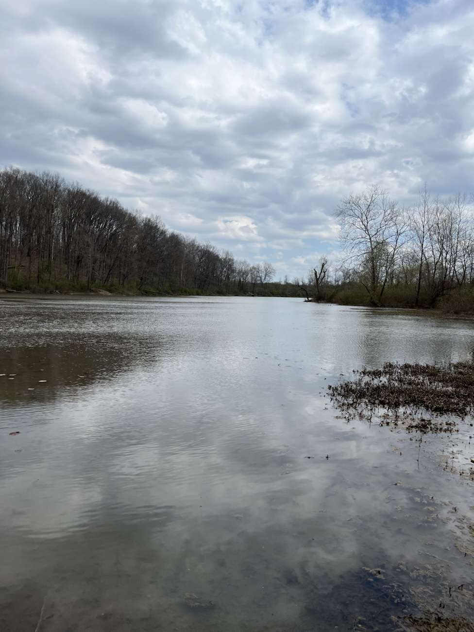
From the first few steps out of the parking lot and onto the path the lightly wooded area opens up to a small lake.
I would honestly refer to it as a large pond if I didn’t know better but, it is called Rock Mill Lake. The trail is rather damp and muddy despite the lack of rain.
Though it does hug and cross the lake. On the far side the lake shore opens up to a grassy incline.
Upon cresting the grassy knoll you will find a unique stretch of land where it feels less as if you’re in a forest. For a short 360 degree view you’ll begin to think you’re traversing through a working farm and its neighboring tree lines.
After walking a short ways through the fields of rolling Ohio foothills, treetops in the distance, and rustic farm structures, you’ll be glad to enter the tree-line on the last edge of the lake.
Here on the very far side of Rock Mill Lake is a massive rock perched right on the shoreline perfectly. Already adorned with a classic rope swing hanging out of a tree and over the water.
It’s the kind of spot that looks like a summer dream from a distant, nostalgic memory. Which begs us to return equipped with lake day items. Though, our current trip’s reality was a bit harder to swallow. The area was unfortunately covered in trash and broken glass, which is a massive ew. Especially for individuals like me hiking with a dog or who is an avid nature and conservation advocate.
The Legacy of Rock Mill and the Hocking River:
Even when the trails are closed, the mill itself is an imposing piece of history. The current structure was built in 1824. Though, the original site dates back to 1799.
Stebelton operated as a gristmill for nearly a century before closing its commercial doors in 1905. The geography here is what made it a prime location for early industry; the mill sits 90 feet above the gorge where the Hocking River plunges over a 14-foot waterfall.
Why the Rock Mill Gorge Trail has Been Closed:
The gorge trail remains closed until late April, due to the trails unique geology. The Hocking River has carved and eroded through soft Black Hand Sandstone here for years.
In the off season months, the combination of melt and heavy precipitation makes these slopes incredibly unstable. Opening the trail too early would lead to massive soil erosion, and potentially dangerous conditions for hikers navigating the steep descent to the water. Seasonal closures act as protection for the site and the trail- comers alike.
Mill Hours: Starting in May, the mill is open for tours on Wednesdays and Saturdays from 11:00 AM to 2:00 PM, and Sundays from 1:00 PM to 4:00 PM. The mill and gorge close yearly in November.
The Iconic Queen Post at Rock Mill:
The iconic covered bridge positioned directly alongside the gristmill is the Queen Post. This iconic Fairfield County landmark dates back to 1901.
A humble 37-foot span that was constructed by Jacob “Bluejeans” Brandt. This is one of the last remaining examples of a mill and covered bridge combination in the entire country. It features a Queen Post truss design, which is a classic wooden support system that uses two vertical posts to distribute the weight across the span.
Though the covered bridge looks like it has been there forever, it was actually built to replace an earlier structure that couldn’t withstand the Hocking River’s temperamental flooding.
This covered bridge was listed on the National Register of Historic Places in 1976 and underwent a major restoration in 2008 to ensure it stays standing 35 feet above the gorge. While it no longer carries vehicular traffic, it serves as the perfect vantage point for photographers looking to capture the mill and the falls in a single frame.
Looking for More Covered Bridges?
If you’re a fan of the covered bridge at Rock Mill Park, you should know Fairfield County is the holy grail for them.
Did you know that Fairfield County actually has more original covered bridges than any other county in Ohio?
Just a short drive away, you can find the Johnston Covered Bridge in Two Glaciers Park, which was built in 1887. This is a massive covered bridge with a 98-foot span. Surprisingly it still rests on its original abutments over Clear Creek. It’s unique because of its double canopies. These are like little wooden awnings over the windows that let you see the intricate Howe truss system from the outside.
Another nearby gem is the Hanaway Covered Bridge, which is famous for its lopsided look. It was built on a curve in 1881 and only has a canopy on one side. Drivers in the 1930s could actually see if someone was coming from the other direction before pulling in due to this.
If you’re looking for something closer to the city, the McCleery Covered Bridge now sits along the Lancaster bike path. It was actually the first bridge built by Jacob Brandt. Yes, the same “Bluejeans” Brandt who built the one at Rock Mill. However, this bridge had to be shortened significantly over the years due to dry rot.
These spots are perfect for quick stops if you’re trying to make a full day out of a trail of covered bridges.
The Tick Invasion: A Critical Safety Warning-
If the trash wasn’t enough of a deterrent, the ticks were out in full force. The slightly high grass in the farm fields was littered with ticks.
At one point during the hike, I had to stop and pull a literal handful of them off Luna, in one swoop… seriously consider the amount of ticks that is.
With the warmer, humid weather, they are waking up hungry, and this trail like many others I’m sure, is currently a prime hunting ground.
Identifying the Risks to Humans and Pups:
Tick-borne illnesses like Lyme Disease or Rocky Mountain Spotted Fever are no joke. In humans, early onset symptoms usually appear within 3 to 30 days and include a “bullseye” rash (approximately 70% of time), fever, and muscle aches.
If left untreated, prolonged symptoms can escalate to severe joint pain, heart palpitations, and neurological issues like Bell’s palsy.
For dogs like Luna, the signs are a bit different. You might notice “shifting leg lameness,” where they limp on one leg one day and a different one the next.
Other early signs include a loss of appetite and a sudden fever. Long-term, untreated tick bites in dogs can lead to chronic kidney issues and painful, swollen joints. If your dog seems lethargic or stiff weeks after a hike, it’s time for a vet visit.
Natural Defenses and Prevention:
While chemical repellents are commonly used, like DEET. There are natural ways to help keep these hitchhikers away.
Ticks are highly sensitive to scent, and certain essential oils can act as powerful deterrents.
Effective Repellents:
Lemon Eucalyptus oil is the heavy hitter for humans
Clove and Thyme Oils: Studies suggest that clove bud oil and thyme oil are highly effective deterrents. A combination of citronella and thyme has specifically been found to be one of the most effective natural mixtures against ticks.
Rose Geranium oil is a popular natural choice for use on dogs just a drop on the collar (avoid direct skin contact) can help.
Peppermint and Cedarwood oils are also known to create a scent barrier that ticks find repulsive.
Lavender Oil: Often cited as being as effective as DEET in some studies, lavender not only repels adult ticks but may also prevent their eggs from hatching.
Neem Oil: A natural insecticide and repellent that is generally safe for pets and humans when diluted.
Pet Safety: PLEASE use extreme caution with pets. Some oils, like eucalyptus and tea tree, can be toxic to cats and dogs if used incorrectly. Always consult a veterinarian first.
Yard Management Strategies:
Gravel or Wood Chip Barriers: A 3-foot wide barrier of gravel or wood chips between wooded areas and your lawn can prevent ticks from migrating into your yard.
Short Grass: Ticks thrive in tall grass; keeping your lawn mowed regularly reduces their habitat.
Diatomaceous Earth: This fossilized algae powder can be sprinkled in the garden to dehydrate and kill ticks. Ticks have a waxy outer coating on their exoskeletons that helps them retain moisture. The microscopic particles of DE are extremely sharp and highly absorbent.
Natural Landscaping Options:
If you want to keep your yard less hospitable to ticks, you can plant these naturally tick repelling species:
Chrysanthemums: These flowers contain pyrethrin, a natural neurotoxin that kills and repels ticks.
Marigolds: They produce a strong scent and contain pyrethrum, a compound used in many commercial repellents.
Rosemary and Sage: Both herbs have strong aromatic oils that ticks avoid.
Garlic: Planting garlic around borders can create a sulfurous barrier ticks tend to avoid.
Always do a thorough tail-to-nose check the second you get back to the trailhead. It only takes a few seconds for one to latch on, but a proactive check can save you and your pets weeks of trouble.
Extra Pointers when it Comes to Ticks:
Prompt Removal is Critical: Removing a tick within the first 24 hours drastically reduces the risk of most bacterial infections, especially Lyme disease.
Partially Fed Ticks: If a tick was previously attached to another host and then reattaches to you, it can transmit diseases much faster. Since now the pathogens are already active in its saliva.
Physical Indicators: An “engorged” or puffy-looking tick has likely been attached for at least 36 hours, indicating a higher risk of infection.
The Final Verdict:
What isn’t mentioned when you’re looking at the trail map is the specific kind of silence you get out here.
Unlike the crowded boardwalks of Hocking Hills, Rock Mill Lake is untouched. It’s a transition space, caught between a managed wildlife area and a working farm.
A brisk 35-minute loop that served as a reminder: the “backup” plan usually ends up being the most honest experience of the day.
It’s not a destination hike, but if you’re already hitting the covered bridges in Fairfield County, it’s a solid way to burn an extra half-hour in nature.
Whatever you do just don’t skip the tick check before you climb back in the car.
solitude seekers, amateur geologists, rockhounds, and hikers looking for primitive trails away from the main Hocking Hills tourist hubs.
Thank you Kylie for your guest appearance.
Discovering the Quiet Side of Hiking Hocking State Forest
While the nearby state park draws the masses, the Hocking State Forest Rappelling Area offers a rich chance to view, the unfiltered Appalachian plateau. Located off Big Pine Road, this 99-acre designated zone is the only state land in the county where climbing and rappelling are permitted.
For hikers, this means a trail system that hugs the base of massive vertical walls, winding through recess caves and past some of the tallest and quietest waterfalls in the region.
On March 27th a great mid 50-degree day, Kylie and I set out to explore the hollows and cliffs that define this rugged landscape. The air was crisp, and the silence of the forest was a sharp, welcome contrast to the bustling trails of Old Man’s Cave.
The man is in awe.
Navigating the Cliffs and Big Spring Trail:
Our trek began at the parking area in-front of the iconic hemlock trail in the Hocking Hills region. Crossing the road and the bridge from the lot act as gateways to two distinct experiences. To the left, the trail follows the stream to the base of the climbing cliffs, a waterfall, and the fat man-squeeze ; to the right lies the path to one of Ohio’s hidden giants and many smaller falls.
We just love the views at hocking.
The Rappelling Walls and Fat Man Squeeze
We went to the left after the bridge first which leads you directly under the shadow of nearly a mile of sandstone cliffs. This area is a geological playground featuring:
Safe travels Kylie.
Fat Man Squeeze: A narrow natural passage formed by “slump blocks” massive chunks of sandstone that have pulled away from the main cliff face due to gravity and erosion.
Table Top Rock: A unique flat-topped formation located about a half-mile along the Buckeye Trail section, offering a clear example of the area’s resistant upper layers.
The vibe here is cathedral-like. The massive overhangs create recess caves that trap sound and cool air, making even a three-mile hike feel like a journey into a different era.
Table top rock.
Big Spring Hollow Waterfalls:
After exploring the cliff line, the fat man squeeze, and the waterfall at the end of the rappelling area, we doubled back to the bridge. Upon reaching the bridge we headed right toward the Big Spring Trail. This path culminates at Big Spring Hollow Falls, which stands at an impressive 120 feet, making it one of the tallest waterfalls in the state, and my favorite so far in Hocking State Forest.
The Climb: At the end of the trail, a scramble up the rocks gets you close to the main cascade.
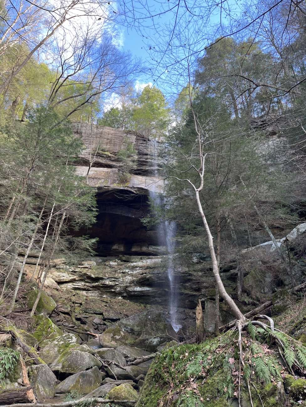
The Recess Cave: another waterfall drops over a smaller horseshoe-shaped overhang. Standing inside the cave, you can watch the secondary fall trickle down the mossy face of the Black Hand Sandstone. This is actually the first fall on the trail though you need to cross a shallow stream together to it.
I just want to be inside… her.
The Geology of the Hollows:
The towering features of the Hocking State Forest are carved from Black Hand Sandstone. This was formed over 350 million years ago during the Mississippian Period, this rock was deposited as river delta sediment.
The view I live for.
The squeezes and caves you encounter are the result of differential weathering. The sandstone has three distinct layers: the top and bottom are hard and cemented, while the middle layer is soft and easily eroded by wind and water. When that middle layer wears away, it creates the deep recess caves we explore. When the weight of the heavy top layer becomes too much, vertical joints (cracks) cause massive blocks to shift, creating the narrow “Fat Man Squeeze” passages that hikers love to navigate.
The view up.
Final Thoughts from the Trail:
We clocked a little over 3 miles total, leaving the Amazing Grace trail for a future venture. Before heading out, Kylie and I found a spot on some downed logs near the waterfall and cave on Big Spring trail to just sit and take it all in with a cigar.
Another view I live for.
There’s a specific kind of peace found in the Hocking State Forest that you just can’t find anywhere else. I feel it is found in a mix of ancient stone history and the simple quiet of the Ohio woods.
Emotional reflection readers, those navigating loss, the naturalist by hobby, those with interest in the geography of grief, and spiritual explorers.
2.What part of your past still echoes the loudest?
The Infinite Loop of Presence:
I head into the wilderness seeking what I know I will never locate indoors. I cannot hold this inside the four walls I call my home. I aim to get outdoors in the woods at least a few times a week, if I’m lucky enough to do so. Out there in the wild I find the only place large enough to hold what’s left of my mother, her memory.
It is not a circular journey and yet it doesn’t follow a straight line either. This is not directed by a typical map. While standing in the mist of the Beach City Wildlife Area, with only my dog by my side, the distance between the past and the physical present collapses.
I am not just a hiker with a dog on a trail; I am a vessel for a connection that I refuse to allow be severed by a physical absence. I go into the woods to keep the things my mother and I loved together alive. Hereby, ensuring the flame of that shared joy doesn’t flicker out in the static of my daily life.
The Spirit in the Current:
The loudest echo from my past is the presence of my mother. She is and always will be the atmosphere of the trail itself. March 25th, 2026 on my recent 2.6-mile trek near Dundee Falls, her presence wasn’t minimized to a memory trapped in a house or a photograph.
I found her walking in the sudden shift of the wind and the steady, rhythmic pulse of the flowing water against sandstone. It is through her I also learned the geography of grief when I realized that I don’t go to the woods to locate her as if she were lost; I go to meet her where she is now. She is the elemental force that guides my way. My mother is the map to my adventures as well as the motivation.
New Views and Old Echoes:
There is a profound purpose in taking her to places she never saw while alive. I typically try to hike as much as I can at least once weekly, but prefer when I can go on multiple times a week at that. This way I can always take her to new horizons and breath-taking views.
While Luna and I navigated the path from the smaller waterfall to the bigger waterfall, I felt her experiencing it right along with us. There is a genuine joy in that exploration; a sense of three souls moving through the Ohio landscape together. Sadly, that joy is always layered with the sharp, cold spray of reality, just like the spray from the cold waterfall misting us. Every time I want to make a comment or a wish to share an awe-struck glance…
I have to remember again that she is only ever going to be with me in spirit, for the rest of my days in this life. The worst part is this moment isn’t uncommon. It is a moment that all new trails I come to explore own claim over. I expect it now I’ve been met with it so commonly, it’s practically second nature. The high of the adventure and the let down of the coming to terms with reality.
The Ebb and the Rage:
My grief is like the water cycle that ebbs and flows. A diagram of it would show something similar to the streams linking the multiple Dundee waterfalls.
There are days when the current is weak, a gentle background hum that accompanies my steps. Then, like clockwork, the rain comes. Followed by a grief that rages like an overflowing watershed after a brutal Ohio thunderstorm.
I have learned that the raging waters are just as much “her” as the whispers in the wind are. The pain of that realization is a persistent, patient force motivating my movement and continuing my momentum.
As I continue to move forward walking through it, I am letting the water carve the rocks of my heart and soul. I am working to make more rounded instead of sharp edges. The “gone-ness” one day will hopefully feel more like a natural part of the scenery.
Acceptance in the Mist:
Can you point to it on a map? Maybe locate its address, the latitude and longitude coordinates if nothing else? Sadly, again… no.
Acceptance isn’t a destination to point to on a world map; it’s the waterfalls straying mists hitting your face when you stand too close to the falls. It’s a full body realization. It is all I get: the joy of the trek and the weight of the loss.
In my journal, I usually come back to ask myself again what lesson these repetitive moments are aiming at teaching me. The answer I come back to after trails like that of Dundee falls is that grief like water never stays the same. Though, the river always remains.
Yes, my mother’s physical form is gone, but her echo is as permanent as the Black Hand Sandstone making up Ohio’s geology. I find her by moving forward into the wild because that is where my memory of her lives most vividly. Every mile I drive and every following step I force myself to take are the evidence that love doesn’t stop when life does: it just changes its form.
Trail Reflections for the Soul:
The Vessel: Your body and breath are the primary tools for carrying those you’ve lost into new spaces.
The Sound of Grief: Whether it is a trickle or a roar, mimics the sounds of water. This is a reminder that your emotions are a natural, necessary cycle.
New Horizons: Taking a lost loved one to a “new” place is a way to continue your story together rather than just re-reading the old chapters.
Spirit in the Wind: Look for the “echo” in the elements that leave no scars, like the wind in the trees and the light on the creek.
Grinding through the Emotional Reflections Journaling Work:
Next time you are on the trail, try to be the person who notices the small things, not just the small waterfalls. I mean actually try to notice the spirits of those who visit places with you after their physical life ended as well. Where do you find them in the invisible layers of the environment? Where do you see the geography of grief?
The Geography of Grief:
The water at Dundee doesn’t just flow: it carves its own path and demands space. Flowing water, currents are a persistent, patient force that has spent thousands of years shaping the sandstone into ravines.
My mother’s spirit has become part of that geology, I just replaced the flow of water with grief. She is in the soft winds that move through the leaves and the spray that hits my face when the current is high.
The reality is I don’t go into the wild to find her as if she were lost. I go to the places her memory almost can convince me she’s alive. Cherish your loved ones; one day all you may have are the places where their spirits come alive. I locate my momma’s energy by moving forward into the wild; that is where our story continues.
Take the Journey with You – Waterfall Confessions:
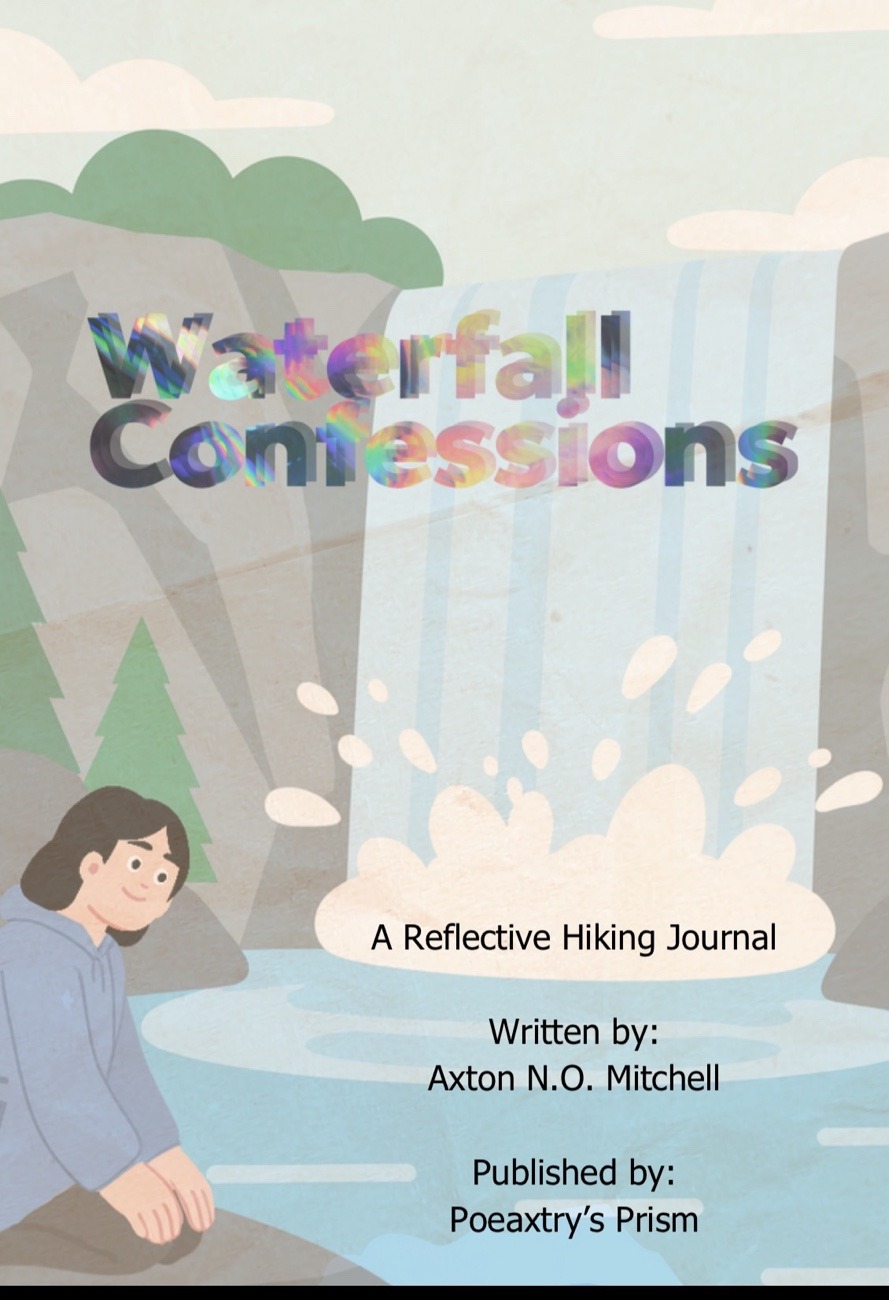
If this reflection resonates with your own walk through grief or other emotions, you can now own the full Waterfall Confessions Collection. Available as a digital download and a self printable collection for only $2, links provided to direct purchase at the end of post.
I am sharing three entries as deep dives into how I use my own journal collections for emotional support. I do plan to share one more prompt from this specific set as a final sneak peek inside. You can read the first one here.
This specific emotional reflection journal is designed to be versatile with you in mind. I have tried to provide you with the ability to use this while you are physically on the trail, for post-hike reflections at home, or even to process memories of places you visited long ago. While also being usable digitally and accessible to easily print on your own.
Near the back of the collection, you’ll find a dedicated space to track the locations you’ve reflected on. This is provided to help you keep your reflections and adventures organized.
Don’t front I have quite a few other emotional and creative journals planned for you. This one is only the beginning. The upcoming releases like this collection and the one before it were designed to support your endeavors both creatively and emotionally. I do so by providing a structured yet fluid way to navigate creative prompts for art and literature as well as prompts designed to move you through the emotional hurdles life may hand you.
The unpolished hiker, film nerds who appreciate cult-classics, fungi fanatics, and those seeking a visceral dialogue with the ancient, iron-stained bones of Ohio.
Act I Deep Inside Butternut Cave-
The Seasonal Labyrinth:
Luna and I experienced the transition from winter to spring in Ohio at Malabar Farm State Park, on Thursday March 25th. The weather here is never a straight path. The seasonal attitude of the weather here is a jagged, beautiful cycle of end of season sudden snowfalls followed by 69°F heatwaves. You never know what Ohio will hand you.
Butternut Trail:
Picking up where the morning left off, Luna and I moved from Doris woods trail to our car and toward the Pugh Cabin. This is a 1940 log home built by Jim Pugh, a neighbor and close friend of Louis Bromfield, the original owner of Malabar Farm. While this cabin is globally recognized as the cinematic site where Andy Dufresne’s wife was murdered in The Shawshank Redemption, the real story today was written in the vibrant orange Black Hand Sandstone and the cold, reviving spray of Ferguson Falls.
I thought I was parking in the wrong spot again. Yes, the same place that it sent me when looking for the Doris Duke trailhead but, this time, the large gravel lot by the Pugh Cabin and the maple syrup cabin was where we needed to be.
The area was swarming with at least six Natural Resource Officers. Whether it was a convention or a massive shift change, their trucks lined the trail past a few more cute little cabins, along the trail.
The Geology:
Butternut Cave part of the larger Rock City outcropping in Malabar Farms. This is a masterclass in Black Hand Sandstone formations. This rocky outcrop formed roughly 350 million years ago during the Mississippian Period. This type of stone is named after a famous Indigenous petroglyph near Newark, Ohio.
This was created by a massive ancient river delta system depositing quartz and iron-rich sediment into a shallow sea. The high concentration of iron oxide is what gives the walls their iconic, beautiful, burnt orange and deep red hues.
The Skylights:
I spent the afternoon maneuvering through around the sky lights in rock city’s roof, after walking around inside. These are natural erosion holes in the cave roof. This cave is a rare periglacial feature, meaning it was sculpted roughly 14,000 years ago by the intense freezing and thawing cycles at the edge of the Wisconsinian Glacier.
As water seeped into the sandstone joints and froze, then it expanded through frost wedging, eventually causing up to 100-foot sections of the ceiling to collapse into the skylights in the roof of the cave that we explored today.
The Ice Ghost:
Luna and I felt the cool wind blowing from yards away from the cave mouth. Once in the mouth of the cave, the air temperature drops what feels like twenty degrees.
I found flat, massive ice formation on the cave floor under one low lying, ceiling. I was spooked at first since the frozen almost transparent ice patch looked like a humongous spiderweb. Yet one of the last frozen remnant of the snow that fell just last week, still trapped in the cave’s natural refrigeration.
Honeycomb Weathering:
The walls of the cave here show heavy tafoni or honeycomb weathering. This occurs when salt crystallization or differential erosion eats away at the softer pockets of the sandstone faster than the iron-cemented Liesegang bands. This is what created the intricate holes that look like fairy houses tucked into the rock.
Act II: Ferguson Falls
All Gas & No Brakes
The trek to Ferguson Falls is a brutal, unshaded incline that felt like a physical dialogue with the earth. Luna and I attempted this same trail in the Febuary shin-deep snow, turning back after losing trail and dog boots many times. By 12:20 PM, the sun was beating down with an intensity that felt wrong for March, making the destination a necessity rather than a luxury.
These two trails were marked as a loop, however I now see they share the same parking lot and different trailheads. The trailhead at Malabar Farm State Park for Ferguson Falls is at the bottom of a steep access road, gravel of course.
The Reset:
After the early spring heated up my skin, I needed to soak my hair with Luna so, I stood under the freezing spray. The descent to this waterfall was worth every second of the soul cleansing chill it provided.
This is a recess cave waterfall. Geologically, it occurs because the hard Black Hand Sandstone caprock sits on top of the much softer Fairfield Member of the Cuyahoga Shale. Over centuries, the falling water splashes back and erodes the shale much faster than the sandstone, creating a hollowed-out “recess” behind the curtain of water.
Folklore & Marker Trees:
Along the trail, I encountered a skinny tree bent into a perfect arch. In Appalachian folklore, these are “Portal Trees” or spirit gates.
Historically, many of these are known as Marker Trees (or Trail Trees) these saplings were intentionally bent and tied down by Indigenous peoples, such as the Shawnee or Wyandot. Tying these down created living navigation signs pointing toward water, safe crossings, or sacred sites. While nature can mimic this through snow-loading, the specific “elbow” and “nose” of a true marker tree is a cultural relic of the land.
Act III –
The Summit at Mount Jeez:
Luna and I ended our trip to Malabar Farm State Park the day at Mount Jeez Overlook. This spot is the highest point in the park at an elevation of 1,234 feet. The history of this hill is a story of total redemption.
When we came here in Febuary the gate was closed and the road unplowed. Upon driving to the top with Luna today, I am glad I decided against walking up it in the snow that day.
Another vehicle with a dog in tow too arrived just as we did, so Luna and I sat in the air conditioning and enjoyed our view while the other visitors poked around the massive 360 degree view.
Poverty’s Knob:
Before Louis Bromfield returned to Ohio in 1939, this hill was known as “Poverty’s Knob.” The soil was so depleted from a century of poor farming practices that it was considered “worn out” and worthless, unable to even grow weeds. Bromfield used his “New Agriculture” techniques such as contour plowing and “trash mulch” farming—to heal the land. Thus changing the outlook of the land in the area and successully starting what would eventually become Malabar Farm State Park.
The Name Mount Jeez:
The name “Mount Jeez” was coined by Bromfield’s business manager, George Hawkins. When visitors arrived at the Big House looking for the famous author, Hawkins would point toward the summit and say, “He’s up there,” often followed by a “Jeez!” at the effort required to climb it.
Through time a lot of visitors to the peak often have an awe-struck reaction to the vastly beautiful view once at the overlooks peak. All you can see are the rolling foot hills and patchwork farmlands that make up much of Ohio’s terrain.
The Glacial View:
From the top, the 360-degree view of the Pleasant Valley, in Richland county, Ohio shows the exact path of the Wisconsinian Glacier. The glacier stalled just miles from here, leaving behind the silty loam and gravelly moraines. THe minerals left behind provideded the rich foundation for Bromfield’s agricultural revolution. After I sat there in the AC waiting, I found more heart-shaped quartzite rocks in the gravel while watching the valley below.
Malabar Farm State Park
Everything has a cycle: of life, death, winning, and losing. Today, for Luna and I won. The spring trail reminded us that regeneration is always just one thaw away. Hopefully, you don’t have to wait to much time between your winning times.
For Highlight reels from Malabar Farm State Park & other trips with Luna and the homies, as well as other visual content catch Poeaxtry_ on socials like:
The unpolished hiker, film nerds who appreciate cult-classics, fungi fanatics, solidarity reflective journal readers.
The Great Escape – Doris Duke Woods Trail:
Welcome, Luna and I explored the Doris Duke Woods Trail on Thursday, March 26, 2026, I pulled into the parking lot of my great escape at 10:03 AM. The air at Malabar Farm State Park sat at a comfortable 60°F, but the stillness the the woods typically offers was about to surprise us with a straight up ninety degree incline. To top it off the incline from Hell was also wet as a bitch.
Navigating this park requires a bit of patience. I finally parked just after 10 am, before that I had been driving around nearly twenty minutes. I was just scouting the perimeter to find the place I was supposed to park to access this hiking trail.
Finally impatience and the need to urinate took ahold of me. I decided on parking at the main farm lot. My first win of the day.
From here, Luna and I had to walk a small portion of the road to reach the Doris Duke Woods Trail’s trailhead. I found a few green-hued stones underfoot in the parking lot suggest a surprising geological diversity waiting in the treeline.
Let’s Hike Together Through Ohio & Appalacia.
The Reality of the Ascent – Not Your Average Nature Walk:
The Doris Duke Woods Trail wastes no time making its intentions known. This is loop trail, just follow the white-blazed, tree markings. You should be prepared for a physical dialogue with the earth.
Doris Duke isn’t paved, and it certainly isn’t ADA accessible. Between the massiveroots waiting to trip the unwary and the sheer number of fallen trees, it is clear that recent Ohio storms have left their mark on this ridge. Luna and I aren’t just walking; we’re climbing over timber and navigating a landscape in transition.
There is a specific kind of triumph in reaching the top of that first steep hill. The inclinefinally broke at a cute little bench, I finally had the chance to stop and shed my hoodie. Luna, ofcourse got a few drinks from my Spongebobwater bottle before we started off on the trail again. From this vantage point, the farm and the pondbelow look like miniature models, a stark contrast to the ground nearby where I was able to photograph vibrant red mushrooms that appear to be laid upon the damp soil.
When we finished the Doris Duke Woods trail, AllTrails said we did just over 1.5 miles. Which took us a few minutes shy of 45minutes to complete. AllTrailshumbledme, when I checked the elevation and saw we only gained197feet in elevation. In retrospect this is hilarious considering I was complaining about the climb the entire time. Maybe it just felt like more from the ground being slick and the incline that was immediate.
“Widow Makers” & the Legend of the Monkey Vines:
As the best dog in the whole world and I move deeper into the woods, the trees are draped in thick, heavyAppalachiavines. Growing up, we called these “monkey vines,” I can remember imagining creatures swinging through the Ohio hardwoods. However, my friend recently informed me of their darker existence. Her dad had found these wooden vines a more fitting, grounded, and dangerous, name to go by: Widow Makers.
These vines are massive woody lianas that can grow to be as heavy, if not heavier than a standard tree branch. When the supporting tree begins to rot or the windcatches an Appalachia Vine just right, these “monkey vines” can snap and fall with lethal force. They may look like something out of the jungle book, but in the context of a life-ending risk, they serve as a reminder to keep your head up.
This trail was fairly easy as long as you have the breathing capabilities to conquer the initial hill. Don’t forget not to walk under the Appalacia Vines if you can help it, and keep your eyes peeled to watch for falling debris. keep your wits about you, there is no “impending doom” just the waitingwilderness, and wildwoods.
The Shawshank Connection and Bromfield’s “New Agriculture:”
Malabar Farm is a site defined by the vision of Louis Bromfield, the Pulitzer Prize-winning author who returned to his Ohio roots in 1939. Bromfield didn’t just want a farm; he wanted a revolution in sustainable agriculture, transforming “worn-out” soil into a flourishingecosystem. His fame brought Hollywood to the hills of Richland County, most notably when Lauren Bacall and Humphrey Bogart were married here in 1945.
The park embraces this legacy with several signs posted around the trails marking this as part of the official “Shawshank Movie Trail.” For many, the woods of Malabar are synonymous with The Shawshank Redemption (1994). While the famous “Shawshank Oak” (which stood nearby until 2016) is the most cited landmark, the entire park breathes the atmosphere of the film. The opening scenes of Andy Dufresne’s trial and the exterior of the “Pugh Cabin” utilized these very grounds. Walking these trails is an exercise in “geography as character,” the same Black Hand Sandstone ravines and dense timber that provided the backdrop for a story about hope and persistence.
Geological Curiosities and the Forest Soundscape:
The geology on the Doris Duke Woods Trail is dominated by the Black Hand Sandstone, a sedimentary layer formed over 300 million years ago when Ohio was covered by a shallow inland sea. This stone creates the dramatic cliff faces that make Ohio iconic, and the rock formations even influence the way the trees grow.
The Humor of Nature: Sometimes, nature doesn’t grow in a linear fashion. Along the trail, you might find a “big old tree that looks like it had a big old wiener.” Some things in the woods and world never change. I’ll forever see weiner’s where others see wood. That is just one trope that forms the joy of the trek.
The Percussion of the Woods: Just like the daybefore, the forest is alive with the sound of woodpeckerspecking into the wood of nearby trees. They are the primary architects of the “tree beat–boxing,” taking advantage of the fallen timber to find their next meal.
Transitioning to the Next Descent
By 10:48 AM, Luna and I had torn through that loop happily finishing the trail. The moment before you see your descent to the end, the trail passes by a large open field designated as a picnic area. Though, for those on a mission, it’s just a landmark on the way to the descent. The Doris Duke Woods Trail is a reminder that a hike is more than just mileage; it’s the sensory download of the wet earth, the history of the soil, and the physical effort of the climb.
With Doris Duke Woods Trail being the first loop at Malabar Farm State Park we did in the bag and the car in sight, the morning is far from over, for Luna and I. The white blazes of Doris Duke are behind us, but the water-carved echoes of Ferguson Falls and the dark mysteries of Butternut Cave are the next stops on the map.
For Highlight reels from Malabar Farm State Park & other trips with Luna and the homies, as well as other visual content catch Poeaxtry_ on socials like:
Individuals Interested in exploring Ohio’s largest Cave, history buffs, geology enthusiasts, hikers interested in sustainability, and nature journal readers.
The Biggest in the North-East, Machan’s Rock:
I guess Northeast Ohio has just been hiding some iconic geological treasures in pretty much plain sight. If plain sight is now equal to tucked between gravel roads, huge rocks, still in use railroad tracks, and what looks like a few working farms.
That’s exactly where Luna and I found the infamousMachan’s Rock, also known lovingly as “hobo cave.” She lays in wait for those willing to navigate the gravel roads that lead up to her dodging giant potholes, boulder fields, and broken glass shards at her beautiful base. Just to begin exploring all over again, once they arrive inside her of course.
Let me just start by warning you Machan’s Rock is not your average manicured trail. There are nosigns, handrails, or stairs here. There isn’t even a dedicated “trail.” This is rugged, wild, and unmarked, terrain. Leaving me to enjoy exploring with little to no cell function and minimal visitors.
This cave packs exactly the kind of adventure you want to keep with you. While providing a thrill you need to plan for as well as remainingopen to change regardless of your “fear of missing out” in places like this it is always safety first.
Exploring at Machan’s Rock:
I pulled up with Luna mid-afternoon, March 25th, 2026, after completing and setting off from Dundee Falls Trail. I set my GPS set to Machan’s Rock, knowing the cave itself might be unsafe for Luna to enter, and being totally okay with just exploring the caves vast exterior.
It’s worth noting that most of my exploring is not about reaching every interior space or completing a full entry. More commonly I have seen it align with what you find while exploring.
While standing on the cave’s roof, makes this space feel less like a single chamber and more like a fractured system. One where life, light, stone, and sound behave differently depending on where you put your feet.
Luna spent a good bit of her time here whining to go walk; while I took my time exploring and trying but failing to see down inside the natural skylight.
To appease my dog’s need to move we traced the edges of massive rock formations. While exploring I discovered crystals embedded in the ancient side of the road, stones.
Man, today was a great day that was more focused and in-tune with the journey than the destination.
What Is Hobo Cave?
Locals often refer to Machan’s Rock as Mackens Rock, Bear Claw Rock, Skull Mountain, Hobo’s Cave
This significant natural landmarkand cave system have. Even used by individuals living in Ohio for decades. Hobo cave is widely regarded as the 2nd largest cave in Northeast Ohio. However, this rock formation’s true classification leans more toward a massive rock shelter with multiple rooms than a deep, subterranean cave.
Exploring the Geology of The Sharon Conglomerate:
This rock formation is part of the Sharon Conglomerate. Which is a geological layer of Mississippian-age sandstone deposited roughly 300-320 million years ago when much of Ohio was covered by coastal plains and river deltas.
The Sharon Conglomerate is known for being particularly resistant to erosion. Leading us to understand why places like Machan’s Rock, The Hocking Hills region, and Mount Pleasant stand as towering, overhanging cliffs rather than eroding into gentle slopes.
Over millennia, water seeped into cracks, froze, expanded, belted, and repeated. This process wedged apart sections of the rock and worked at creating the skylight, multiple entrance openings, and the sheltered overhang that all define the cave today. The execution of this design by nature is even more awe inspiring when you consider that it isn’t a plan and just happens like that… naturally .
What else makes this site geologically significant?
The contents of the exposed conglomerate, if you’re asking me of course. This is totally my own personal opinion but, I feel it’s another unique layer of nature’s never-ending beauty.
You can see rounded quartz pebbles and cobblescemented naturally within the sandstone matrix. Which is factual verifiable evidence of ancient river systems that once carried minerals from distant mountains. When I was picking up red rocks and what I called moon rocks (in early childhood) I was actually handling fragments of a 320-million-year-old rock formation.
In the broader regional context, this corridor sat within active abolitionist movement routes, where sandstone shelters and ravine systems were used across Ohio as temporary concealment points during northbound escape networks.
Underground Railroad History – Fact and Oral Tradition:
Local lore places Hobo Cave within the network of Underground Railroad sites in Northeast Ohio. While definitive documentation linking Machan’s Rock specifically to the Underground Railroad is elusive, the broader region, particularly Portage County and surrounding areas, was deeply active in abolitionist efforts.
Ohio’sgeological landscape played a practical role in the Underground Railroad. Sandstone rock shelters, caves, and ravines provided temporary concealment for freedom seekers moving north toward Lake Erie and Canada. Sites like Hobo Cave, with its multiple entry points, skylight for ventilation and observation, and remote location, fit the profile of a natural refuge.
Whether Machan’s Rock served as a station, a stopover, or simply a landmark along the route, the oral tradition persists. Walking the perimeter, looking into the three entryways where I could hear running water, it was easy to imagine how this place could offer both shelter and danger. It is close enough to railroad tracks for navigation, remote enough to avoid unwanted attention.
Hobo Cave Ohio Deaths
Unverified local accounts and online discussions reference past injuries and fatalities in and around the cave system, though no consolidated official record confirms specific incidents tied directly to the formation itself.
Camping
Nearby land-use history, including references to campstructures such as Camp Buckeye. This reflects how this broader landscape has been continuously repurposed for recreation, conservation, and informal local use over decades.
Gravel Roads, Railroad Tracks, and Tire-Eating Potholes:
Driving into the area where Hobo Cave sits requirespatience and maneuverability or a vehicle with decent clearance. The route leads down a gravel road where you park adjacent to active railroad tracks. From there, it’s a short walkacross or down the tracks.
Is Machan’s Rock owned by the railroad? Land jurisdiction here is reported as primarily under the Muskingum Watershed Conservancy District, with proximity to active railroad corridors adding a layer of restricted adjacency rather than direct public ownership.
I do want to mention there is no official trailhead. No real parking lot or signsmarking the cave. What you will find:
· Potholes that are extra-large, large, medium, and small. Back home we call the XL ones tire-eaters. I swear some of these potholes looked as deep as my tires are tall. A few maybe even deeper. You have to be slow, steady, and attentive, or you may pop a tire out of what would seem like nowhere to you. · Water pooling on the sides of the road after hefty rainfall. This area holds water, which means soft shoulders and hidden depths. · Yellow signs not like any Public access hunting signage, so wear bright non-natural colors. · A few horses and cows standing next to the roadways, doing horse and cow things, watching you drive past boulders into what feels like little house on the prairie.
It’s a surreale approach. At points I was not quite sure we were going the right way. At last I saw the massivesandstone cliff emerging from the trees.
Exploring Without Entering:
I didn’t take Luna inside. The amount of broken glass around the entry points made that decision easy. Between the glass, and the sandstone that can be abrasive on paws, and the uncertainty of how she’d manage the interior, we explored the perimeter instead.
Let me tell you, that was a reward all on its own.
We walked along the edge of the huge rock, looking down to the dirt to scan the grounds surface for shiny things. We also climbed up on top of Machan’s Rock and peered into the skylight, a natural opening in the ceiling that lets light filter into the cave below. We stood for a moment looking out over the railroad tracks and my car. Before heading to check out the skylight where I could clearly see how it provides ventilation as well as a way to gauge time of day without ever stepping outside.
Local memory & community discussions frequently describe the area as a place where teens gathered informally. Especially near Dundee Falls and the sandstone cave formation, further reflecting on its long-standing role in regional recreation culture. Instead of just the usual formal historical designation.
I looked into a few different entryways, while listening to running water somewhere inside. The sound of moving water through sandstone is distinct, muffled, echoing, and yet still persistent. It made me want to come back without Luna. Then I would have the time I need to go exploring around the full expansive interior.
The interior conditions also reportedly support seasonal bat habitation, which is consistent with similar sandstone overhang ecosystems in Northeast Ohio.
I found a crystal here upon making it back to my car. A Small, but unmistakablequartz cluster, almost all the way smooth. I took a photo of it resting in my palm, light catching on some of its surfaces. We also found a collection of red rocks. These rocks are iron-rich sandstone fragments and several hollow holy rocks that felt significant in a way that’s hard to explain, yet instantly recognizable. I bet you know the feeling if you’re like me and pick up rocks on your many hikes.
Dundee Falls, Paw Checks, and Luna’s Recovery:
Exploring here today came after spending time at the Dundee Falls trail. I was already in the habit of checking Luna’s paws for abrasions. Sandstone can be rough on dog pads, and the glass around Hobo Cave confirmed that my caution was justified. I was able to stay ahead of the curve and keep her freshly healed paw safe.
Luna’s old injury has healed completely, and she has no open areas. My little baby has no new booboos. She handled Dundee Falls beautifully, and at Hobo Cave, she stayed close, content in exploring the perimeter with me while I peered into entryways I didn’t think she couldn’t safelynavigate.
If you’re bringing a dog to Hobo Cave:
· Check pawsbefore, during, and aftersandstone and glass are both risks. · Skip the interior unless your dog is small enough to carry through tight spaces and you’ve confirmed the floor is clear of debris, or if you have proper puppyfootwear. · Bring paw wipes or a rinse if you’ve come from Dundee Falls or another sandstone baring and water-adjacenthike.
Why I’ll Be Back: Swimming, the Cave Interior, and Unfinished Business:
This trip confirmed two things. First, I need to returnwithout Luna begin properlyexploring the interior of Machan’s Rock. Three entryways, running water, a skylight, you and I both know that’s too much curiosity for me to leave on the table.
Second, I’ll be coming back with Luna in tow to go swimming. If I’m going in the water, she’s coming with me. This exploration trip will be its own fresh but wetadventure, and as always I’ll approach it with the same caution.
There’s something valuable about leaving part of an adventureunfinished. It turns a one-time hike into a place you return to. Hobo Cave earned that status.
Driving through the field of boulders.
Practical Tips for Exploring Machan’s Rock:
If you’re plan on exploring here on your own own, here’s what I think you should know:
· Location: Portage County / Northeast Ohio. GPS to Machan’s Rock and expect the final approach to feel uncertain, especially if you’re in a smaller car like me. · Parking: Adjacent to railroad tracks. Do not block access roads. Be aware that trains are active. · Road conditions: Gravel road with largepotholes. Drive slowly. If you’re in a low-clearance vehicle, pay attention or be prepared to change a tire or two. · No official trail: You’ll walk across boulders and open ground to reach the rock formation. · Glass hazard: Significant broken glass near entry points. Wear sturdy shoes. Keep dogs out of the interior. · Best practices: Leave no trace. Do not disturb the rock formations. If you’re unsure about access, check local land ownership. This site does exist in a gray area between public interest and private land. · What to bring: Water, paw care items for pups, a camera for the rock formations and views, and extra patience for the drive in and out.
Exploring in the Heart of Northeast Ohio:
Hobo Cave isn’t polished. It doesn’t come with interpretive signs or a maintained trail. What it offers instead is something increasingly rare: a place where you have to figure it out as you go. The cave itself is geologically significant, as Northeast Ohio’slargest sandstone shelter, formed over 300 million years, shaped by water and time into a formation with a skylight, multiple entries, and the echo of running water deep inside.
The history is layered on top like the trees whether confirmedUnderground Railroad use or an enduring oral tradition, adds weight to the walk across the boulder. The moment I first saw the rock emerging from the trees. If you add in the tire-eating potholes, the farm animals watching from the field, the crystals and red rocks collected along the edge, and you have a memory of exploring that can’t be replicated on a curated trail.
I left with unfinished business: the cave interior sits unfinished waiting on the my next trip the Northeast without Luna. As well as a return trip planned for swimming with her when the conditions are right. That’s the mark of a good place. Not one you check off a list, but one you want to keep returning to.
If you go, drive slow on that gravel road, watch your tires, check your dog’s paws, and take a moment to stand on top of Machan’s Rock. Before you leave make sure you stop and look down through the skylight. Some of the best hikes don’t announce themselves with signs or trails. They just wait for the ones meant to find them.
Regional reporting and local featured writing consistently frame Machan’s Rock as a significantsandstone formation on the edge of Beach City, situated near conservation-managed land and historic rail infrastructure.
Baby girl all tired on the way home.
This site functions less as a marked destination and more as a recurring field site for observation, interpretation, and return visits.
Machan’s Rock, also known as Hobo Cave, is a Sharon Conglomerate sandstone rock shelter near Beach City, Ohio. This cave system is defined by multiple openings, a natural skylight, and long-standing local historical and recreational significance.
No fees, no hoops, just guidance! Get your solo manuscript ready, polished, and published with Poeaxtry’s Poetry Prism submit a form or email poeaxtryspoetryprism@gmail.com for more information
Earth Day Enthusiasts, new adventures, the naturalist by hobby, content creators, nature lovers interested in leave no trace practices, and environmental advocates.
Dillion State Park, Ohio.
Leave Only Footprints Take Only Pictures – Leave No Trace
I’ve been told at least a million times in my thirty-four years of live to leave only footprints and take only pictures. I’m sure you can say the same or that you’ve heard some variation of the saying. This is why I was shocked on my latest hike whenI realized that for many, that’s easier said than done.
While I was exploring the Beach City Wildlife Area, with my dog I found myself looking at the forest through a different lens. Where the permanent scared bodies of trees revealed the nutrient starving marks we leave behind when we think we’re just making a memory immortal.
Tree Carvings in a trees bark on Kennedy Stone House Loop in Salt Fork State Park, Ohio.
Dundee Falls Trail
During my recent 2.6-mile trek through the Beach City Wildlife Area to view both large waterfalls, I did something I usually try to avoid: I started counting.
In that short out-and-back stretch, I registered 45 separate carved trees. Most were initials and or dates. A seemingly small gestures intended to “immortalize” a moment. But in forest ecology, these aren’t just mementos; they are biological disruptions.
When we talk about Leave No Trace (LNT), we often stick to the surface. But as of 2026, the data shows that “not littering” is just the baseline. True stewardship requires understanding the invisible layers of impact. Everything from the vascular systems of the trees to the microscopic life in the streams.
Initials and names carved in the historic sandstone at Black Hand Nature Preserve in Nashport, Ohio.
The Anatomy of a Wound – Why Carving Kills:
A tree’s bark is similar to its immune system. When someone carves into a tree, they aren’t just “marking the surface.” They are bypassing the tree’s primary defense and allowing easy entrance for other things to do so as well. Directly beneath that bark are the xylem (which moves water up from the roots) and the phloem (which moves sugar/food down from the leaves).
Deep carvings slice these “veins,” effectively starving the tree of needed nutrients. These wounds then as mentioned serve as open doorways for fungi, bacteria, and wood-boring insects. While a human scar typically fades, a tree’s scar is permanent. Making the tree structurally compromised for its entire life.
Furthermore, many trees are connected through underground fungal networks; a disease introduced via a carving on one tree can technically travel to infect an entire stand of timber.
Graffiti Pac-Man Ghost on the Sandstone at Piatt Gorge Park in Woodsfield, Ohio.
Beyond the Trash Bag – Layering the 7 Principles:
Most violations of LNT principles stem from a lack of awareness or the convenience of a “small” action. To stay truly informed in 2026, we have to look at the nuances of these universal ethics:
Durable Surfaces & “Social Trails”: We often walk around mud puddles to keep our boots clean, but this “widens” the trail. This, creating social trails that destroy vegetation and cause massive soil erosion. It is better to walk directly through the mud on the established path. Wear shoes on the trail and nature adventures that are suitable to get dirty.
The “Organic Litter” Myth: Tossing an orange peel or banana skin into the brush is still littering. In Ohio, a banana peel can take up to two years to decompose. While citrus contains natural insecticides that even local bugs won’t touch. These “natural” scraps also teach wildlife to expect easy meals of human food, increasing the risk of them becoming roadkill.
Leave What You Find, Where You Find It (The Souvenir Trap): This includes everything from natural minerals to “stacking rocks.” Also called building rock cairns in streams or near trail. These may look cool for a photo, but it’s a disaster for aquatic life, and may even misguide hikers. Moving those rocks uncovers the homes of macroinvertebrates and salamanders, the water “bugs” that fish rely on for food.
Minimizing Sensory Impact: LNT now heavily emphasizes light and noise pollution. High-lumen white headlamps can disrupt the circadian rhythms of wildlife and the experience of other hikers. Using warm-colored (red or amber) LEDs at lower intensities is the 2026 standard for preserving the “wild” in wildlife. As well as hiking with quiet voices and any music or other phone voice minimal or listened to through headphones.
A fully carved up tree on Big and little Lyons falls loop at Mohican in Ohio.
The Practical Challenges of the Backcountry:
Planning ahead is foundational, yet a lack of preparation often leads to “accidental” violations. This includes not having the right gear for weather changes, which might lead a hiker to build an illegal fire or expand a campsite onto non-durable ground.
Proper waste disposal remains one of the most cited challenges. Digging a proper 8-inch cathole for human waste (at least 200 feet from water) and correctly storing “smellables” (food, lip balm, deodorant) in bear-resistant containers are non-negotiable for preventing wildlife encounters. In 2026, even sealed food is considered an attractant to a bear’s nose, which is thousands of times more sensitive than ours.
West Salem, Ohio another tree carved.
The “Only One” Myth: Collective Damage vs. Collective Care:
Every single one of those 45 trees with carvings all over them started with the same thought process. “I’m just one person; what’s the harm?” When you see 5 trees tree trunks on one trail completely covered in initials, you aren’t looking at one person’s memory; you’re looking at a group of people who all thought they were the “only ones.” Now imagine 45 separate trees and the damage that causes.
You cannot feign ignorance and claim solo actions have no consequences when the evidence is written in the scars of the forest along this very trail.
The good news is we can turn that same logic on its head. If we decide to be the “only ones” to pick up that piece of trash, to stay on the path, or to teach a friend a better way, we create a new kind of group.
This is a group of people all doing the right thing, thinking it’s just them. We are allowed to make mistakes; LNT is a journey of awareness, not a demand for perfection. One small change in how you hike today is the starting point for a forest that survives for the next generation. We have to respect the Earth now, because if it’s ever gone, that’s it. I’m not aware that there is a “Plan B” for Earth or nature.
Though normally damaging defacing park property can deplete park funding and cause park officials to remove amenities.
Quick Reference – Other Common LNT Myths vs. 2026 Reality:
Myth: “It’s biodegradable, so I can leave it.” Reality: even natural items can take years to rot and poisons the local ecosystem’s diet.
Myth: “Wild animals poop in the woods, so my dog or myself can too.” Reality: Pet and human waste contain foreign pathogens and excess nitrogen from processed food that causes algae blooms in local water.
Myth: “Stacking rocks is harmless art.” Reality: It destroys the “roofs” of aquatic homes and can lead hikers astray if they mistake your art for a trail marker.
Large Carin an Ohio creek bed.
The Gravity of the Situation – Rock and Stone Carvings:
While tree carvings are biological wounds, carving into rocks, especially the soft Black Hand Sandstone found throughout Ohio, is a geological trauma.
Accelerated Erosion: Sandstone is held together by a thin layer of natural cement and “biological crusts” (lichens and mosses) that actually protect the rock from rain and wind. When you carve into it, you break that protective seal.
Mechanical Weakness: Carving creates “stress points.” Over time, water enters these grooves, freezes, and expands (freeze-thaw cycles), causing massive chunks of the cliff face to flake off. This is a process known as exfoliation.
Gravity’s Hand: Once the structural integrity of a rock face is compromised by deep carvings or graffiti, gravity does the rest. What was a stable cliff for thousands of years can become a landslide risk in just a few decades of human interference.
Human clothing littered on the litter trail in Mount Vernon, Ohio.
The Forager’s Footprint – Leaving Life Where It Grows:
When it comes to plants, mushrooms, and natural minerals, the rule isn’t a strict no, “don’t take.” A smart and ethical plan is closer to”take only with a plan.” Even when a permit is free, there is a vital reason to get one. As well as monitoring foot traffic in areas where they are rebuilding or protecting habitat. Which makes free collection and hiking permits important to obtain.
Monitoring Foot Traffic: Agencies use permit data to track “visitor load.” If they see 500 people are foraging in one small acre, they know that area needs a break to allow for plant regrowth. Without that data, they can’t protect the very plants you’re trying to enjoy.
The Rule of Thirds: Foraging is stewardship. A common ethical standard is to never take more than 10% to 30% of a healthy population. If you take the only two mushrooms you see, you’ve removed 100% of the spores needed for next year’s crop.
Never take protected or endangered species or organisms.
Natural Minerals & Fossils: Removing “cool rocks” or minerals disrupts the soil chemistry and removes potential habitats for insects and microorganisms. In many protected areas, these minerals are legally considered part of the “natural feature” and must stay put to preserve the park’s geological story. Do not remove natural materials unless permitted to otherwise.
Free permits like the one to visit corkscrew falls in hocking hills exist to monitor and limit foot traffic in ecosystems that are fragile or undergoing restoration. Other non-foraging hiking permits exist to limit foot traffic due to. Saftey risks if over populated.
Dennison Biological Preserve Respect the Reserve Sign in Ohio.
The Dundee Evidence: 45 Scars in 2.6 Miles:
While the images scattered throughout this post show the carvings I’ve documented across Ohio’s parks, the slideshow below is a concentrated record of the separate trees I encountered on a single 2.6-mile trek at Dundee Falls. This is the proof of the “Only One” myth in action. Each slide represents another biological disruption on just one small stretch of this one Ohio trail.
Dundee Falls Trail Tree carving
Dundee Falls Trail Tree carving
Dundee Falls Trail Tree carving
Dundee Falls Trail Tree carving
Dundee Falls Trail Tree carving
Dundee Falls Trail Tree carving
Staying Educated is the Only Shield:
Next time you’re on the trail, be the person who notices the small things, and not just the waterfalls. Really notice the health of the wildlife and living organisms surrounding them. What’s one ‘small’ change you’ve made to your hiking habits lately or even one you plan to make but haven’t been able to implement yet?
I’ve taken protected organic material from places before I realized it was harmful. At some point I didn’t even know better or care to think of the what if’s. But we are in an age where information is at our fingertips. No longer can we claim we simply “didn’t know” anymore.
The principles of Leave No Trace are dynamic guidelines, and nit meant to shame anyone. Use these not as rigid rules for perfection. They are designed to help you make the best decision for the specific environment you will be experiencing and exploring.
Let’s learn from the 45 scared trees I saw at Dundee. Take the information, share it with your hiking group, and clean up after those who don’t yet know. That is all it takes to keep our backyards wild.
Waterfall Lovers, high reward hiking enthusiasts, Ohio locals, nature journal readers, and anyone looking for adventure.
The green poles for trails “A” & “B”
Trailhead Overview – Beach City Wild Area:
Location & Access:
The trailhead for Dundee Falls I parked at is a large gravel lot located off of Dundee Wilmot road in Beach City, Ohio, within the Beach City Wildlife Area. A small brown sign that says “Beach City Wildlife Area” marks the entrance.
Luna and I made our arrival at 10:14 AM, on March 25th, 2026. The temperature registered 46°F according to the car’s reading. However, by the time I returned to the vehicle after completing the 2.6-mile out-and-back trail, the temperature had climbed to 65°F. The drive from my starting point took approximately one hour and forty-five minutes. After passing Zanesville all the way to the trailhead, there weren’t many-established towns. About the time I started thinking I’d surely pee my pants I found a gas station combined with a car wash, and I am so thankful they had a facility.
Small waterfall.
Trail Markings & Facilities:
The trailhead is marked with a square green metallic sign displaying the letter “A.” Additional signage indicates the Beach City Wild Area boundary, though numerous “Posted Private Property” signs are also visible in the vicinity.
There are no restrooms at this trailhead. There are no garbage cans, no garbage bags, and no other facilities of any kind. Visitors must pack out everything they bring in, and ideally, pack out additional trash left by others. It is essential to bring doggie bags and your trash back to your car and to a garbage can from there.
Mossy log.
Parking Lot Geology:
The glittering appearance of the gravel lot is not from crushed glass or decorative stone. It’s actually from the natural bedrock that underlies the entire Beach City Wildlife Area. This is the Sharon Conglomerate formation, a quartz-rich sandstone deposited by ancient river systems millions of years ago.
The silica within the sand crystallized over time, forming hundreds of tiny quartzcrystal facets that catch the light. While the sandstone matrix is too brittle for tumbling, individual quartz grains can be collected from this matrix for specimen jars, representing the foundational geology of the region.
Though collecting in Beach City Wildlife Area is not legally permitted. This acts as an identification and geographical guide for areas that allow the collecting of natural materials.
Small orange mushrooms.
Ohio Cannabis Law Update: March 2026:
A significant shift in Ohio law occurred this week regarding cannabis. Adult-use marijuana is still legal in Ohio following voter approval last year. Now the specifics of where consumption is permitted are much more narrow. The law technically limits smoking cannabis to private residences specifically, the house that you own or where you have explicit permission from the property owner. Public consumption, including in vehicles, in parking lots, on trails, and within wildlife areas, is not legally permitted.
This is a changing legal landscape, and individuals are responsible for understanding their rights and risks. I do not care what the law is or what it doesn’t say. I care that people are aware of where they stand within the changing legal framework. Whether you choose to bring products with you or not, knowing the current restrictions allows for informed decisions.
Nice rock overhang bro.
Trail Experience – Upper and Lower Dundee Falls:
The trail from the “A” marker follows an out-and-back route along the creek system, crossing the water multiple times throughout the journey. The path provides access to a series of waterfalls, beginning with 2 smaller cascades before reaching the first major waterfall.
After crossing over the top of that first large waterfall and continuing alongside it, the trail reveals many additional smaller waterfalls. Before arriving at the second major waterfall where the trail ends many more smaller waterfalls pop up letting you know you are close. Beyond that point, the trail continues a very short distance before ending just as quickly as it began.
The smaller of the two bigger waterfalls.
Water Features & Cave Recesses:
Throughout the trail, water appears in various forms beyond the named falls. Water drippings. These not quite waterfalls but consistent seepage, emerge from the edges of cave recesses and along rock walls. These drippings contribute to the moss growth visible on many surfaces and create the damp conditions that make portions of the trail slippery.
The cave recesses themselves are numerous, particularly off the areas leading up to the two big waterfalls. One area features a natural alcove where water falls into a pool surrounded by cave walls. A spot that I feel would be ideal for sitting in the water on a warmer day.
A smaller waterfall after the first bigger waterfall.
I have an insatiable urge to be inside the stream of as many waterfalls as I can.Today though, I went behind the second waterfall. Yes, the larger of the two, to get photographs and videos from that perspective, as well as to check out the cave behind it. When water temperatures and air temperatures are warmer, I plan on standing underneath both of these running falls and spending more time in the water.
The second of the bigger waterfalls,
Trail Conditions & Safety:
The final section leading down to the last larger waterfall presents the most challenging conditions. The path becomes much more narrow, slippery, and wet, requiring careful foot placing. The trail runs along the edge for a considerable distance with open drop-offs that lack any warning barriers.
None of this trail is ADA accessible, nor is it suitable for large groups. For those bringing children, only bring those who listen reliably, mind the trails edge, and respond to verbal warnings.
Luna baby on the trail.
For dogs, full control is non-negotiable. Luna, my pitbull, navigated it without issue, but a dog that pulls, bolts, or ignores commands could be seriously hurt given the open edges throughout.
Speaking of Luna, she is back on the hiking prowl after some time away, and this was her first full-size hike since returning, yesterday. She took full advantage of the warming weather. Wading or swimming in every pool and stream she could find. I checked her tag. It reads “made out of 100% water dog” given how quickly she finds any available water it fits.
Luna waiting to jump on in the water.
Trail Markers & Offshoots:
One offshoot from the main trail is marked with a red spray painted arrow. This loop ultimately leads back to a different section of the trail already covered, making it a detour rather than a separate destination.
The B-sign offshoot, encountered on the return before reaching the first big fall a second time, leads to two or three small overlooks. These are accessible by standing on different rock and boulder ledges. The overlooks provide varied perspectives on another side of the ravine system.
Large rocks on trail.
Total Mileage & Time:
The total distance covered from car to car was 2.6 miles. I completed the trail in 2 hours and 5 minutes. This pace was much slower than what is typical for me. This slower time is a product of the numerous stops I took for:
photography & videography of the trees, streams, waterfalls, rock formations, and Luna,
nature journal note-taking
observation
reflection journaling
and allowing Luna to explore.
My croc junipers were wet and dry at least three times over the course of the hike due to creek crossings and damp conditions.
Luna walking in the wading pools.
Geological Features & Rock Hounding:
Sharon Conglomerate Formation: The quartz-rich parking lot gravel is only the beginning. Throughout the trail, the Sharon Conglomerate appears in outcroppings, creek beds, and exposed rock faces. This formation dates to the Pennsylvanian period, approximately 300 million years ago.
It represents ancient river channels and delta systems that once covered this region. Other large rock formations are visible at Nelson-Kennedy Ledges, Hocking Hills, CVNP, and other Ohio nature preserves. This acts to demonstrate Ohio’s topography extends far beyond farmland or flatlands.
Boulders, moss, trees, and leaves.
Iron Stains & Color Indicators:
I noticed a significant number of orange and black rocks throughout stream next to the trail. These iron deposits are characteristic of the region and indicate the presence of mineral-rich water percolating through the sandstone over millennia.
The same orange staining appears on rock faces, within cave recesses, and along the edges of water drippings.
Graffiti on sandstone cliffs.
Honeycombing & Fossils:
The cave and rock walls throughout the trail feature extensive honeycomb weathering. This is a pattern of small cavities eroded into the sandstone. A texture that is common in the Sharon Conglomerate and adds visual interest to the recesses and overhangs.
Fossils are also present within the formation, though identifying them requires careful attention to the rock matrix.
Water dripping off overhanging cliffs covered in moss.
Downed Trees & Specimen Collection:
Our recent slew storms bringing high winds have felled numerous trees along the trail. Downed trees like these are excellent places to look for crystals such as quartz points, and other natural materials.
When a tree falls, it brings up the material that was buried underneath it. These materials would have been otherwise stuck in the ground beneath the tree’s root system, inaccessible while the tree grew.
When in places that allow natural minerals to be collected, collecting from felled trees requires no disturbances. You’re not harming organisms and digging into the soil, making it a low-impact way to find specimens.
Me on trail.
A Leave No Trace Breakdown:
Tree Carvings the Scope of the Issue :
Over the course of this single 2.6-mile out-and-back trail, I counted 45 separate carved trees. Given my tendency to hyperfocus on some details while missing others, there were likely additional carvings I passed without registering. These 45 carved trees are on one trail in one nature preserve. The carvings are mostly initials and dates
One tree features a cross-shaped missing patch. From what I think was natural causes or at least caused by something non-human. Then someone carved “Jesus” below it. As a nonbeliever and a tree carving hater, I both laughed and shook my head.
Carved tree
Why Tree Carvings Matter:
Tree carvings damage the vascular tissue beneath the bark, creating entry points for disease, fungi, and pests. A tree that survives a carving still bears that wound for its lifetime. Unlike a scar on human skin that fade, the damage to a tree remains. Thus, structurally compromising a tree for years and years.
Graffiti on Natural Elements:
There is also spray paint all over the rock faces throughout the trail. Please, if you must tag or do graffiti, do it when you are urban exploring. An abandoned factory or warehouse is one thing. Historical, geographical, and natural places are not your ethical canvas.
The same applies to rock carvings. Natural rock surfaces take centuries to recover from graffiti and carvings. The sandstone here is soft enough to carve easily, which makes it all the more vulnerable to permanent damage.
Jesus!
A Note on Accountability:
I am not saying I have never done any of these things. I have taken organic material from places before I realized it was harmful, and left organic food materials outside of their normal environment. I have at some point in my life not known better. Though, I didn’t care to either; I did not give a fuck.
We are in an age where information is at our fingertips. We cannot claim we just did not know or we just do not care anymore. The Earth deserves better and information is available. The principles of Leave No Trace are accessible to anyone who looks.
Let’s learn from all of our past mistakes. Take the information and do better. Share it with the people you bring with you. Clean up after those who do not yet know. That is all it takes. Just one person, one small kind piece of advice, and one small changed action.
Deflated tree.
Flora, Fauna, & Sensory Notes:
Wildlife Encounters:
Upon exiting my car at the trailhead, I heard a woodpecker knocking on a tree. Occasionally a light wind moved through the field and trees.
Then in the stream, while crossing, Luna started messing with something on the dry rock bar in the stream. For the first time ever we happened upon a snake, before I could see what it was. The creature got away from her before she could get it and thankfully swam off unharmed. It was a garter snake, dark-colored, possibly black, with a green or yellow stripe down each sides.
I tried to get a video but only managed two very low-quality photographs while fumbling with my phone. I wish I had gotten a better image or video captured of it. Snakes usually do not take me by surprise.
The look from inside the bigger waterfall.
Spring Growth:
Light pink or purple wildflower patches appeared in several locations along the trail. The bulbs and growth of onion grass are visible throughout forest floor foliage. Onion grass looks like grass, smells like onions, tastes like onions. Moss and mushrooms thriving on cave walls, forest floors, and recessed rock surfaces.
Clearly taking advantage of the consistent moisture from water drippings. The fresh spring growth is evident in the greenery emerging along the trail edges and the increased bird activity.
Smaller of the two waterfalls.
Human Encounters:
I did not see another person on the trail until the return portion of the hike. When Luna and I passed an older couple. One of the two stopped and greeted us, asking if she could pet Luna. After we exchanged pleasantries and went our separate ways.
This is the second trip in two days where Luna has received attention from strangers. At rising park yesterday a child played with her. Then today an adult gave her head pats. I love this for her.
In the past many times when we were on trails with friends’ dogs, some people shy away or make assumptions because Luna is a pitbull. Not only are those people missing out on a friendly, well-behaved water dog who just wants to say hello, they also seem to affect her mood however momentarily it may be.
Mystery blue stones.
Ohio’s Hidden Topography:
Beyond the Flatland Reputation:
Ohio gets dismissed as flat, and boring farmland. There is nuance to the actual topography of Ohio. I am not sure we have an actual mountain, but we have insane views for the Midwest.
Believe it or not you can get Tennessee waterfalls without leaving Ohio. You can also get Kentucky natural bridges without crossing the state line. Elevation gain without booking a flight. You just have to know where to go.
Comparable Ohio Locations:
The rock formations at Dundee Falls are similar to those at Hocking Hills, Rising Park (Mount Pleasant), Piatt Gorge, Raven Rock Preserve, Nelson-Kennedy Ledges, and Cuyahoga Valley National Park to just name a few . These are not destinations that require extensive travel. They are mostly small-name parks, preserves, and natural areas scattered across the state.
Tree growing out of a rocky cliff.
You may be surprised how many of them in your backyard. You just have to look. You have to be willing to do the work instead of opening an internet browser, booking a flight plan, and flying to the next tourist destination to stand in line behind hundreds of other hikers doing the same thing.
Sustainable Backyard Hiking:
I am not saying do not take that big trip ever. I am saying phase them out. Love what you can hear before you cannot. To practice more sustainable backyard hiking.
There are views are here as well. The waterfalls are here, even the elevation changes are here. They are just not all advertised the way the tourist destinations are.
You just have to look. You might have to be willing to drive an hour and forty-five minutes to a gravel lot with no restrooms and a sign that says A. As well as willing to cross the creek many times and get your shoes wet. That is how you find the places that are still worth finding.
Posted private property sign.
Gear & Preparation Notes:
I brought a Red Bull, a Starbucks glass bottle vanilla coffee, and my hiking pack.
My pack contained, like always my large battery pack that will recharge my phone roughly seven or eight times on a full charge. As well as three metallic reusable path water bottles, an iPhone charger, a C-type charger, an the school universal charger. I of course have my small med kit, a change of socks, bags to put over my socks yet inside my hiking shoes (a trick for keeping feet dry after crossings), a tripod, and other content creating items. As well as Luna’s boots in case she needed them and the will to adventure.
Health & Safety Gear:
My pack also included my inhaler and prescription medication, a smaller pack with my ID and medical card, a notebook, a pen, a Sharpie marker, and a change of underwear with the extra socks.
I brought medical surgical masks and KN95s in case of bat droppings or anything harmful to breathe in cave recesses, and a hat with a face covering. I also had a toboggan for myself and a jacket for Luna. Cold weather gloves and specimen gloves were packed separately. One pair for warmth, one for handling bones or foraging materials without contaminating them.
Large heart shaped rock.
Rock Hounding & Specimen Collection:
I still have my ice spikes on my pack for winter conditions. As well as my chisels and pickaxes for rock hounding and plastic bags for specimens.
The downed trees along the trail would provided opportunities to examine material brought up from below. Doing so this way removes the digging and disturbing living organisms. I found a few dark blue stone that felt like natural material rather than slag glass. Though I am not sure if they are slag left over from the iron smelting process or natural materials.
Navigation & Communication:
I downloaded an offline use map on AllTrails and I also maintain a subscription that allows location sharing in an emergency situation without needing service. There is not reliable cell service at the trailhead or along most of the trail, making offline maps essential to navigation. I typically notate through Google Keep to take trail journal notes throughout the hike as well to keep my memories and thoughts until I can draft.
More rocks
Final Trail Stats:
Total Mileage: 2.6 miles out-and-back
Total Time: 2 hours 5 minutes
Start Temperature: 46°F
End Temperature: 65°F
Creek Crossings: Multiple; shoes wet four times and dried three times before reaching the car
Carved Trees Counted: 45
Other Hikers Encountered: 2
Trash Collected: Glass, Pepsi and beer cans, and pistachio shells
Animal Sightings: 1 snake, many minnows, a few squirrels, and a woodpecker
Waterfalls: 2 very large walk-behind waterfalls and many little ones surrounding.
Luna baby
Before you go:
Waterfall Confessions reflection journal prompt answered here. “What part of your past still echoes the loudest?”
Subscriber here and get updates directly to your email. You’ll also get 10% off physical items and 20% off digital items all Poeaxtry_ online shops and never miss a post again.
Central Ohio Explorers, small park lovers, history buffs, and hiking journal readers.
Getting back into it:
I’ve always loved this 1918 bench at Rising Park & Mount Pleasant.
Today, March 24th, 2026, Luna and I went to Rising Park & Mount Pleasant unexpectedly. My day was supposed to start with a nap after an overnight shift. I wanted to be up by late morning and drive to Dundee Falls by early afternoon. My last alarm was set for noon, but clearly, my subconscious had other plans. I managed to sleep right through all of my alarms, not waking up until a little after 4:00 PM! My intended exploration was hereby postponed before it even began.
Though I was feeling a bit bummed about missing my Dundee Falls window, I also knew Luna, absolutely needed to get out, after her extended break. It was obvious that her energetic sighs were getting quite dramatic, so I shifted gears. Dundee Falls will have to wait until tomorrow morning. Instead, we decided to visit a beloved semi-local gem in Lancaster, Ohio: Rising Park.
Luna’s Paw-some Return:
Some awesome looking cliff faces.
This trip to Rising Park felt particularly momentous because it was Luna’s first time out of the yard since her paw infection. In solidarity with her, I ended up taking five long weeks off too. Poor girl had one paw so swollen up, and the veterinarian’s orders were 2-3 weeks rest.
I swear after the first three days she spent the rest of the time looking longingly out the windows. She favored dramatically flopping onto my bed or couch. While she handled her “unjust” confinement with relatively good grace; seeing her finally sitting excitedly in the passenger seat, nose twitching with excitement, was the best feeling. Her tail was like a furry metronome, keeping time with her pure joy at heading back to the trail.
It was a beautiful reminder of the simple pleasures. As well as the importance of allowing time for healing.
The look back view of Rising park.
Rising Park & Mount Pleasant the Majestic Mount Pleasant:
Rising Park & Mount Pleasant is something special, to me and I’m sure other locals alike. The most striking feature, and the centerpiece of the hike, is Mount Pleasant. Looking at it, and starting your walk up it you immediately realize you’re not visiting a typicalOhio hill.
A Glimpse into the Past:
Geography:
I like rocks, especially from Rising Park & Mount Pleasant.
Rising Parn & Mount Pleasant is yet another stunning example of Ohio’s Black Hand sandstone. Back in the early Mississippian Period roughly 350 million years ago, this area was covered by a vast, shallow sea. Sand, gravel, and mud washed in from ancestral Appalachian mountains to the east, forming a huge delta. The coarse-grained sand deposited here eventually cemented together. Thus, creating the strong, resistant sandstone.
Mount Pleasant stands so proudly above the surrounding landscape. Later, glaciers moved through the area, smoothing and leveling much of it. Yet, they couldn’t quite wear down this stubborn block of stone. It’s essentially a resilient survivor of ancient environmental changes.
Another view of the terrain here.
History:
Historically, this massive formation has been a significant landmark for centuries. Native American tribes used it as a signal point, observation post, and a place for spiritual rituals.
In fact, a popular, albeit tragic, legend says it’s named “Standing Stone” because of a Native American woman. Her name was Mon-ka-ush-ka. The story says she fell in love with a white settler, but her family opposed the match. When they took her to the top of the rock, she leapt to her death. After she vowed her spirit would always inhabit the place.
Whether purely legend or inspired by some long-ago event, the story adds another layer of solemn mystery to the place. Today, however, the primary drama was Luna’s triumphant sprint dragging us towards the overlook.
The trail on the way up to summit.
Our Solitary Hike
There’s something uniquely satisfying about a solo hike with your dog. Just you, the sound of paws on the dirt, the rustle of leaves, and the shared excitement of discovery.
I just love the geology in Ohio.
The main trail up to the top of Mount Pleasant is short but definitely gets your heart pumping. As we climbed higher, catching glimpses of the cliffs, it felt great to be moving and breathing fresh air after my accidental deep-sleep session.
We were lucky to have the summit nearly to ourselves. Sharing it only with a couple and their toddler who happily asked to play with Luna.
The view from the top is, quite simply, incredible. You can see for miles over the city of Lancaster. The surrounding, slightly rollingFairfield County landscape, a patchwork of fields, forests, and small towns stretched out under the wide sky.
The view right before sunset!
Luna, was less interested in the sweeping vista and far more intrigued by a particularly friendly family of three. Being a bully breed she sometimes is shooed away from children and people she’d normally be excited to greet. So, after she thoroughly sniffed every inch of the overlook area and played nicely with the young boy she received her well-earned praises for being the “best, bravest, paw-healed explorer.” Before leaving we sat for a bit, soaking it all in.
Changed plans:
One of our first trips here in 2021
Though my day didn’t go as planned, our spontaneous decision to revisit on of our favorite spots, Rising Park & Mount Pleasant turned out to be the perfect substitute. The beautiful scenery, the fascinating history of the area, and most importantly, seeing Luna finally running happy and free again, made for an unforgettable afternoon. My accidental oversleeping actually led to a satisfying experience. Now, though, I must set my multiple alarms, because Dundee Falls truly does await tomorrow morning!
For Highlight reels from Malabar Farm State Park & other trips with Luna and the homies, as well as other visual content catch Poeaxtry_ on socials like: