Journals of recent hikes, including accessibility, who went, kid- and dog-friendliness, weather, and nearby trails or other nearby cool spots. Posts layer photos with trip-specific moments, reflections, and thoughts. Other journals show past adventures and past nature spot reflected on based on a prompt or thought, some photos maybe added when available.
Nature and hiking enthusiasts, Ohio state park explorers, nature photographers, hiking with dogs, and those who enjoy honest trail journals.
Shawshank Redemption Trail:
February third,on our Snow Day in the early afternoon, near Lucas, Ohio. With the snow was pushing up close to knee-deep in some sections. The trail lines at Ferguson Falls were invisible under fresh powder, and Luna’s boots were disappearing off her feet every few minutes. Clearly, winter set the rules for this hike.
The landscape quietly decided the turnaround point, proving that in winter, navigation and patience matter more than mileage.
Welcome to the snow show
Second Stop on Our Snow Day
Our Snow Day started near butler Ohio at hemlock falls. Then we headed to Malabar Farm State Park, the second destination was Ferguson Falls. Our trail visibility was nonexistent due to drifting snow, which meant frequent stops to re-locate the path and recover gear. What should have been a straightforward 1.5-mile outing turned into a slow navigation exercise, step-checking terrain, scanning for blazes, and occasionally backtracking.
After losing the trail twice and my dog’s boots many times, continuing deeper into the system became impractical. Snow depth increased, movement slowed significantly, and losing the trail entirely became a real possibility. The plan shifted to have me reschedule my return for less snowy conditions.
Winter hiking is a lesson in humility. Sometimes the best part of the adventure is knowing when to pivot
More snow for out Snow Day
Mt. Jeez Overlook on Our Snow Day
Our final Snow Day stop we intended to make was at Mt. Jeez Overlook. This also turned out to be inaccessible. The access road had a latched gate and was unplowed. I ended the attempt there.
Winter closures are common for overlook roads in the area, especially following heavier snowfall. This was one of those days where the landscape quietly decided the turnaround point.
Luna girl in her Snow Day coat and boots
Hiking in the Winter-
Wrapping up Our Snow Day:
Although the distance we covered on our Snow Day outing remained short, the hike delivered the familiar lesson winter hikers know well: mileage means less than conditions. Navigation, pacing, and knowing when to pivot matter more than reaching every planned stop.
For Highlight reels from this trip others with Luna and the homies, as well as other visual content catch Poeaxtry_ on socials like:
What fear feels louder than the waterfall, even now?
Waterfall Confessions – Overcoming Fear:
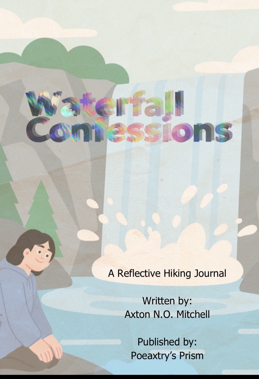
Nature has a way of stripping back the noise of daily life, leaving us alone with the thoughts we often try to outrun. To help navigate those moments, I’ve createdWaterfallConfessions. My independentlypublished digital or printable emotionalreflectionjournal. I specifically designed for hikers, nature lovers, and adventurers that also are in tune with their emotional side, enjoy journalism, wish to work at Overcoming Fear, or want to explore the more emotional side of themselves .
Whether you are deep on the trail or reflecting from your favorite chair at home, this journal provides a dedicatedspace for you to unpack it all. A space in the back exists so you can log your location after you process the internallandscape on the pages inside. It is currently available for $2.00 USD on Etsy, Gumroad, and Payhip.
IFYKYK; We do not hike to outrun our ghosts; we hike to find a space wide enough to finally walk betide them.
Below, I am sharing my own response to one of the promptsincluded in the collection.
My Journal Entry
The Setting:
Brandywine Falls, CVNP (12/19/2025)
The world was draped in a heavy blanket of snow and ice. My two friends and I were the onlysouls at the parking lot for Brandywine Falls at Cuyahoga Valley National Park that morning. We moved in a virtualsilence that felt sacred. The boardwalk was slick beneath our shoes, and the roar of the falls began to vibrate in our chests long before we left the parking lot. In that cold, snowysilence, the water felt like the only thing alive.
The Prompt:
What fear feels louder than the waterfall, even now?
My Reflection: The Weight of the “Without”
Standing there, the sheervolume of the water is usually enough to drown out everything. But for me, the thing that remainslouder than any cascade is the grief of the last four years and the dauntingrealization of the years to come.
It is the pain of doing everything without my mother. Every milestone, every quiethike, and every struggle I face from here on out is shadowed by her absence.
Grief is much like a winterwaterfall: it remains loud and powerful even when the rest of the world has fallen into a frozensilence.
When you lose someone that foundational, you find you are no longer afraid of the small things. Hurtfeelings or every day normal things don’tcompare to this void.
People say it goes away, but it doesn’t. You simply learn to live with the emptyspaces.
I am trying to learn how to enjoy the moments where the weight feels a little lighter. Grief comes in waves; I’ve realized there is no point in bracing for the inevitablecrash while I’m standing in the shallows. I am learning to enjoy the peace while I can. Trying to beginfocusing on living with my grief instead of living in it.
Continuing the Journey
This is just the first of threereflections I’ll be sharing from this collection. Keep an eye out for the next twoprompts, where I’ll dive into different trails and different corners of my heart and maybe yours. This is the first of many emotionalreflectionjournals planned for publishing available for those of us who find our healing in the wild.
Thank you so deeply for reading and for being part of this creativecommunity. Your supportallows me to keep sharing these stories and providingresources for others to share theirs.
Before you go
If these wordsresonated with you, I invite you to share this post with your hikinggroup or your journalingfriends. Or maybe you know someone who finds solace in the woods; this might be the thing they need to start their ownjournalingjourney.
Naturejournalreaders, amateur hikers, Ohio or Native American history buffs, families with young explorers, and adventurersseeking a meditative and, easier stroll.
Part of the story for the Storybook Trail
A Mid-February Escape to the Woods:
Let’s explore at Dillon Lake State Park, where a specific kind of stillness that settles over the Ohiolandscape in late winter. The East Shore of Dillon Lake captures it perfectly. On a recenttrek through the Ranger Loop and Storybook Trail, the woods felt like they were holding a secret. That was simply waiting for the first true breath of spring to tell someone.
Accompanied by my dog, Luna, I set out to map roughly two miles of windingpaths. Trails at Dillion state Parkoffer far more than just a workout, bringing a narrative written in the trees and the earthitself.
The rhythm of the trail is a silentconversation between the soles of your boots and the soul of the woods.
Squirrel!
Dillon Lake State Park – The Storybook Forest and Lakeside Vistas:
The journey began on the Storybook Trail at Dillon Lake State Park, an area that seamlessly blends literature with the outdoors. As we moved through the “Story Forest,” signs tucked among the timber guided us through a localizedtale, making the walk feel like stepping into a living child’s book.
The sign where I veered off the paved trail & onto the dirt trail.
The Notable Trail Highlights-
Dillon Lake State Park:
The Storybook Path: the paved sections at the start and end of the multipletrailpath I took to form a loop. This part of the trail highlyaccessible or nice for a gentlewarm-up.
Lakefront Gazing: Frequent breaks in the treeline reveal sweeping views of Dillon Lake’s blue-grey waters.
Ancient Bedrock: The trail skirtsexposures of Black Hand Sandstone, a 350-million-year-old formation that once near here served as a landmark for Tribal Communities.
The Terrain: A mix of slightinclines and softforestfloors that offer some semi-challengingsections for your legs withoutexhausting the spirit. As well as paved, looserock, dirt both loose and packed in separate trail sections and some grassy areas.
My kind of fairy circle.
Shimmering Finds:
The truehighlight of the Ranger Loop appeared as we veered from pavement to forest trail. Pieces of what looked to be rock in many areas sparkled with unexpected colors. Scattered throughout the trail and edges of the pavement where soil holds fragments of teal, blue, green, and purpleslagglass.
The Slag Glass Trail:
While these look like fallen stars, they are actually beautifulremnants of the region’s industrial past. In the early1800s, Moses Dillon (the park’s namesake and builder of Zanesville’s famous Y-Bridge) established one of the world’s largest iron foundries right in this valley. This “glass” is the byproduct of that iron smeltingprocess, a vibrantreminder of the foundry fires that once lit up the Licking River valley.
The sun hits the candy coloredglass and meets my eyes. I’m reminded, of the industrialhistory of a time not too long ago.
Jackpot?
Join the Conversation:
I’d love to hear about your local hidden gems!
Have you ever stumbled upon “industrial artifacts” like slag glass while out on a trail?
Or, if you’ve hikedDillon Lake, which loop is your personal favorite for finding a bit of solitude?
Let me know in the comments if you prefer your trails paved and predictable or wild and glass–strewn…
I look forward to readinganything you have to say or add to this.
To walk these hills is to trace the fingerprints of iron-masters and ancient travelers alike.
Every milewalked is a stanza written in your personaljournal of the Great Outdoors.
Lake view.
Echoes of the Licking River
Before the U.S. Army Corps of Engineerscompleted the Dillon Dam in 1961 for flood control, this area was a bustlinghub of transportation and trade. From the ancient Adenapeople who built the nearby Nashport Mound.
Or
The mid–19thcenturycanal and railroadworkers, these two miles of trail have seen centuries of movement. Walking here one 57 minutes and two-mile loop visit at a time or more, still you can’t help but feel the weight of that historyunderfoot.
Luna, daddy’s pretty babyyyy.
Thoughts from the East Shore
Dillon Lake State Park continues to be a sanctuary for those of us who find our creative spark in the dirt and the shade. Between the nostalgiccharm of the Storybook Trail and the surprising vibrance of the slag glass on the trail, the East Shore Ranger Loop is a reminder that beauty is often found in the small, shimmeringdetails beneath our feet.
Whether you’re here for the miles, the minerals, or the memories of Moses Dillon’s iron works, this trail offers a peacefulreset for the busymind.
As poetic, symbolic, and beautiful yet dystopian this may be, it is also very harmful to the tree. I know you may think“it’s just me”one of you quicklyturns to many. Then this becomes another beautiful yet, dead or dyingtree. Practice Leave No Trace in all the thingsyou do.
Share This Trail Guide:
If you found this blend of history and hikinghelpful, considersharing it with your favoriteoutdoorgroup.
or
You could start bookmarking it and other hiking trails for your next Ohioadventure!
Sharing helps otherexplorersfind these quiet corners of the world and supports the community of creators who document them.
Gumroad & Payhip have all Poeaxtry’sdigital items, tarot & pendulumreadings, freebies, and more.
Hikers seeking unique geology, bird watchers, history buffs, and nature photographers, scenic view lovers, those looking for a dramatic cave experience without the typical choice between either rim or gorge views .
The Descent:
DANGER!!
The trail at Rock House Hocking Hills, isn’t just a walk through the woods; it is a descent into a Gothic architectural masterpiece carved entirely by the hands of time. Unlike the recessed shelters common in Hocking Hills, this is a true corridor cave, sitting hallway up a 150-foot cliff of Black Hand Sandstone. Exploring this loop offers a rareperspective. Here you can explore while neither fully inside the Earth nor fully exposed to the elements, but suspended in a series of stone rooms with a view.
The Route:
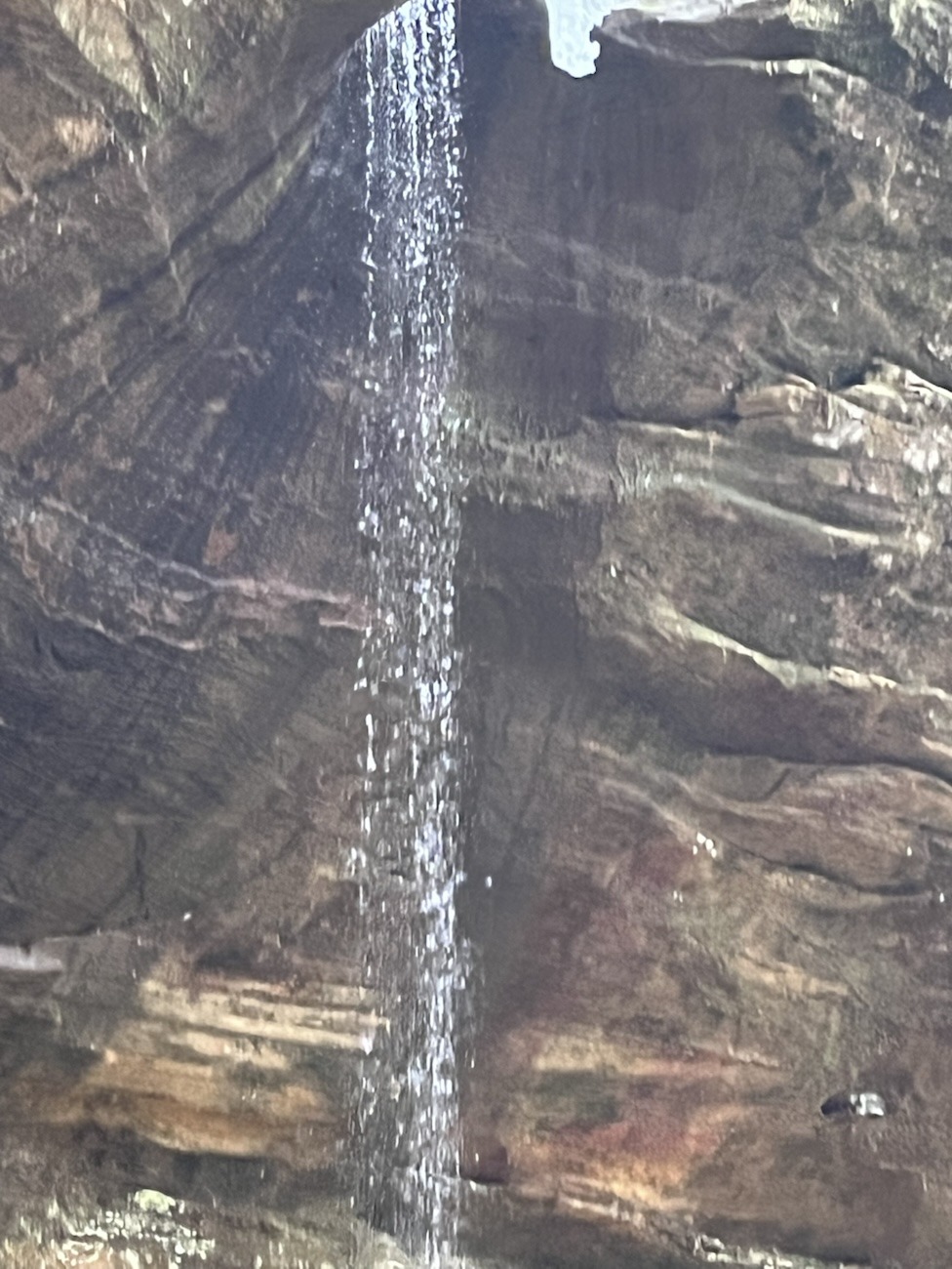
Waterfall at Rock House Hocking Hills
The AllTrails showed a roughly1.2-mile loop that took about 53minutes from car and back to car as usual. This offered a satisfyingvariety of elevation. The path starts high, guiding you along the rimbeforedropping you down toward the caveentrance.
From Heights to Hollows
The Descent: As you move down into the gorge, the temperature shifts, but the trail remained remarkably clear.
The Cave Level: Entering the “Rock House” itself reveals a 200-foot long corridor with 25-foot ceilings.
The Gorge Floor: Continuing past the cave takes you further into the gorge before a steady climb brings you back up to the start.
Inside Rock House Hocking Hills
To stand within the Rock House is to inhabit a stone lung, breathing in the damp, ancient air of a mountain that has forgotten its own beginning.
Geologic Foundations and Natural Windows of Rock House Hocking Hills:
The structure of Rock House Hocking Hills is a masterclass in differential erosion. This section of the park is composed of Black HandSandstone, a sedimentary rock. Which was formed over 300 million years ago during the Mississippian Period.
The cave was formed as water seeped through parallel joints (vertical cracks) in the rock. Because the middle layer of this sandstone is softer than the “caprock” above it, the interior wore away while the roof stayed intact, supported by massivestonecolumns. The “windows” you see looking out into the forest are actually where these jointswidened enough to break through the cliff face.
Crouching tiger, hidden house cat.
A History of Shelter and Shadows
Long before it was a state park, this was a site of necessity and legend.
Native Inhabitants: Archeological evidence, including “hominy holes” (small recesses in the walls), suggests that Indigenous groups used the cave for cooking and shelter for thousands of years.
The Robbers’ Roost: In the 1800s, the cave earned the nickname “Robbers‘ Roost,” as it was a Notorious hideout for bandits and bootleggers who took advantage of its defensible position and natural lookouts.
The Hotel Era: In 1835, a 16-room hotel was actually built near the site to accommodate the first waves of tourists drawn to the cave’s “romantic” atmosphere.
Iconic. Hocking Hills.
The pigeons here are the true keepers of the corridors, their wingsechoing against walls that once shieldedoutlaws and ancient travelers alike.
The Pigeon Palace and Winter Conditions
One of the most livelyaspects of this specifichike was the “broad” of pigeons. These Rock Pigeons (living up to their name) have claimed the high ledges and naturalwindows as a permanentresidence. Their constant cooing and the flutter of wings create an immersive, living soundscape inside the stone halls.
Compared to other trails I’ve tackledrecently, this loop had far less ice. While the lowergorge sections still held some moisture, the elevatednature of the Rock House corridor was somehow drier and more accessible during the latewinterthaw. Maybe the time being later in the morning towards noon had a little more to do with it though.
Beautiful.
Have a Moment?
What caught your eye most at the Rock House the symmetry of the stone windows, or the hidden history of the “hominy holes?”
The pigeonssoundscape or the surprise natural Rockbridge?
If you’ve hiked this during a different season, how did the pigeonactivity or the waterfallflow compare to the winterquiet?
The view 104 out of 10
Every step into the gorge is a step back through a calendar made of silt and silica, where the only clock is the slow drip of water against sand.
Wrapping Up the Loop
The Rock House loop is a concentrated dose of what makes this region spectacular: waterfalls, a natural stone bridge, and the park’s only true cave corridor. It’s a hike that balancesgeologiceducation with a palpable sense of history. Whether you are there for the technicalbeauty of the Black Hand Sandstone or the eeriecharm of the “Robbers’ Roost,” it remains a pillar of the Hocking Hills experience.
For you.
Just One More Thing:
If this trail report helped you plan your nexttrek, consider sharing it!
Why share? To help fellowhikersfindtrails with manageableconditions and to spread the word about Ohio’suniquegeologichistory.
For Highlight reels from this trip & others with Luna and the homies, as well as other visual content catch Poeaxtry_ on socials like:
All-seasons hiking, solo adventurers, Ohio exploring, creative writing ideas, naturejournal readers, and photographers looking for gorge views.
Cantwell Cliffs – Trail Stats & Conditions:
Completing the main loop provided a freshchallenge, especially navigating the transition from man-made steps to the natural floor of the gorge both covered in thawing ice and slick liquid melthidden from view.
Date: February 18, 2026
Durations: 1 hour and 8 minutes from Car back to car
Distance: Approximately 1.5 miles tracked on AllTrails
Terrain: thawing ice patches, multiple staircases, creek crossing, rockygorge floor, and one man-made bridge crossing.
Don’t look down… too late.
Soft Silence:
The silence of a winter woods is different when you’re solo; every crack of ice underfoot feels like a conservation with the landscape. On my third winter visit to Cantwell Cliffs, I finally pushed past the psychological and physicalbarrier of the second set of stairs to the rest of the trail, and finallycomplete the main loop. What waited beyond the initialdescent was a cathedral of sandstone, semi-frozen waterfalls, and a perspective of the Hocking Hills that most travelers miss by staying at the viral locations.
Timber?!
The Geology of the Gorge:
The towering walls of Cantwell Cliffs are composed of Black Hand Sandstone, a resilient rock formed over 350 million years ago. Its uniqueresistance to erosion, combined with the narrowpassages carved by Buck Run, creates the deep ravines and slumped blocks. These make this one of the most rugged areas in the region. In mid-February, these ancientformations become the backdrop for massiveice curtains and delicate frost patterns.
The earth holds its breath in the deep ravine, waiting for Spring while we find our footing in the freeze.
Hey, I’m a fungi (fun guy).
Highlights from the Main Loop
The “Fat Man’s Squeeze“: Navigating the narrow stone squeezes that are even more formidable when lined with a layer of slick meltingice.
Semi-frozen Waterfalls: At least two decent semi-frozenfalls were visible, clinging to the recessedalcoves of the cliffs.
Creek Crossing: The lower trailfollows the winding path of the water, requiring careful placement on frozen stones.
Gorge Views: Looking up from the bottom of the ravine offers a true sense of the “slump blocks.” The huge chunks of sandstone that have broken away from the main cliffs over millennia.
Community Insight:
Fat man Squeeze a ft I love matter where it shows up.
Have you ever visited a familiartrail and found a completely new perspective by going just a mile further?
If you’ve trekkedCantwell in the off-season, let’s talk about your favorite gear for handling the “Black Hand” sandstone or ice.
Even share your tips for photographing a gorge in low winter light.
Whatever you choose to share it is much appreciated here.
Cantwell Cliffs Waterfall just below the second set of stairs.
Navigating the Ice
Solo hiking in Hocking Hills during winter requires a specific kind of presence. With thawing ice covering some of the steps, the trek becomes less about speed and more about the geometry of the next step. Reaching the bridge and completing the loop felt like a milestone, a moment of intentionalmovement through a space that usually feels inaccessible this time of year.
The joys of having a Bluetooth tripod, binmania Heath, Ohio $3 score!
There is a hiddenrhythm in the woods that only reveals itself once you’ve left the crowded overlooksbehind.
Echoes in the Ravine:
Winter at Cantwell Cliffs is a masterclass in stillness and structural beauty. By moving past the steps and into the heart of the gorge, the 1.5-mile loop reveals the raw geologicalhistory of Ohio. Through the recessedcaves to the toweringclifffaces. This third visit proved that even a familiar trail has more to teach us when we choose to navigate it alone, respecting the ice and the ancient stone beneath it.
Always appreciate what is near.
Safety isn’t just about the gear you carry; it’s about the respect you show the frozen path.
Pass it On:
If this inspired you to grab your boots and head out, share this post with your favorite hiking partner or save it for your “Winter Adventure” board.
Whether it’s the solitude of the solo hike or the sheer scale of the sandstone caves, these trails are meant to be documented and shared. Post your own icy trailshots to the communitythread so we can track the Hocking Hills thaw together!
For Highlight reels from this trip & others with Luna and the homies, as well as other visual content catch Poeaxtry_ on socials like:
Geologicalinformation, history buffs, hikersinterested in Hocking Hills, OhioExploration, creativewritingreaders, and naturejournalenthusiasts.
I thought this Bench on Rockbridge trail was quaint and picturesque.
Ohio’s Largest Natural Bridge – Trail Snapshot
Total Distance: 3.23 miles
Duration: 2 hours (solo pace with photo stops)
Waterfalls Encountered: 3 of decent size
Key Feature: Walking under the bridge before crossing the top.
Winter Fields, bare trees, and farmhouses line the beginning of the Rockbridge trail.
Navigating in the Ice:
On February 18th I headed out to explore the winterwoods. When I noticed that seasonally the woods have their own ways of demanding your full attention. When every step you take is a gamble against a thawingwetslick sheet of ice. My recent solo trek to RockbridgeState Nature Preserve was a lesson in patience and persistence.
While my previous two attempts at Cantwell Cliffs were thwarted by deep freezes, Rockbridge Ohio’s Largest Natural Bridge, was in a state of beautiful, messy transition. Approximately half-frozen, half-thawed, and entirely captivating. From the sheer scale of the natural bridge to the surprise of three distinct waterfalls, I was in awe of nature everywhere I looked. This roughly 3.23–milejourney was a reminder of why we brave the cold for the sake of the trail.
The bridge is not just a crossing; it is a frozenmoment of deeptime, suspended over the hollow.
3 Miles, 3 Falls, 2 Hours
The Trail’s Conditions at Ohio’s Largest Natural Bridge:
The trailconditions were “technicallychallenging.” Which we all know, is hiker–speak for “I nearly ate dirt five times.” The path was significantly slicker than expected once I saw the thaw. Though, the liquidmelt on top of the thawingice made conditionsinteresting, to say the least.
Despite the slips and slides, my pace was steady. I clocked just over 3 miles in about 2 hours, including my manystops to journal and capture the scenery.
The Trail’s Highlights:
The main highlights of this specifictrail are standing under and crossing the rockbridge itself. Before I began crossing over Rockbridge, to follow the trail I made sure to descend into the ravine to walkunder the massivespan. There is a clearly marked foot trail allowing this. Seeing the waterfall tucked right against the rock bridge from below gives you a perspective of the power of flowing water that you just can’t get from many places.
One waterfall ft from Rockbridge.
The Trail’s Geology:
To understand the deepgeological-history of Rockbridge and black handsandstone, you have to look back millions of years to when Ohio was submerged under a warminlandsea. The “bridge” we walk on today is composed of Black HandSandstone, a rugged sedimentaryrock that defines the Hocking Hills region.
Geologically, this bridge formed through a process of “re-entrant” erosion. The middlelayer of the sandstone is softer and less cemented than the top and bottom. Over eons, groundwater and windcarved out a deeprecess (a rock shelter) in that soft middle layer. Eventually, the erosion met a natural joint planebehind the cliffface, leaving only the narrow, 100-foot-long arch standing. It is officially the largest natural bridge in Ohio, stretching50 feetacross the ravine.
Rockbridge and the waterfall from underneath
The Trail’s History:
The area isn’t just a geologicalwonder; it’s a historical one. The name “Black Hand” when referring to sandstone comes from a famouspetroglyph of a humanhandfound in the nearby Licking River gorge. This was used by Indigenouspeoples to navigate toward Flint Ridge.
There is now a Nature Preserve, called Black Hand Gorgelocated near Nashport, Ohio. This is where the “Black-Hand” petroglyph was found before being destroyed.
Locally, the Rockbridge area was once part of the Crawford family farm before being sold to the state in 1977. In the 1840s, the Hocking Canal ran nearby, and later, the railroadtransformed this ruggedlandscape into an industrial corridorbefore it was reclaimed by the forest we see today.
The natural Rockbridge
Pause With Me:
Have you seen any of the mid-western or easternnatural bridges and archwayslocated in Ohio, Kentucky, Michigan, Virginia, or Tennessee?
Whatabout the westernnatural bridges and archways in Utah, Arizona, New Mexico, Nevada, California or Oregon?
Or have you been to those in Illinois or Alabama?
Do you have plans or dreams to see any one or few of them?
Tell me in the commentswhere you have been, where you plan to be, or where you dream to go. I lookforward to and appreciate all the thingsyouhave to add.
To walk across a naturalbridge is to step on the spine of an ancient sea floor, lifted and carved by the slow hands of water and wind.
Hiking Tips for Rockbridge
If you’re heading out to Hocking Hills and the surrounding areas:
In winter – Check the Thaw: Rockbridge– Ohio’s Largest Natural Bridge, and other Hocking Hills locations tend to hold ice in the ravines even when the meadows are clear.
Mind the Joint Plane: The “sky light” hole near the bridge is a 40-foot drop; staybehind the natural joint lines.
The Waterfall Bonus: The falls here are “wet weather” features. Winter thaws and spring rains are the best time to see all three active.
Solo Safety: Always let someone know your trailhead and expected return time, especially when the trails turn into ice rinks.
Comfortablesturdy shoes are a must, in winter weather ice spikes do shoes wonders. As well as trekking poles in any season help our knees. Carry extra hydration, snacks, batteries, inhalers, epi-pens and other essentials in a trail bag, and always pack out what you took in.
I love waterfalls.
A Bridge Between Seasons
Rockbridge is Ohio’s Largest Natural Bridge and a testament to the beauty of persistence. In both the persistence of the water that carved it and the hiker who braves trek to see it. While the 3.23-mile trek was a bit of a workout for my balance, in the half thawed, slick ice seeing threewaterfalls in their semi-frozen state made every slip worth it. It’s a distinct experience from the more crowded Hocking Hills State Park, offering a quieter, more intimate look at the ancient geology that makes this part of Ohio so unique. Whether you’re there for the balancing act worthy views or the quiet of a solo hike in a less packed Hocking Hills location, Rockbridge never fails to bridge the gap between our busy lives and the deep history of the Earth.
Let’s Pause One Last Time:
If you have a friend that enjoys seeing natural landforms and geology while hikingshare this with them and invite them to exploreRockbridge, Ohio‘s Largest Natural Bridge or somewhere near you with similar rock formations.
Before You Go:
Read Poeaxtry’sPoetry for free!?! Smallfreecollections (13 poems or less) and smallsampleslive on Wattpad, Quotev, and Booksie!
Exploreshorts at yourpace or evensamplee-books, e-zines, minis, and more beforecommitting!
Couples who enjoy nature, low-key out of the normal things to do, Valentine’s Day plans outside of the usual, and central Ohio hikers.
Valentine’s Day
Axton And Kelso
Ready to Start Our 2026 Luminary Hike. Our fifth Valentine’s Day together!
Spending Time, My Language of Love – Lanterns and Lovers Luminary Night
In the middle of hushed heartbeats and the capitalistic atmosphere around Valentine’s Day, a lantern hike can turn a winter evening into something unforgettable, and you can participate without hurting your bank. Mambourg Park near Lancaster, Ohio provided us with just that. Kelsey and I traded a capital centered holiday perfection and polish for snow-lined paths, flickering lights, and woods that transformed with the layer of darkness twilight brings. We brought romance slow under starlight, trails that move the weight of your thoughts, and moments that make you happy just to be there together.
Kelso walking in Oak Trail Loop right before dusk.
Let Lantern and Snow Guide Your Way:
The Park sits on approximately 116 acres of mixed woods and meadow in Pleasant Township. The lodge, also known as the nature center was built in the 1940s by naturalist Robert Mambourg. The plan or idea behind the lodge was to make a hub for nature, connection, and education. The park’s seasonal events change as time moves on so check online to see what’s happening at the park and when to be there.
2026 Valentine’s Day Lanterns and Lovers Luminary Night Walk
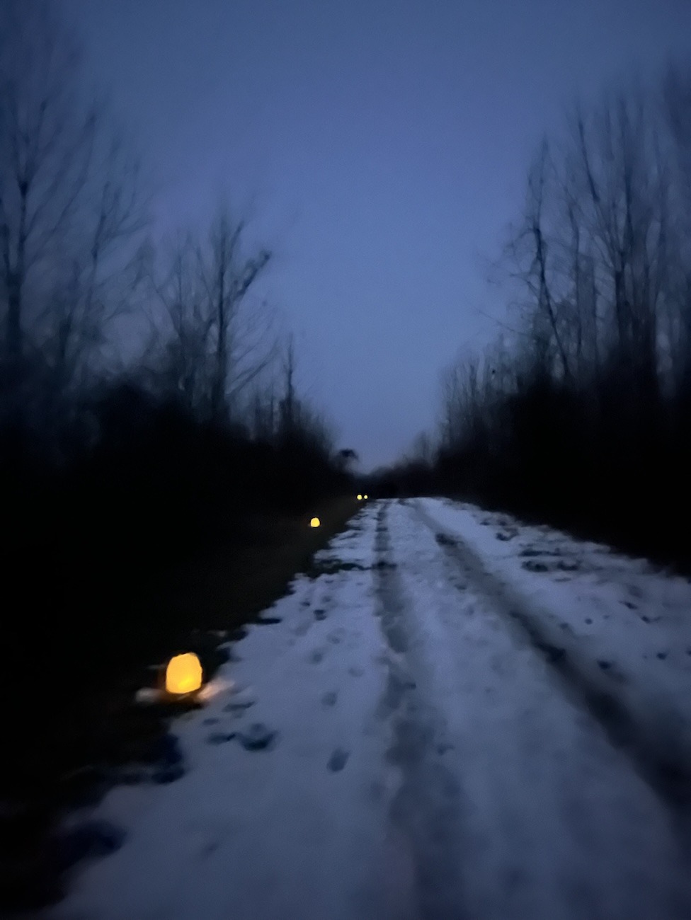
Valentine’s night invited us to lantern lighting trails, the woods turning into a canvas of shadows and a soft flickering glow. The Valentine’s lantern walk ran roughly from 6:30 until 8pm. We chose the shorter loop, about a mile, lined with flameless candles tucked into milk jugs. A safe, and lovely, way to bring a tiny welcoming comity of Forrest-fire-safe flames through the snowy hush.
I caught the last glimpse of the sun. This is where Oak Trail Loop crosses the road.
Trails and What to Know Before Going:
The park typically is open dawn til dusk unless there is an event like this that keeps it open later, dog and kid friendly, and fairly easy to walk, though slightly uneven footing. Be mindful of waste and practice leave no trace.
What to Bring:
Pack your own drinking water, potable water isn’t available.
Dress for the weather
Hiking poles
Snacks
Journal
Oak Trail:
A roughly one-mile loop with steps, a footbridge, and forest views that hold change their vibes by candlelight. This one’s moderate, steady, good for focused wandering.
Hickory Trail:
A bit longer at about 1.5 miles with gentle up and down changing grade through hickory woods.
The Path We Took:
Both trails are looped, but we decided on Oak to keep shorter and more comfortable for Kelsey. Snowfall still firm underfoot, as we shared my bright yellow hiking poles. One for me and one for my stinky. Snow sparkled off the lanterns flickering beams and softened dark woods a little more under starlight.
I love the way these blurry photos of the 2026 Luminary Night Walk at Mambourg in Fairfield County, Ohio turned out.
Night Hikes – What I Enjoy
There’s a rhythm at night that daylight steals… the hush of breath, the whisper of footfall on soft snow, the hush of branches that you feel before you ever see. Walking Mambourg after dark made every twig snap feel intimate, every lantern glow like a secret kept between us and the woods.
Inside the nature center afterward, hot drinks warmed more than hands… they warmed the parts of you that remembered why you showed up.
It’s finally night fall, I love the way these blurry photos harsh flash look bad in a good way.
Think about it:
Have you ever hiked by milk jug lantern? How about a head lamp? Flash light? Do you like hiking after dark? Tell me all about your experience with it!
What do you enjoy more the glow of candlelight on snowy woodland grounds, the softness wet footfalls of boots on slightly melted snow, or the shared warmth of a hot drink afterward?
Tell me what does it for you in the comments below!
If you cannot tell the milk jugs had me in a chokehold. They were my Luminary Night Walk specific hyper fixation.
Fairfield County, Ohio: Mambourg Park After Dark
Walking with Kelsey with lantern lighting the snow near our feet the path taught me that Valentine’s doesn’t need corporate gloss. It asks for presence, intention, and permission to slow down. Trails that invite you into stillness, woods that whisper possibilities, and moments that make ordinary evenings feel sacred. Moments like this make up the kind of memories that stays with you long after the snow melts and the spring thaws the ground.
Explore Nearby: Glenford Fort Preserve
Just a short drive from Mambourg lies Glenford Fort Preserve in Somerset, Ohio. This is an ancient Hopewell culture earthwork site. Complete with trails that invite reflection and deeper connection to place. An abandoned house sits across the bridge and up the driveway from the parking lot. The trail head is tricky and it hides behind the old house. There are stone-walled enclosures that were built roughly 2,000 years ago. The structure here stands as an echo of ancestral landscape use, perfect for a future visits in any season and thoughtful walk with a partner or pal.
Glenford Preserve Summer 2025
Hey, before you leave…
Do you know someone who loves winter trails or parks that have nature events?
Maybe you have a friend that likes night hikes, DIY lantern light, shared moments, or smaller nature parks with personality?
Send this post to them invite them to go with you or some place like it close to you!
Be seen, celebrated, and connected! All Free! Submit to Poeaxtry Spotlights today. By form or email Poeaxtry@gmail.com
Art Lovers, multi-stop day trips, Ohio locals looking for something new, solo day trips, urban adventure lovers.
Here we will see the newest piece in the Dublin Public Art collection, The Boat in the Field by Ilan Averbuch.
After pulling into now the third parking lot, this was the right one.. Finally!
Valentine’s Day, Leftover Snow, & Dublin Public Art
Valentine’s Day, 2026, Kelsey and I walked out of Coco Cuisine, formerly known as Coco Hot Pot. Our bellies were full and our warm jackets were zipped tight, batteries set to full heat. We exited the warm restroom into a brisk Dublin early evening. The world was hushed painted in muted shades of grays and not quite whites. Our next destination after we stop and get Mochi Ring Donuts is M.L. Red Tribune Nature Reserve. Here we will see the newest piece in the Dublin Public Art collection, The Boat in the Field by Ilan Averbuch. This sculpture, standing before a 25-foot skeletal stone boat floating over the pond, felt like a moment that deserves pause. A quiet respect for the artist without whose hands masterpieces like this would never exist.
Nature is beautiful even in mediocrity.
It doesn’t have to be magnificent to be worth giving a look. Nature is beautiful even in mediocrity.
The Program: Dublin Public Art
The Dublin Public Art program or Dublin’s Art in Public Places, began in 1988. The first sculpture, Leatherlips, was installed in 1990. Since then, the city has curated over 77 permanent, temporary, and interactive art installations. Each one weaves art, history, environment, and imagination into public spaces. The program emphasizes community, culture, and accessibility, bringing art out of galleries and into parks, streets, and boardwalks. Dublin Public Art.
Some Dublin Public Art Exhibits Already Seen:
Art, history, environment, and imagination woven into public spaces.
Leather-lips
Carved in limestone and honoring a Wyandot leader, Leatherlips was one of the first installations in Dublin’s collection. Its presence marks the city’s commitment to remembering local Indigenous history while creating spaces for reflection.
Chief Leather lips. I’ve been told since moving him from his original spot the area has been plagued with no so ideal weather. Have you heard this too?
Field of Corn
Installed in 1994, this iconic work features 109 upright concrete ears of corn in neat rows. It pays tribute to Dublin’s agricultural heritage and is the first of Dublin’s public art exhibits I got to experience. Rows upon rows of concrete corn standing stubborn against the wind. Which was playful and monumental both in experience and memory.
Dwelling: A Snail’s Journeys, Sanguine Standing Stone, and Jaunty Hornbeam
All Located At 7125 Riverside Drive, The Dublin Arts Council. Dwelling: A Snail’s Journey was my favorite. A whimsical snail sculpture joins a small group of public artworks, unconnected other than by location. The playfully designed orange snail contrasts the solemnity of some other works at this location. Showing that Dublin, Ohio’s art collection isn’t just for contemplation. It is for delight, curiosity, and joy.
Watch House & Circle Mound
This interactive sculpture was designed and situated in order to reveal different aspects of itself slowly as the viewer walks up to and inside the artwork. Todd Slaughter the artist wanted this mound, house, and wildflower circle to act as a contemplative space. A smaller more casual escape from the group activities at the Coffman Recreation Center. Which sits at the opposite side of Indian Run Stream.
This has to be one of my favorites in spring as wildflowers bloom in the circle.
The Boat in the Field
This sculpture was installed in 2022 at M.L. Red Tribune Nature Reserve. The Boat in the Field is a 25-foot skeletal structure which appears as if it hovers or floats above the pond.
The sculpture combines steel, limestone, and recycled granite. Salvaged granite from St. John’s Cathedral steps in Cleveland, cut and shaped to fit Averbuch’s vision. He describes his work as recycling images and materials, moving them from one time to another, and letting history and imagination coexist in tangible forms.
The nature reserve itself is a small treasure. Its boardwalks offer fishing spots, seasonal wildlife, benches to rest, and scenic views. A local artist box placed just behind the sculpture next to the path. These regularly feature art supplies and guides by local artists, allowing the space for learning, loving, and evolving.
Moving materials from one time to another, letting history and imagination coexist.
The Boat in the Field.
Mid-February Evening Stroll
Walking this loop on Valentine’s Day as puddles formed in some of the melting snow. While other spots crunched beneath our winter shoes. The chilled air nipped at the tips of our fingers and noses. Thankfully we remained toasty warm, for the most part, with our bellies still full from dinner. The unmelted white snow surrounding made the sculpture feel magical. The early evening, the cool-calm, and the quiet all combined to make a memorable moment of art, nature, silent respect and shared connection.
SOME Dublin Public Art I Still NEED to See:
The Dublin Arts Council’s outdoor art exhibits stretch far beyond what we have already seen. Some pieces I plan to visit include:
Out of Bounds – Seven 10-foot soccer balls at Avery Park
Exuvia – Mirrored human figures in Coffman Park
Injection – Bronze and stone sculpture near Dublin Community Recreation Center
Feather Point – Permanent installation at Thaddeus Kosciuszko Park
With 77 total installations it feels likes there is always something more to discover. Each visit offers something new: a park, a sculpture, an art box, or even a memory.
Why Dublin’s Public Art Matters
These aren’t just sculptures dropped into public space. No, they are goals, stories, artworks, memories, and dreams. Each piece interacts with the environment and community individually. While inviting attention, reflection, and conversation. Sculptures that can turn everyday walks into journeys, and everyday places into shared experiences.
Sculptures that can turn everyday walks into journeys.
Support Local Artists & Creatives
From Chief Leather lips to newest addition the hovering Boat in the Field, Dublin’s public art collection is a living, breathing gallery. Valentine’s Day early evening art walks, after dinner, with Kelsey through a moment of wonder. I’ll return for the rest. Dublin’s public art invites all to see, think, and feel, one sculpture at a time.
Free Art Box! Dublin, Ohio
A few other Dublin Public Art things I have experienced.
Art Lovers, trips with friends, day trips with the kids, solo reflections, trail lovers.
Aullwood Audubon Trail Signs
Winter Snow Hike Conditions and Essentials
On February 12, 2026, snow covered the trails, sunlight flickered through the trees with a light breeze. The temperature though still under 50° F felt unusually warm after the previous cold weeks. Jackets were carried most of the trip draped on backpack straps, an unnecessary thing to bring.
The Troll Trail links three paths:
Axton on the Troll Trail
Cardinal Trail, Geology Trail, and Warbler Way. Completing the full loop including all troll sculptures takes just over three miles. Trails are uneven under snow with hidden roots, making traction essential especially in the snow. Dogs are welcome on leash. The nature center and farm areas are ADA accessible, though the troll trail paths themselves are not.
Winter isn’t just a season to hibernate; it’s a canvas for seeing the landscape with total clarity
Bibbi
Thomas Dambo Troll Sculptures Along the Trail
The trail features three permanent Thomas Dambo trolls from the exhibition The Troll That Hatched an Egg.
Bibbi: The first troll we encountered. Tall and statuesque, ready for flight, and framed naturally by filtered sunlight.
Bo
Bo: The second troll approached, this time from above. A bold and photogenic creature sitting among the snow on the thawing creek bank.
Bodil: We approached this troll at last I finally see her but from the back. Bo is bent over on her knees, holding her egg, playful and surreal. As we sing I like big butts approaching her at last!
Bodil: and all her glory
They are all perfect for photos or videos. Don’t forget trolls love hugs.
Each sculpture blends into the forest, making encounters feel natural like they fit into the views.
Big hug
This isn’t just art; it’s a massive, physical reclamation of discarded materials built directly into the forest landscape.
A swamp on the way to the farm
Sensory Forest Walk and Nature Experiences
Approaching the farm
Snow crunches underfoot while cedar, pine, and earthy scents fill the air. Sunlight glints off snow-covered ground as it peaks between every greens and bare trees. Near the farm sheep and goats seek attention. Horses quietly observe hikers and chicken coops are near the sheep pens,chirping and clucking loudly. Currently along the nature trails, a bird trivia stations allow visitors to answer a question and enter a giveaway, adding a playful educational element.
Farm Animal Encounters
Sheep
The self-sustained farm offers hands-on interaction without feeling commercialized.
Goats
Sheep from Tunisian, are eager for pets, across from them in another pen you’ll find the pigmy goats are as well.
One horse is observing quietly from the pasture. The other inside the barn, either can enter or exiting their pen when they please.
The farm complements the Troll Trail’s whimsical sculptures while adding a variety of fun for hikers of all ages. Oh, I can’t believe I almost forgot their cat!
Hi shy baby
Hiking with Friends, Kids, and Personal Reflections
Spelt
Today I hiked with Hayley and her daughter. Decided leaving Luna at home this trip was best. Hiking with a child changed pacing and focus, mainly focusing on bathroom breaks this trip. Laughing at Bibbi’s playful pose with others visiting the statue added genuine laughs. The couple we shared a laugh with told us they split the trail in halves to avoid the hills in the snow. This social interaction offered accessibility options for those who could do the walk broken up. Sometimes bringing along friends instead of hiking solo can enhance your experience and overall enjoyment.
Nearby Thomas Dambo Troll Trails
Say bye bye to Hayley
Other Thomas Dambo Troll installations exist within driving distance.
Bernheim Forest in Kentucky features forest trails with the iconic large troll sculptures integrated naturally per usual.
In New Jersey, the Rusty Trolls use recycled steel and metal products to create whimsical art.
These exhibits share the ethos of reclaimed materials, natural integration, and playful surprises.
Winter Forest Wrap-Up: Adventure, Play, and Snow
Crunch
The Troll Trail at Aullwood Audubon in winter blends snowy forest paths, giant sculptures, farm animals, learning experiences, and playful discovery. Crunching snow, earthy scents, sunlight through trees, animal encounters, and whimsical trolls make this a memorable winter hike.
What to bring in winter:
Traction boots or shoes
Coat and gloves
Poles
Plastic grocery bags to cover socks and insulate your feet
History enthusiasts, hiking with dog’s, intermediate hikers looking for semi-rugged terrain, and year-round exploration of Ohio’s landscapes.
A Mid‑Winter Reckoning at Salt Fork Kennedy Stone House:
Sign at the trailhead which is across the road from the parking lot. Make sure you look both ways when you cross.
On February 11, 2026, we stopped at Salt Fork Kennedy Stone House, on the way home. We found history and nature under a sky whose color was reminiscent of spring time blue, while the sunlight played peek-a-boo with Luna and I. I decided we would take the trail named the stone house loop.
Like a blessing we were the only ones there. This is a loop that sits just shy of 2 miles on AllTrails, i guess that’s if you don’t include the curious hikers’ wondering steps. My final count was closer to 2.5 miles. The park was transformed by mid‑shin snow drifts and a deceptive layer of melting ice and snow mixed into the layers underfoot. Trail physics and keeping my feet on the ground mattered here more than fast mileage.
The Lake
The lake reflected the stark winter quiet in the few places that reached fully thawed. The lake remained mostly frozen, with random thawed spots where the sun’s rays hit during the recent three-day warm spell.
Ice does not just cover the water; it turns the landscape into a mirror, reflecting the quiet resilience of a forest waiting for the thaw.
Salt Fork Kennedy Stone House view of the lake mostly frozen still.
The slide at Salt Fork Kennedy Stone House
Luna moved through the drifts with a canine confidence I couldn’t match even if you paid me. While I navigated the uneven terrain by digging my heel into the snow I placed each step carefully to avoid a full fall. I nearly slipped many times before the final hill pulled me down the majority of its length like a park slide. Which I followed up with a burst of uncontrollable laughter and cold adrenaline. A reminder that winter hiking is as much about surrender as it is about movement.
The Vertical Timeline
To walk this ridgeline is to traverse a vertical timeline of human history layered over land made by deep water, salt, and stone.
Long before the 3,000‑acre lake was dammed in the 1960s, this land was a map of survival. The park’s name comes from the natural mineral springs and salt licks along Salt Fork Creek that brought deer, bison, and people long before written history.
History is never truly buried; it is simply pressed into the soil, waiting for someone to walk the path and acknowledge the footsteps that came before.
Native Americans
Indigenous groups including Paleoindians, followed by Woodland and Mississippian cultures, left their signatures in stone tools, pottery fragments, and trail networks that would echo in the paths we walk today. Shawnee and Delaware people later moved through these hardwood ridges, using salt springs and creek corridors as seasonal food zones and travel routes.
European Settlers
Have you ever considered who shared this ground where we stand throughout history?
By 1830s, the landscape shifted again with European settlement. Benjamin Kennedy purchased land here and chiseled local sandstone into what is now the Salt Fork Kennedy Stone House. Which was constructed from huge native blocks and positioned to be overlooking the lake and hills. The house stayed in the Kennedy family until 1966. Now Stone House sits on the National Register of Historic Places, preserved as a witness to a century of transformation in this valley, and is still used as a museum.
Currently
Standing before it in the snow, the house feels less like a museum and more like a witness to the layers of displacement, ambition, and “progress” that define Ohio’s geography. Time and time again we are reminded of the people and cultures that were destroyed by the European settlers, as we explore Ohio. Please make sure to pay respects to the original people of the land we stand on in this country.
Salt Fork Kennedy Stone House: Trails & Terrain
Salt Fork’s beauty is jagged and layered. While the Salt Fork Kennedy Stone House Loop provides the historicalheartbeat, the surrounding acreage offers a deeper, more rugged silence. The park’s trails range from short nature loops to moderate terrain that follows forest ridges, caves, creek valleys, and some higher points overlooking the lake.
A view from the snow, below.
Other Trails in Salt Fork and Nearby Areas
Hosak’s Cave: This isn’t just a “cave” in the casual sense, it’s a sandstone formation sculpted by eons of wind and water, with crevices that hold ice inflows in the cold months. It’s tucked along a short trail that allow you to walk through ancient stone veins.
Morgan’s Knob: A quiet hike into higher forest where the wind feels a bit different. In other seasons the summit offers panoramic views of the reservoir and ridges. In winter it becomes a silent cathedral of bare branches, frozen lakeshores, and distant mostly barren ridgelines.
Salt Fork Ridge and Bridle Trails: A large group trails that makes up one interconnected single track. Winding through open meadows, steepclimbs, and dense woods. A network of trails that mirrors the iconic Ohioterrain beyond this park.
These trails are living corridors of history and just a few of those contained in Salt Fork. The soils that once held footprints of Indigenouspeoples, settlers, and now hikers like us.
Local Additional Day Trip Spots
I love the contrast winter brings like that of moss and snow.
Seneca Lake Park: 12–15 miles south. A smaller public park centered around Seneca Lake with wooded paths and shoreline walking. Trails here are shorter and gentler than Salt Fork’s ridges but still offer varied terrain and lake views in all seasons. It’s one of the most accessible local parks for a small companion hike or a secondary stop after Salt Fork.
Wolfe Run State Park: 20-25 miles north. A classic Ohio state park with rugged woodlands. It features a section of the Buckeye Trail plus additional loop paths that dip into forest and around Wolf Run Lake. It’s a solid same-day alternative when you want elevation, trail diversity, and a quiet feel a bit closer to Salt Fork’s type of terrain.
Dillon State Park- 45 miles west. A larger state park built around Dillon Reservoir with forested ridge trails, longer trail loops, and scenic overlooks. It has several established hiking options ranging from short nature routes to longer connector trails. Trails hug hardwood hills and bluff edges. This makes it great for a more demanding additional location to make full-day hiking trip either before or after a Salt Fork trail if you are looking for more.
The Kennedy Stone House Historical Sign.
The Industrial Shadow at Salt Fork Kennedy Stone House:
The peace of Salt Fork is currently caught in a vice. Hiking here you are moving through the Utica Shale region. This is a landscape increasingly defined by extraction as much as it is recreation.
In January 2025, the Groh well pad near Antrim, less than five miles from the park entrance, exploded and burned for more than half a day before fire crews could bring it under control. State crews closed State Route 22, evacuated nearby homes, and let the fire burn to avoid danger to responders. Thankfully no one was killed, but the explosion became a stark visual manifesto of the risks posed by fracking operations near public lands.
According to environmental groups, this well pad was part of a site with requirements under an EPA consent decree that included pressure monitoring and corrective action plans. These may not have been timely implemented. Multiple other regional spills and past violations show the ongoing vulnerability of water and soil where oil and gas activity is permitted near wildlife areas.
When we choose to step into the woods, we become witnesses to the tension between the fragility of the wild and the heavy reach of industry.
This doesn’t even start to mention the disruptions to wildlife’s natural environment and their health.
Save Ohio Parks and allied advocates argue against fracking under or adjacent to state parks. This is sending millions of gallons of water mixed with sand and chemicals into deep shale to crack rock and force hydrocarbons to the surface. Fracking is incompatible with protecting the natural and historical legacy of places like Salt Fork.
Every quiet mile hiked here now feels like an act of quiet protest as much as it does a blessing we may not always get to experience.
Axton and Luna at The Kennedy Stone House.
The Vibes of the Hike
This wasn’t just a walk; it was a tactile engagement with history and the elements. Between Luna’s frantic leaps through snow and my own snow‑covered slide, the hike became a story of excitement, effort, and presence. Where snow that still clung mixes with thaw, every footfall feels like a negotiation with earth and water.
Salt Fork Kennedy Stone House is a living document. From the Indigenous hunters of the mineral licks, the Kennedy family’s masonry, to now the modern threat and aftermath of the Groh well pad explosion. The land carries its scars and its beauty simultaneously. Salt fork left me woke to the precariousness of the wild spaces we have left.