Journals of recent hikes, including accessibility, who went, kid- and dog-friendliness, weather, and nearby trails or other nearby cool spots. Posts layer photos with trip-specific moments, reflections, and thoughts. Other journals show past adventures and past nature spot reflected on based on a prompt or thought, some photos maybe added when available.
Individuals struggling with balancing burnout & social obligations, readers looking for real human vulnerability in literature, & lovers of small indie projects.
The Essence:
Read Time: ⏰4-6 minutes| Mood: 🍃 Grounding & Reflective | Weight: ⚖️ Balanced between Personal Vulnerability & Social Battery Drainage |
The Vault:
Victim of Enthusiasm
Grace, Honesty, & The Circle Who Gets It.
The Reset: Silence, Solitude, & Four-Legged Companions.
The Layers Between: Navigating the Space Where You Recharge.
Victims of Enthusiasm:
I know at least once a month I am a victim of past me’s enthusiasm. Okay so picture this: you’re at home, it’s a random Saturday, and you are feeling unusually ambitious.
The next thing you know you are signing up for an action packed Wednesday hike with multiple people planning to come along.
In this moment the future you is bulletproof.
You have endless energy, a fully charged social battery, and zero concept of what it actually feels like to wake up still tired. You map out your trek and commit to obligations with the cheerful innocence of someone spending monopoly money.
Then, the date on calendar page changes. The morning you were planning for arrives, and you look at the itinerary with a profound sense of betrayal.
The you who made those plans feels like a distant, overly caffeinated stranger who had no right making commitments on your behalf.
This is a strange kind of temporal whiplash where you realize that the version of you who booked the day didn’t have to live through the week that preceded it.
Grace, Honesty, & the Circle That Gets It:
There is an awkward choreography to canceling plans. Society teaches us to invent elaborate excuses
a looming deadline,
a sudden disaster,
a mysterious illness that requires immediate isolation.
Carrying around those little fabrications can get exhausting, especially when all you really want is permission to exist in your own space without performing enthusiasm you do not possess.
That changes entirely when you reach a certain threshold of closeness with people. With the right people, you get to skip the theatrics. You get to just drop the polite social mask and tell the truth: your social battery is blinking red, and the thought of leaving the house feels like climbing a vertical cliff face with no gear.
The real friends don’t care, they just want you to be comfortable. Honestly more often than not, most of my friends respond with a sigh of relief because they were secretly hoping for an excuse to cancel their own obligations and put on sweatpants.
Finding people who accept your low-energy days without taking it personally is rare currency.
The Reset: Silence, Solitude, & Four-Legged Companions:
When your social debts are paid and the obligations are cleared, the real work of recovery begins. For some, recovery looks like a weekend of total hibernation, wrapped in blankets with the curtains drawn. For others, it requires a different kind of quiet, one found out where the cell service drops and the human noise fades into the background.
I find that there is a specific kind of medicine found when walking a remote trail. Bonus points if it’s one where you might not see another human for miles. For me this isn’t about conquering a summit or setting a pace; it is about movement through space with a dog whose only agenda is sniffing the wind.
When you are out there with an American Pit Bull Terrier leading the way through unfamiliar brush or a quiet stretch of woods, the static in your head starts to clear. The trees don’t care if you are introverted, overwhelmed, or running on empty. They just stand there, offering a steady, grounding presence that no crowded room can ever replicate.
The Layers Between: Navigating the Space Where You Recharge:
Between the moment you cancel the plans and the moment you finally feel like yourself again, there is a delicate transition space. It is that quiet afternoon where the guilt of bailing slowly dissolves into the comfort of low stakes. You realize that protecting your peace isn’t antisocial; it is simply maintenance. Just as a machine requires downtime to cool its circuits, human minds need those deliberate pauses to process the sheer volume of daily existence.
Ultimately, learning to honor your own limits changes how you move through the world. You stop treating rest as a failure and start treating it as a necessity. Future You is still going to make ambitious plans from time to time, and that is just part of being hopeful.
However future you gets the final say on how to live in the immediate moment, whether that means showing up for the world or quietly stepping back into the trees.
Herbalists, ethical foragers, nature lovers, wild-crafting enthusiasts, & readers who are curious about traditional plant preparations rooted in respect for the forest.
Ghost pipe has always felt less like something you collect and more like something you’re fortunate enough to encounter.
The Vault:
What is ghost pipe?
Why fresh plants are preferred for tincture making.
My 16-ounce tincture preparation
Why high-proof alcohol is used
Ethical harvesting considerations
Traditional herbal context versus modern evidence
Some Traditions Wait Patiently:
Every spring, summer, and fall while I trek I keep my eyes trained on the forest floor.
I search for bones, rocks, and plant material craft tinctures, wind chimes, jewelry, and other things to give away or sell in my store. Every time something white catches my attention I feel excitement perk up at the chance of finding the elusive ghost pipe.
Some years I don’t find enough plant material to ethically gather any. Other years I stumble across small cluster after small cluster of the sometimes hard to find white plant. This year, after missing the opportunity to make any last season, I finally found enough to prepare another small-batch of tinctures.
This isn’t about chasing rare plants or just filling as many jars as I can. It’s about paying attention to a species that appears only when the forest decides the conditions are right. Ghost pipe has always felt less like something you collect and more like something you’re fortunate enough to encounter.
What Is Ghost Pipe?
Ghost pipe (Monotropa uniflora) is one of the strangest native plants you’ll find in North American forests. At first glance it looks unnatural. Its stems are ghostly white, sometimes tinged with pink or black, and unlike every green plant around it, it contains no chlorophyll.
Instead of making its own food through photosynthesis, ghost pipe survives through an underground relationship with mycorrhizal fungi, which themselves are connected to nearby trees. Because of that relationship, ghost pipe depends on an entire healthy woodland ecosystem to thrive.
It’s one more reminder that forests aren’t just collections of individual plants, trees, and other flora. They’re full of interconnected communities.
What is Pinesap:
While botanically this plant is known as Monotropa hypopitys, pinesap is often considered a sister plant or cousin to the plant ghost pipe. Though, if you thought ghost pipe was elusive pinesap is even more so. Both organisms lack chlorophyll. This was actually the first time I noticed pinesap on a hike and I was astounded by its deep red and yellow hues.
Harvesting With Respect:
Do know that just because I found ghost pipe does not mean I harvested every stem. I never take an entire patch. I never pull the roots either.
Plants like these deserve to remain part of the landscape that supports them, and future hikers deserve the chance to experience that same quiet surprise when they spot them tucked beneath the trees.
Wildcrafting carries responsibility. Take only what you’ll actually use. Always leave healthy populations behind. Do note that ghost pipe is considered rare in many places so it helps to know your local regulations.
Remember that not every beautiful thing needs to come home with us.
Why You Should Use Fresh to Make a Tincture?
Ghost pipe changes quickly after harvest. Many herbalists traditionally prepare it fresh because its appearance and chemistry begin changing almost immediately once it’s picked.
Using fresh material also avoids drying a plant that’s already naturally high in moisture. While research on ghost pipe remains limited, fresh tinctures have long been the preferred preparation among many herbal practitioners.
My Preparation:
This year’s batch went into many 16-ounce glass bottles. After gently cleaning away any debris, I roughly chopped the fresh plants before placing them into the jar.
From there I covered everything completely with 151-proof alcohol, making sure every piece stayed submerged beneath the liquid.
The alcohol served two important purposes. First, it extracted many of the plant compounds that water alone doesn’t. Second, it preserved the preparation for long-term storage while helping prevent spoilage.
Over the last several weeks I kept the jar in a cool, dark place and gave it an occasional shake before eventually straining the finished tincture into amber bottles.
One of my favorite parts of the process is watching the color change. What begins as pale white stems transforms into a deep purple or nearly black extract over time.
A Plant Surrounded by Stories:
If you’ve spent any time researching ghost pipe online, you’ve probably seen countless claims about what it supposedly does.
Some are rooted in traditional herbal practices. Others have grown through word of mouth until they’ve taken on a life of their own.
Historically, ghost pipe has been included in some North American herbal traditions, including uses related to discomfort, emotional distress, and altered sensory experiences. However, modern scientific research is still limited, and there isn’t enough high-quality clinical evidence to confirm many of the claims you’ll find online or establish safe, standardized dosing.
That’s one reason I think it’s important to approach this plant with curiosity instead of certainty. Learning where tradition ends and evidence begins helps us appreciate both without confusing one for the other.
More Than a Jar on a Shelf:
For me, making a ghost pipe tincture isn’t only about the finished bottle. It’s another excuse to spend time moving slowly through healthy forests. It’s another reminder that nature doesn’t operate on anyone’s schedule.
Some years ghost pipe simply doesn’t appear where I hike. Other years it does and it is plentiful. That unpredictability is part of the experience. It makes every encounter with this beautiful white plant feel earned instead of expected.
Maybe that’s the biggest lesson this unusual little plant has to offer… Not everything rare is meant to be chased, sometimes it’s simply meant to be appreciated.
Plants, Nature, & Our Interactions:
This jar has spent the last several weeks quietly doing its work while I continue doing mine. The forest has already given me the best part of the experience: another season of paying attention.
Whether you make herbal preparations yourself or simply enjoy learning about unusual native plants, I hope ghost pipe inspires the same sense of wonder it continues to inspire in me.
Sometimes the smallest plants leave the deepest impressions.
Fungi Lovers, Nature journal readers looking for humor with their literature, Hikers planning to check out Wayne National Forest, and Others interested in nature photography.
It’s wild to think about how the land takes a beating from the weather, reshapes itself, heals, grows, and carries on.
Trail Notes:
Our Trek: Wildcat Hollow via the 5 mile Short Loop in Wayne National Forest | on June 24th 2026 |
Trailhead Arrival & Distance: 10:07 AM 64°F | 5.34 miles since we turned around | 2 hour & 53 Minutes |
The Roads & Trails
Mud, Mushrooms, & the Path
Deeper into the Forest
Things to see
The Stump of a Lifetime & Sunbeams
Full Circle & Reflection
5 Mile Short Loop – Wildcat Hollow
Wayne National Forest, Ohio
The Roads & Trails Leading to & Through Wildcat Hollow:
The gravel road just before we pulled into Wildcat Hollow was a bit sketchy at the tail end of the drive. The loose stones that covered the roadway made my tires slide around just enough to keep me alert. Down near the parking lot, heavy mud caked the area across the road right up to where we turned to park for the trailhead.
The roadways here looked as if the are had suffered recent flooding. Yet, stepping onto the path at 10:07 AM with Luna on leash, the very first creek bed we hit was dry as a bone.
Compared to the last time out here, the trail looks strikingly more wild and much more overgrown. It’s was hard to tell at first if this is was the same stretch where I thought I accidentally started the larger loop, or if the overgrowth was just tricking my memory.
Though, I know for sure I parked at the same spot and I am almost certain that there is only one trailhead here. Now, that I have had a moment to look around the parking area more.
Lush green moss lined the trail, and the mud was thick, squelchy, and shoe-sucking. Luna was absolutely losing her mind. This old girl was ready to sprint, but I kept stopping to dictate notes into my phone and take photos. At one point, she spun around in a circle so fast and hard that I managed to kick myself in my own shin, leaving a wet, muddy partial boot print on my leg as proof.
At roughly 0.11 miles in, right as I thought I spotted where I missed the turn on my last trip, I realized I’d left my inhaler back in the car. Knowing I’d likely need it, we turned right around, trekked back, and grabbed my inhaler. I also chugged the rest of a Red Bull before re-entering the trail at 10:27 AM.
Mud, Mushrooms, & Clearing the Path:
Back through the sticky, shoe-grabbing mud we went. Luna continued her mission to test my posture, she pulled me through slick spot after slick spot.
Noticeable storm damage was everywhere. Where there used to be only one large downed tree across the path, several new trees had follow suit.
Across a campground entrance, near the spot where I remember seeing those butterflies last time I was here laid even more downed trees. Upon seeing another few dry stream beds (although by this point some were carrying water) I had started to wonder if the storm had rerouted the water.
It’s wild to think about how the land takes a beating from the weather, reshapes itself, heals, grows, and carries on. I feel this should be used as a good reminder for the rest of us, as we go through things and heal.
Just ahead, I pulled Luna off the trail when I spotted a hiker holding what looked like a leash. Turns out he was using a trekking pole to clear out low-hanging spiderwebs. He and his partner mentioned they had cleared the spiderwebs out for the next couple of miles to the right.
Taking their advice, we took the right fork. Which happened to be the exact turn I missed last time.
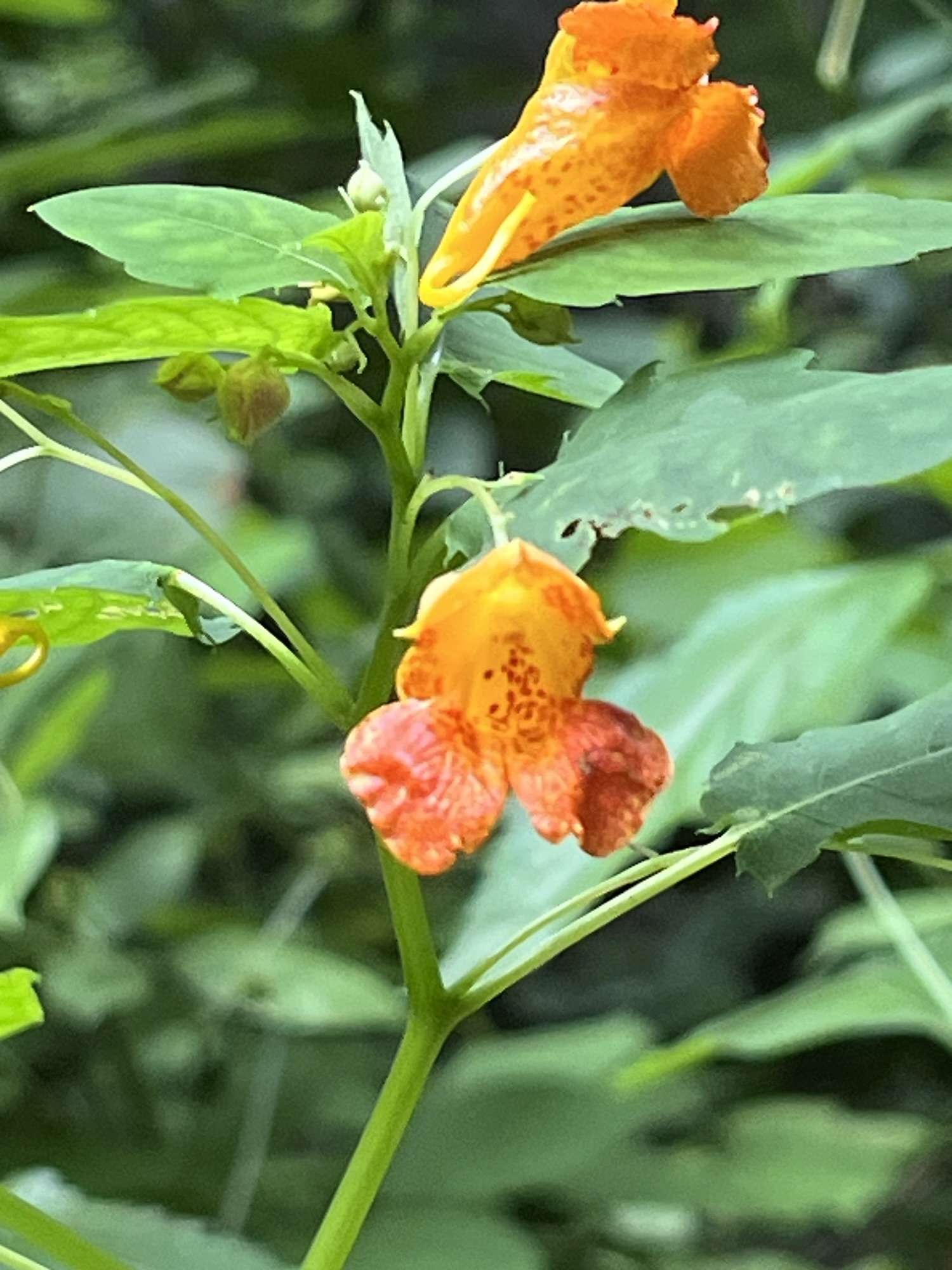
Right before the split, the forest opened up into a neat little camping nook framed with blooming yellow flowers and a cluster of bright orange mushrooms tucked against the wood.
Deeper in the Forest:
(10:55 AM – Distance 1.8 miles)
We continued to follow the white diamond blazes painted on the trees, the trail stayed mostly shaded, with beams of sunlight filtering down through the canopy.
Along the way downed trees and heavy brush crossed the path repeatedly, though the passage was still walkable or at least manageable in most places.
Around mile 1.8 (10:55 AM), Luna finally decided to take a breather and sat right down on the dirt path. Yes, after dragging me uphill like a sled dog. We took a quick break for a trail smoke and some water.
The forest floor here was alive with micro-details:
Fairy Holes & Red Berries: A massive “fairy hole” carved out of a hollowed tree trunk, alongside clusters of red sharp-looking berries on green large leaves. I’d never noticed before in Ohio.
Arching Logs & Fungi: A cozy campsite with a natural arching log made into a bench, accompanied by tiny brown cap-mushrooms and a purple mushroom sitting right in the middle of the trail.
Funnel Webs: Huge, ground-dwelling spiderwebs stretched across the low foliage… equally terrifying and fascinating to look at close up.
The Stump of a Lifetime & Sunbeams:
As the morning warmed up and turned into afternoon sunlight began breaking through the high branches of the trees in golden beams. The sunbeams worked at illuminating the damp woods.
As I approached a steep hillside, I paused at a mossy stump bathed in sunlight. What looked simple from a distance turned out to be an entire miniature ecosystem:
Bright orange and tiny red cap mushrooms clustered around the base.
Fresh, overlapping shelf mushrooms further up the trunk.
A tiny natural arch formed by an oak vine looping over the trail like a portal.
A few steps later, I stumbled upon what was easily one of the most unique downed log I’ve ever seen. It was covered in lush, velvety moss, dappled in orange, white, and red mushrooms hanging juicily off the edges, with pale shelf fungi and delicate spiderwebs underneath.
Further up the ridge, the mushrooms appeared in endless variety… squishy white shelf mushrooms others that looked almost like coral, tiny bright orange trumpet fungi, and rusty orange caps hiding under broad green leaves.
Trail Etiquette, Hydration, & Ghost Pipe:
By midday, the heat picked up. We stopped at an established campsite that was covered in pine needles, so I could take off my shirt, pour cold water over my head, and fill Luna’s bowl. I always pack about eight Path reusable water bottles plus two Hydro Flasks so we never run dry on hot ridge walks.
While we rested, Luna spent a few minutes joyfully digging through the carpet of soft pine needles, a thing I’ve only seen her do a few times now.
Continuing along the ridge before dropping back into the gorge, we hit a few key highlights:
Forest Portals: We passed under several natural tree arches bent over the trail.
Trail Lessons on Leave No Trace: Passing through deep mud pits served as a stark reminder of why hikers shouldn’t widen trails by walking around muddy edges. Remember that doing so tramples native foliage and erodes the soil. Wearing sturdy waterproof boots or trail shoes allows you to walk straight through the center and preserve the trail footprint.
Ghost Pipe (Monotropa uniflora): Near a large rock formation, I spotted several stalks of white Ghost Pipe sticking out of the leaf litter. Lacking chlorophyll, this parasitic plant doesn’t rely on photosynthesis, drawing its nutrients through mycorrhizal fungi connected to tree roots instead.
The sign I didn’t quite make it to last trip marking the split to finish the 5 mile short loop or continue on for the longer 17 mile loop.
Full Circle & Reflection:
Near the end of the short loop, we passed the massive rock face and “Rock House” shelter. This was the exact landmark where I had turned around on my previous trip out here. Seeing it from the opposite direction made everything click: I hadn’t taken a different trail back then, I had just hiked it in reverse and spent too much time lollygagging off-path!
After tackling the final set of switchbacks down into the gorge and completing the loop, the visuals spoke for themselves. From high ridgelines to muddy stream bottoms, Wildcat Hollow put on one hell of a show.
Ohio hikers & travelers seeking less crowded locations in nature, Readers interested in independently written hiking journals that offer more than polished trail notes, & individuals who enjoy real iPhone nature shots without all the editing.
Our Trek: Luna & I | Hemlock Falls Preserve in Butler, Ohio | June 19th 2026 arrived at 5:15 PM | Loop Trail though we did it out-and-back | .6 miles in 25 minutes|
Seasonal Shifts – Revisiting a Trail during Multiple Seasons
If you are like me you also enjoy returning to trails you’ve already trekked in different seasons. You will also know the beauty in the experience of returning to a familiar trail and getting to experience it from a whole new perspective.
Last winter season, near the beginning of 2026 a storm full of a heavy snow filled the skies. The landscape was bare and white, the waterfalls were frozen solid, the snow was near knee-deep in some places, and every turn felt more like a guessing game than the last. The entire preserve was cloaked under a blanket of white.
I found myself itching to come back to Hemlock Falls in Butler, Ohio as spring neared its conclusion..
Let’s walk a quick early-evening out-and-back trek (on this loop trail). Where we completed 0.6 miles in 25 minutes; though Luna and I decided to cut the loop short at the second waterfall and boulder field.
Don’t forget to respect the delicate ecosystems right in our backyard.
Hemlock Falls Preserve was full of unexpected wildlife encounters, vibrant summer shifts waiting to take over, and the quiet reminder of why we always pack out what we pack in.
Navigating the Hidden Trailhead & No-Amenity Realities:
Finding Hemlock Falls can test your patience if you are relying on cell service, which tends to drop out unpredictably around the area. Then comes the parking situation itself which was remarkably understated:
The sign… if there is one I’ve never seen it
The modest gravel entrance which is marked by one orange barrel on either side
The small under ten car lot almost unseeable through the lush trees
If you aren’t paying attention or you blink it is easy to drive right past it. Which is why I was confused for a second when my gps said “you have arrived.”
Then I saw the barrels as I passed them, instantly I remembered turning there a few months prior, so I used the next pull-off spot to turn around.
Once you arrive, you will probably notice almost immediately that this is a preserve stripped of modern conveniences. Here you will not find any trash cans, bathrooms, picnic tables, or grills. This was a vital reminder of an important part of the Leave No Trace rules for wild spaces: pack out what you pack in.
When you leave your trash behind it places an unfair burden on park employees (if existing), volunteers, and ecosystem health, especially in areas where public budgets are stretched razor-thin.
Ecosystem Resilience – Why Staying on the Path Matters:
The trails here weave through a fragile, protected landscape and park employees have placed numerous signs on trail to remind visitors to stay strictly on the designated paths. Ensuring that you are only walking on the established trail helps to protect endangered and sensitive flora.
Most importantly wandering off-trail risks trampling delicate undergrowth and fragile habitats that can take years to recover. Did you know that trekking off trail in protected natural areas can cause them to become either:
permit only experiences in order to control the amount of foot traffic, or
completely closed to the public?
Stay on trail and listen to the park signage so all of us can continue to compare seasonal changes at places like Hemlock Falls Preserve all over.
Hemlock Falls Preserve – Two Waterfalls:
During this particular hike, the contrast in the waterfalls from the winter visit was striking. The first waterfall you come to (sits where you can best view it from the wooden footbridge) was so small it seemed to have almost nothing to freeze had now transformed into the highlight of this trek, fed by recent seasonal rains.
The second waterfall I approached left me confused. In the winter it was massive with thick waves of frozen water covering the area surrounding it and now, it wasn’t even a trickle…
Canine Companions & Unexpected Wildlife:
Hiking with an American Pit Bull Terrier brings its own set of logistical considerations, starting with hydration. In temperatures hitting 80 degrees or higher packing enough water for the both of you is the most important thing. I will also not take Luna hiking once it heats up for the season at all unless the trail has guaranteed access to a body of water for mandatory dog-cooling sessions.
The real excitement of the afternoon, however, came courtesy of a sharp-eyed canine companion. Before there was any human awareness of movement in the brush, a sudden burst of absolute, undivided attention from the trail dog signaled something big. Breaking through the quiet was a magnificent, fully-antlered buck.
He was a breathtaking reminder of who really owns the woods.
The hike also brought up a quiet reflection on the scarcity of wild snakes I’ve seen as an adult. Despite spending countless hours outdoors, running across a garter snake or any other species feels like a rarity these days, making those fleeting, startled encounters feel all the more memorable.
Destination Guide – Hemlock Falls Preserve:
Location & Ownership:
Hemlock Falls is a treasured natural area located off Bunkerhill Road in Butler, Ohio (Richland County). The property is stewarded and protected by the North Central Ohio Land Conservancy (NCOL) and associated regional park partnerships, serving as a pristine jewel along the region’s scenic trail networks.
What You Will Find at Hemlock Falls Preserve:
💦 The Waterfalls: two striking waterfalls nestled within a lush hemlock gorge, shifting dramatically from frozen pillars in winter to a flowing cascades after seasonal rains.
🌺 Flora, Fungi, & Fauna: A rich canopy of mature hardwoods sheltering an abundance of sensitive mosses, ferns, and vibrant seasonal fungi.
🪨 Terrain: Relatively flat paths featuring loose rock, exposed tree roots, and rich woodland foliage. It is family-friendly and dog-friendly, though not ADA accessible.
Essential Rules & Guidelines:
🎒 Pack Out what you Pack In: There are zero amenities like trash cans, picnic areas, restrooms on-site. Leave the space cleaner than you found it.
🥾 Stay on Trails: Strictly obey all posted signage warning visitors to keep off fragile, protected ecosystem zones.
🐕 Leash Your Dogs: Pets are welcome but must remain on a secure leash at all times, with waste properly packed out.
⏰ Hours: Open daily from dawn to dusk.
Out of the Woods & Back on the Road:
As the evening wound down, navigating the rural roads back home introduced a different kind of local transit: sharing the asphalt with horse-drawn Amish buggies. Learning the nuances of rural right-of-ways, speed adjustments, and respecting local transit adds more to think about when you are exploring Central Ohio‘s backroads.
From passing up the entrance and revisiting a winter favorite in late-spring to sharing a breathless moment with a large buck and marveling at fungi, a quick 0.6-mile walk can hold an entire world of experience.
It’s all part of the rhythm of the trail…. sweat soaked shirts, wet paws, floppy ears, and wild wilderness waiting around the bend.
Nature enthusiasts looking for low-commitment options for both solo & family nature walks, Readers looking for nature & hiking journals that are more than just trail logs, History buffs, & Travelers looking to enjoy State Parks in Ohio.
My Trek: June 18th 2026 | 6:35 PM |Hosak’s Cave Trail – Salt Fork State Park | .54 milesout-and-back trail completed in 1.5 hours|
Places that hold Memories
The Rising Lake
Sights of Hosak’s cave
Geology, History, & Modern Uses
Reality Check
Salt Fork State Park a Repeatable Place
Salt Fork State Park – Hosak’s Cave Trail
Cambridge, Ohio
Salt Fork State Park – Trail Weather:
After you hike enough trails in the same region of the world you come to realize that every trail has its own unique experience. Though I think it is common knowledge that no two treks, even over the same trail will ever be the same. I still find some days that the hardest terrain to cross isn’t the mud or the incline, it’s the geography of memory.
When you step away from the group you just were hiking around Indiana and Illinois with and point your wheels toward home, old favorites and ghosts of memories line the shoulders of the road.
On this particular day, being able to choose a route passing the turnoffs for Piedmont, Tappan, Barkcamp and Seneca, while still heading home. I knew exactly where I wasn’t going… Barkcamp.
This State Park is one I try to typically keep behind a locked door in my mind. There are to many good and bad memories that have grown heavy with the fading sounds of old laughs, a gorge of grief, and the unmistakable scent of fish scales mixing with stale lake water that stays in your nostrils like the stagnant memories in your mind.
I’ll return to the small stinky lakeshore overflowing with memories, eventually; some places just demand too much from you. Salt Fork, on the other hand, just lets you breathe, and it has never let me down.
The Rising Lake & the Shifting Shore:
Arriving at the park, the recent heavy rains had left their signature across the banks of Salt Fork Lake. The lake was swollen, pushing far out of its ordinary bounds to swallow the lower treelines and soak the grassy slopes. Yet, out across the gray expanse, a steady, forward-pushing current kept the surface alive, gently rocking the shoreline waves.
There is a strange sort of medicine in water that refuses to stay put. It’s a reminder that sometimes movement isn’t about covering distance, but about standing still long enough to let the world move around you while you find your center. Naturally, that stillness pulled me down the familiar path toward Hosak’s cave.
Sights at Hosak’s Cave:
Even the trails you think you know by heart keep secrets in the blind spots.
At the typical trailhead, the quiet, shrine-like memorial sat heavy in the shade behind it the usual entrance to the trail was blocked. Thankfully just a bit further down to the left, I caught sight of a distinct newly made entrance for the trail. This entrance as just an opening cut into the shrubbery with a short connector to the original trail. After exploring a little around the connector trail and the beginning of the trail, it seems they are updating and fixing the trail’s amenities
The path opened into a pocket of thriving nature and human coexistence:
A few wild blackberry bushes heavy with promise.
A massive, pile of logs stacked in a pile to update trail amenities
A sunlit puddle teeming with healthy, darting tadpoles.
Fat, content frogs
Moss alongside brilliant clusters of wild mushrooms & late spring blooms
A monument with trinkets and offerings marking the old trail entrance
Two bats flying around under the cave & in-and-out of the waterfall
Tree markings & Trail Signs
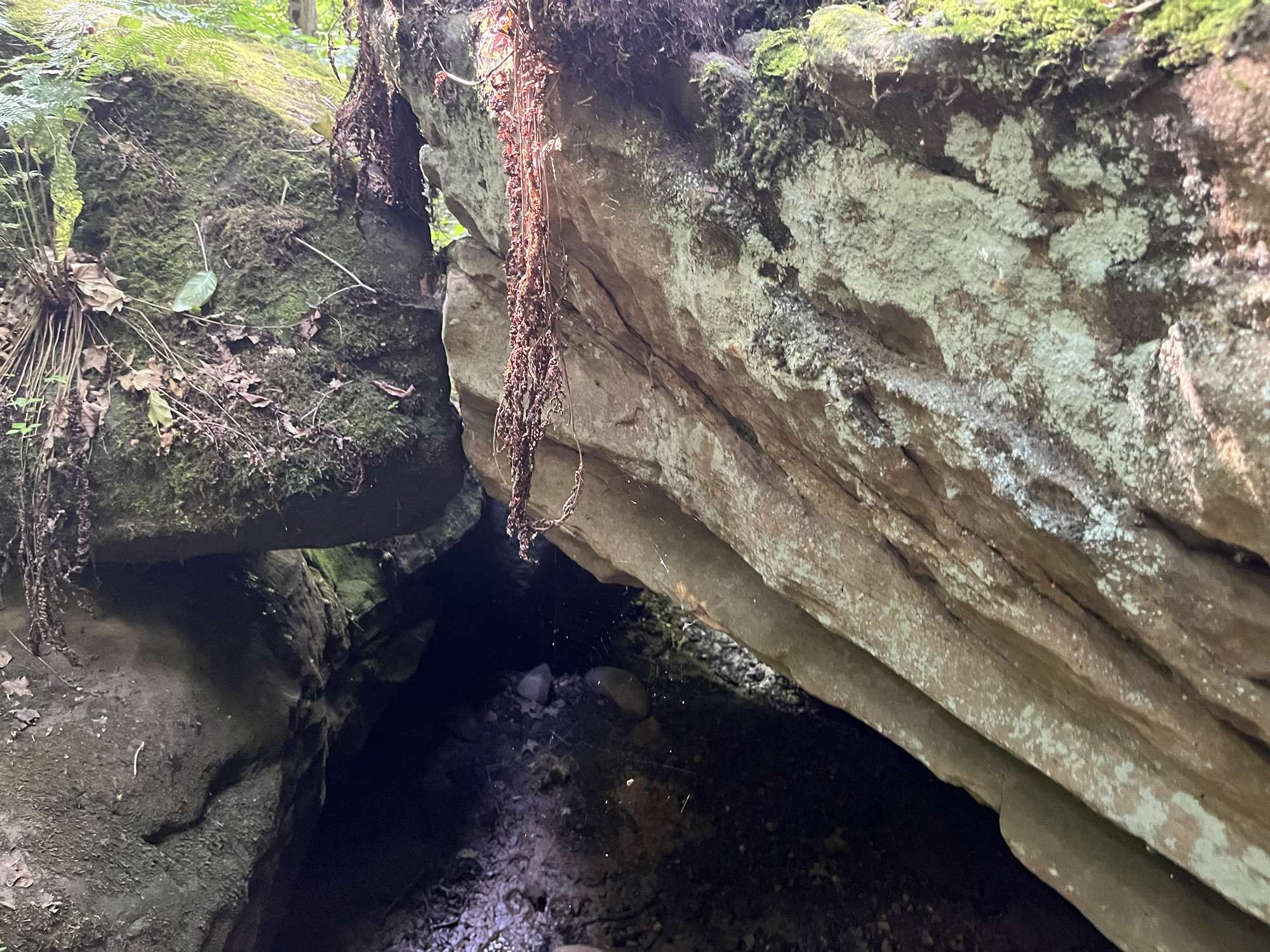
Pushing deeper toward Hosak’s Cave, the air changes instantly dropping what felt like several degrees as the towering sandstone overhang swallowed the sun. The footprints left by modern people on trail are only a few steps away from the stones of history. If you look closely you will see where the modern trail gives way to much older ground.
Geology, History, & Modern Uses:
Geologically, these dramatic rock shelters across southeastern Ohio were carved over hundreds of years as acidic groundwater and surface runoff slowly weathered away the softer shale and sedimentary layers beneath the heavy, resistant Conemaugh-era sandstone caps. Long before this region became a protected state park, these natural alcoves served as vital weather breaks for prehistoric peoples, indigenous tribes, and early settlers navigating the rugged, wooded drainage basins of Guernsey County.
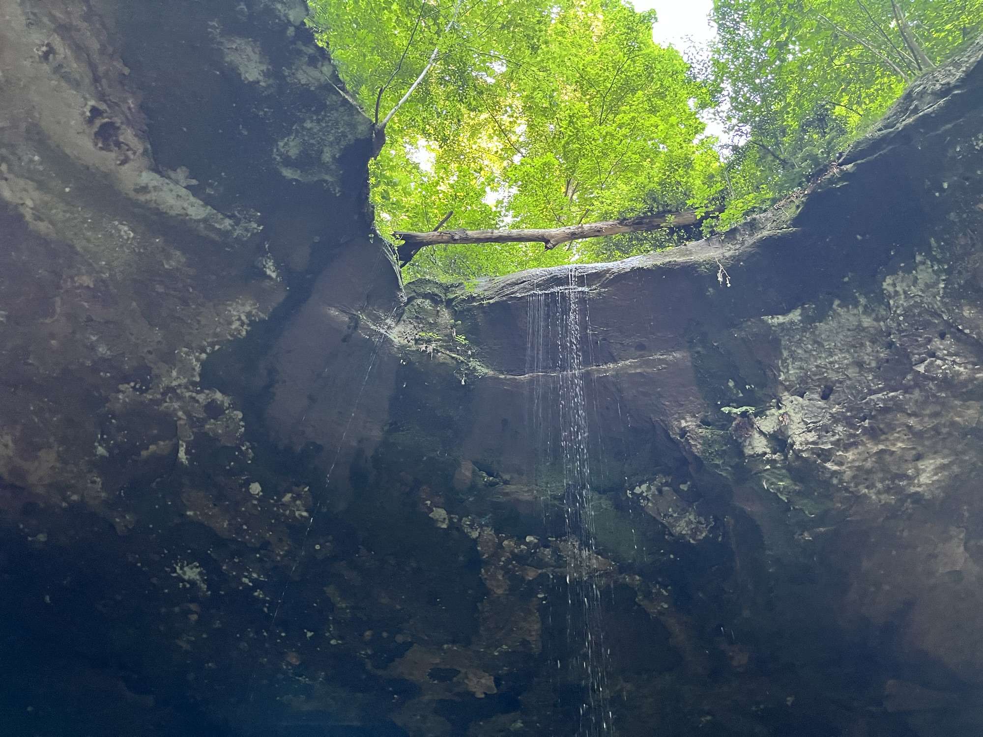
Today, the cave remains a living ecosystem as well as apart of a trail in a state park. When I stood beneath the massive stone ceiling and I allowed the waterfall to wash over me, the acoustics amplify the steady flow of water over me. As I looked up into the shadowed fissures of the dark rock, small, erratic movements caught my eye: a couple bats were in silent, acrobatic loops, using the cool shelter as a roost before emerging at dusk to hunt the forest canopy.
Two Dead Batteries& the Drip of Reality:
At eight o’clock, reality tapped me on the shoulder in the form of a 5% battery warning. Time to head back.
The return trip revealed just how much the recent rains and park maintenance had rearranged things. A fresh gravel path now ran to the side of the memorial area, and the old wooden footbridge across the stream is completely gone. Which explained the strange view I caught upstream while scrambling up the steep embankment.
I also spotted some mushrooms on the far side of the down logs, half-hidden in the damp shade. The impressively large mushrooms were growing in a cluster. Naturally, I tried to grab one last photo. The moment I framed the shot, the screen flickered, went black, and of course my phone died.
Naturally, when I finally got back to the car I realized that the battery decided to follow suit. Thank God for the self-jumping battery box that I had waiting in the trunk.
Salt Fork State Park a Repeatable Experience:
It’s funny how an early-evening meant to quiet the mind can pivot into a minor crisis that adds right back to the ever-growing pile of things to manage.
I went looking for a brief escape from the noise, and I walked away with two dead batteries, muddy hiking shoe, and soaked clothing. Standing there in the cooling air as the woods settled into evening, I realized that’s the point of the wild.
It doesn’t solve your to-do list; it just makes you care a little less about how heavy reality can be.
Cross-state hikers looking for local roadside oddities, readers interested in chaotic travel journals, travelers who appreciate learning the history of a place, & people who enjoy pranking or goofing off with their friends.
The Origin: Crystal Springs Farm was bought by Thomas Christopher in 1901, anchoring a roadside lifeline right off Route 9 in Cadiz that still pulls drivers in today.
The Caretaker Tony Pietrangelo
The Before Trip Stop: Gallon jugs and Hydro Flasks get filled to the brim before any serious miles stack up on the odometer.
Steubenville Shenanigans: A lidless cup of roadside water makes an unexpected flight path straight onto a passenger getting back into the door.
The Circuit: A quick top-off in eastern Ohio sets the fuse for a multi-state trail blitz across Turkey Run, Shelbyville, the Falls of Ohio, & the Big Four Bridge Trail.
The Christopher Spring
Cadiz, Ohio
Filling Up & Falling Out at Crystal Springs Farm:
My fellow roadtrip lovers and multi-state trekkers know some stops are made out of necessity while others are made because they offer something too good to pass up. On June 16, 2026, Tae and I packed out of her house with a simple mandate: stock up on water, ship out, and hit the dirt across state lines.
Before we even thought about scanning horizons in Indiana or tracing limestone cuts in Illinois, we packed the car, filled up on gas and, grabbed road snacks. All that was left was to fill up our jugs and bottles with water. I personally love spring water as a child we used to stop in the Snowshoe Mountains every year to fill up our jugs from fresh springs on our way home from trips to see family in Cass, West Virginia. So I jumped at the opportunity to fill up at a nearby Cadiz, Ohio spring that holds some great history. Plus who doesn’t love saving a few bucks?
Spring Water & History in Cadiz, Ohio:
If you coast down Ohio State Route 9 in Cadiz, just south of the post office, you’ll hit Christopher Spring without even trying. Many people drive past without paying it mind on their daily commutes, but if you’re looking for it you cannot miss it
Thomas Christopher bought what was then Crystal Springs Farm back in 1901, carving a family name into the local history. He even dedicated the spring to his daughters. Fast forward through generations of passing hands (including the Liggett family legacy) and modern stewardship under operations like Crystal Springs Farm, and the pipe is still spilling ice-cold groundwater out into the open air for anyone with an empty vessel.
It’s an open-access lifeline that locals still hit up daily, hauling gallon jugs or metal Hydro Flasks to beat the tap water taste. We pulled up, killed the engine, and let the pipe do its work, filling a couple of gallon jugs and our few Hydro Flasks.
It’s really inspiring to think of it as history you can actually drink; subterranean water that holds a steady, biting chill even when the June humidity is sitting heavy on the asphalt.
The Caretaker Who Kept the Spring Alive:
You can’t talk about Christopher Spring without talking about the guy who actually kept it flowing. Tucked right into the stonework and greenery next to the spring sits a memorial plaque for Tony Pietrangelo.
Tony Pietrangelo was a local caretaker who spent decades looking after the grounds, cleaning the area, and making sure the water stayed flowing. He sadly passed away in December 2013 at 95 years old. Tony’s footprint is baked into every drop of water that spills from this pipe.
When you stop by to fill your jugs today, you’re not just drinking from an old farm inheritance; please stop and take a second to view Tony’s memorial, the old barn on the hillside, and the other informational signs when you stop to collect your water.
Steubenville Spills to State Line Trails:
Of course, road trips don’t run on hydration and gas alone; they are fueled by friction and funny ideas. Not long after we rolled out of Cadiz we made a pit stop in Steubenville, Ohio. This is where the trip’s internal climate shifted from peaceful nature documentary to low-stakes comedy.
Somewhere between Tae stepping out for snacks and sliding back into the cloth seats, I made the executive, entirely ill-advised decision to use the cup that I had filled at the spring to drink while driving as a projectile. As Tae was climbing back into the car, the parasites in my brain took over, and that water found a new home across her shirt.
The laughter that erupted lasted longer than the half a second of silence that filled the air initially. Then just like that, we were back on the move, Tae’s damp clothes dried in the AC as the miles melted down toward the Indiana boarder.
That single splash set the tone for everything that followed over the next few days. We weren’t just driving; we were covering ground with mud caked on our shoes and laughter filling our lungs.
Where We Trekked:
By the time we headed home we had a soundtrack made of the highway’s hum and nature’s symphony. We trekked a cross-section of the Midwest that tested our legs and our patience. From scrambling through the sandstone canyons and ravines at Turkey Run State Park to navigating the water-locked timberlands of Shelbyville State Fish and Wildlife Area, every stop felt earned.
We crossed the downed logs at the Falls of Ohio State Park to stare down ancient fossil beds exposed by the current, and finally we walked the historic railroad bridge of the Big Four Bridge Trail as the sun peaked out through the clouds over the Ohio River.
You start with cold ground water running, add a little cabin fever and a rogue cup of water, and suddenly you’re deep in the trees wondering how far the map will let you go before dark.
Casual hikers who like urban exploration, individuals looking for an easy riverfront outing, photographers who enjoy urban scenery, history lovers interested in old infrastructure, & anyone who likes the idea of casually walking from one state into another.
Our Trek: June 17th at 5:30 pm |1.9 miles| 35 minutes | Started in Indiana crossed over the Ohio River into Kentucky & back into Indiana
Walking across the Ohio River on a former railroad bridge
Barges, sailboats, city skylines, & industrial riverfronts
Live music seemingly following us across the bridge
An adult-powered piggyback child-transportation system
Political graffiti, sidewalk chalk, and unexpectedly strange plants
Why it is called the Big Four
The Big Four Bridge Trail
Jeffersonville, Indiana & Louisville, Kentucky
The Bridge Trail That Became Much More:
Some hikes are about getting into the woods and getting away from everything. Others are about exploring more urban areas. Taelor, her son, and I cleared the 1.9-mile out and back trail in approximately 35 minutes on June 17th at 5:30 PM.
We found ourselves at the Big Four Bridge in Jeffersonville, Indiana, after leaving The Falls of Ohio State Park. Here the trail crosses the Ohio River from Jeffersonville, Indiana toward Louisville, Kentucky. The temperature was on the warmer side around 85 degrees Fahrenheit. Thankfully, there was a light sprinkle in the air, and the wind was already making its presence known.
The Big Four Bridge Trail:
The trail itself is pretty straightforward. It is a paved, out-and-back trail that is just under two miles in length and contains steps at both ends. There are benches, a ton of people, bikes, families, city views, river traffic, and enough things happening around you that calling this a “hike” feels like underselling it.
Our group had barely gotten started before somebody started playing an electric guitar. This man had a full set up, amps, cords, the guitar, and even a decent mohawk. This experience sums up the trail’s overall vibe and set the tone for the trek.
Someone else tried to give us bubbles shortly after we walked past the bridge’s rockstar.
Somewhere between the music, the boats, the city skyline, and the question of what state we were actually standing in, the Big Four Bridge became one of those places where the trail itself almost disappears beneath everything happening around it.
Walking Over the River:
The Big Four Bridge carries pedestrians and cyclists above the Ohio River, creating a long, elevated path with two very different landscapes unfolding on either side of the bridge.
On one side sits Louisville’s cityscape, where you see buildings that rise above the neighboring bridges into the sky. As we walked across the bridge, we watched as a church steeple that started as a tiny point in the distance gradually became one of the more prominent things in our view.
On the other side, the scenery felt almost industrial. There were brick buildings, wooden docks, radio towers, barges, and sailboats making up the river traffic.
It felt like four different worlds depending on which direction you looked. Yet, somehow they were all occupying the same trail.
The river itself was moving below us, green and restless with the wind and waking boats. Sailboats shared the water with enormous barges, and at one point we could even see a sunken barge in the river. There was also a visible change in the color of the water where the different streams appeared to meet.
The wind whipped across the bridge hard enough to become part of the trail’s experience.
The Big Four’s Soundtrack:
There seemed to be music everywhere.
At first, directly before we climbed the stairs to the bridge, there was a woman jamming to familiar alternative rock tracks, followed closely by the electric guitar player with his amps and cords.
Next, we approached the sound of what seemed like a symphony which grew louder as we cleared the distance. The classical music ensemble came from two separate informational booths.
As we continued across the bridge, the music seemed to get louder and louder. The interesting thing about the Big Four is that the bridge does not isolate you from the cities on either side. It puts you directly in the middle of them.
Sirens could be heard in the distance. Police vehicles were seen on the interstate off the trail. Pedal bikes zipped past us and e-bikes flew by. A barge horn eventually joined the soundtrack.
The entire trek had become a collage of sounds. It was chaotic, yet somehow enjoyable.
Somehow the Child Became a Backpack:
Taelor’s son seemed to be having a fantastic time. There were benches to climb on, open pavement to run across, and plenty of opportunities to turn a simple walk into an obstacle course.
Eventually, I ended up with the child on my back. I’m not quite sure how this happened.
The boy zoomed from bench to pavement to bench, while we continued making our way across the bridge. Later, when it became my turn for another piggyback ride, Tae bribed him with the promise of ice cream afterward instead of piggybacking. Thank God.
Trekking with a child seems to change the definition of distance. Two miles suddenly becomes less about how far you walked and more about how many times you stopped, climbed, carried someone, negotiated, looked at something interesting, or answered a completely unrelated question.
Honestly? That is part of what made this walk memorable.
The History Beneath Our Feet:
The trail’s name had me confused for the better part of the hike. I thought “Big Four” referred to the four bridges. The answer is much more railroad-related.
The name comes from the Cleveland, Cincinnati, Chicago and St. Louis Railway, a railroad commonly known as the Big Four. The original Big Four Railroad Bridge opened in 1895 after construction began in the late nineteenth century. The railroad connection became an important transportation link between Jeffersonville and Louisville, particularly as rail and river transportation helped fuel the growth of both communities.
The bridge we experience today is not the untouched 1895 structure. The existing bridge was rebuilt in the 1920s, with the current structure dating to 1929. It was eventually decommissioned as a railroad bridge in 1968 and sat abandoned for decades.
There is also an especially grim piece of history attached to the original construction. Historical documentation records that 21 workers died during construction in 1893 when a crane blew over.
Today, people walk across it carrying drinks, pushing strollers, riding bicycles, taking photographs, listening to music, and carrying tired children.
A structure that once carried trains now carries weekend plans.
Railroad to Walking Trail:
The Big Four spent years abandoned after its railroad life ended.
Eventually, the idea of turning the bridge into a pedestrian and bicycle crossing became reality. The bridge was rehabilitated and reopened to the public in 2013, with the Southern Indiana approach completed in 2014. The result is a non-motorized connection between Louisville’s Waterfront Park and Jeffersonville.
That transformation is one of the things I like most about the place. Nothing about the bridge feels particularly wilderness-oriented.
Here you find no deep woods or rocky switchbacks. Instead, the historical and modern-day urban infrastructure is the landscape.
The steel structure is the trail and the Ohio River is the view. Louisville and Jeffersonville are the backdrop and the people using it are part of the scenery.
Modern-Day Big Four:
Today, the Big Four is much less about getting somewhere by train and much more about people deliberately coming for the bridge.
The Jeffersonville side is anchored by Big 4 Station Park, which includes walking paths, benches, a playground, picnic areas, restrooms, parking, and other amenities. The city describes the area surrounding the bridge as one of Jeffersonville’s premier parks and a destination for people from throughout the community.
One of the more interesting things about this urban trail is that you cannot always tell whether the person passing you is exercising, sightseeing, commuting, or simply killing an hour.
The Big Four accommodates many different types of people.
Signs, Chalk, Graffiti & Everything Else:
There are signs along the way reminding visitors about trail etiquette and restrictions, including a few stating pets are not permitted and warnings to slow down.
We passed political graffiti and sidewalk chalk with messages ranging from “Jesus is King” to anti-ICE statements.
Official park signage, historical infrastructure, graffiti, and even a penis drawn somewhere it absolutely did not need to be all prove this was not a curated museum exhibit.
It was a public place being used by actual people, and people are messy. That became a big part of the character of the walk.
The Walk Back
The return trip felt different even though we were walking the same trail. We knew what was coming. The guitar player was still playing and the classical music was still drifting across the river. The cities were still there and the boats were still moving.
By this point, the entire trail felt like a collection of sounds layered on top of one another.
I realized this was probably the closest thing to a wilderness soundscape that an urban exploration could offer. It was ridiculous.
I loved it.
Back Where We Started:
Eventually, a sign beneath us told us we were back in Jeffersonville. We crossed the Ohio River into another state, turned around, and walked back. There was a circular-looking rainbow-colored building in the distance, and the skyline we had watched grow closer earlier was now receding behind us.
Sometimes a hike ends with a profound realization. Other times it ends with an unanswered question.
The Big Four Bridge Trail:
We finished the trail at about 6:05 p.m. Two miles is not exactly a long hike by my usual standards. Distance has never really been the point here.
The Big Four Trail is an experience built around movement through a very concentrated piece of the region. You have the Ohio River beneath you, Louisville on one side, Jeffersonville on the other, old railroad infrastructure below you, modern recreation happening around you, and enough human activity to make every few minutes feel different.
It is part bridge walk, part city walk, part history lesson, part people-watching expedition. It is also apparently part piggyback marathon.
The Big Four Bridge left me laughing, surrounded by sound, slightly confused, and unexpectedly reflective about the Ohio River itself.
I went there expecting to walk across a bridge. Instead, I got a guitar player, a symphony, church chalk, a child on my back, an ice-cream negotiation, and a reminder that the river I knew growing up can look like an entirely different creature somewhere else.
That is the strange thing about trails: the best ones do not always take you farther into the wilderness. The best trails give you a different way to see something you thought you already understood.
There are no waterfalls at this park, and it is not located in Ohio. That doesn’t make it any less appealing it just makes the name make way less sense. You will find an abundance of fossils here, as well as a dam that resembles multiple waterfalls, and a large train bridge.
The natural world often preserves its most ancient chapters in unexpected places, where the relentless flow of water carves away the modern veneer to reveal a prehistoric past. Along the borders of the Ohio River, ancient seabeds lie exposed to the open air, offering a rare portal into a forgotten geological epoch. Stepping into these landscapes changes the entire rhythm of an afternoon, shifting attention from the routine pace of daily life to the deep, silent timescale of fossils and ancient stone.
Woodland Paths & Sports-Mode Mishaps:
The afternoon started with a familiar battle of wills: trying to coax a seven-year-old out of the car. After some heavy convincing, he finally declared that his shoes were in “sports mode,” bolted out the door, and promptly took a tumble within the first five steps.
Once the initial wipeout was out of the way, however, there was no turning back. Getting him to slow down or chill while we tried to take photos became the new challenge.
The Trail:
Right off the trailhead, we spotted wild mushrooms tucked near the path, alongside a surprisingly interesting outdoor classroom area.
The trail quickly opened up into a landscape teeming with history. There are fossils scattered everywhere along the path, and stepping inside the interpretive center even revealed a woolly mammoth fossil exhibit.
The atmosphere of the trail had its own distinct local flavor, complete with a few local dogs on the walk and the unmistakable scent of weed drifting through the air.
By the time the clock hit five o’clock, we had cleared the few available trails here. To enter and leave the area that I would struggle to call a beach we had to scramble over massive piles of drift logs.
While walking along the beach we explored the exposed rock formations and looked into the small cave-like openings. This felt almost like stepping onto another planet, every inch of the stone under our feet were made of massive fossil plates.
The kid who threw a fit just to get out of the car ended up having the absolute time of his life, demanding to know where else we could explore next. That’s just how kids are, keeping the adventure alive right to the end.
The Ancient Architecture:
The Falls of the Ohio State Park is a unique geological and ecological sanctuary situated along the Ohio River in Clarksville, Indiana. Unlike typical waterfalls driven by vertical drops, the “falls” are actually a 2.5 mile series of rapids and cascading limestone ledges where the river drops about 26 feet over a relatively short distance.
This dramatic descent historically created the only major navigational hazard for early riverboat travelers, requiring flatboats and steamboats to navigate carefully or portage around the turbulent stretch. Today, the park serves as a protected National Wildlife Conservation Area and state park. The goal here is preserving one of the largest exposed Devonian fossil beds in the world.
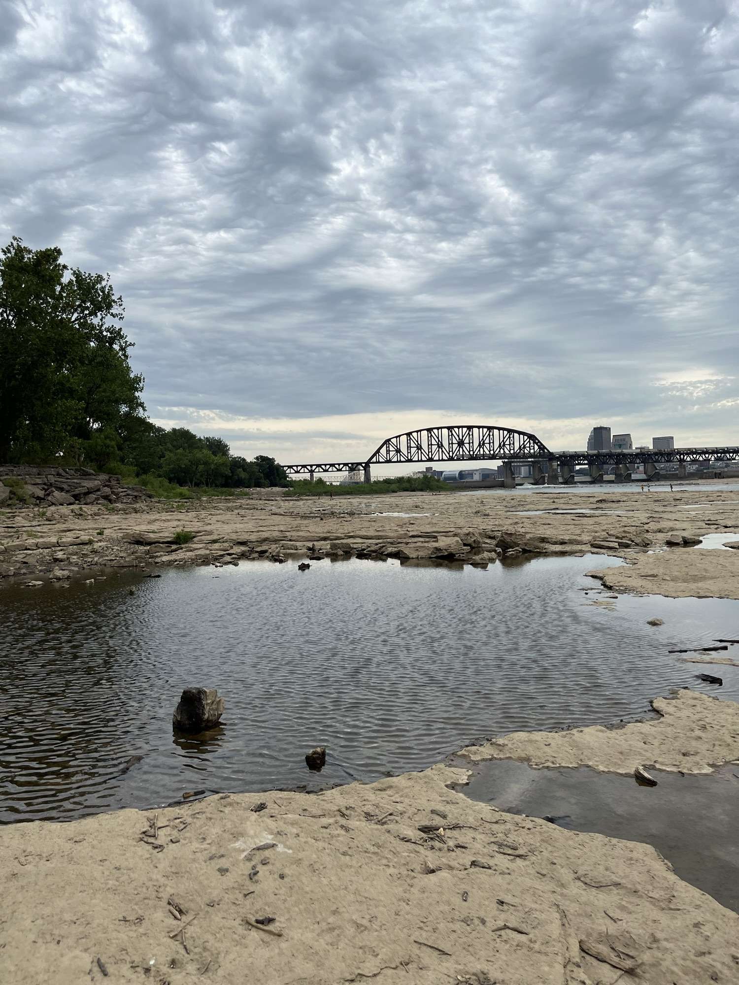
When river levels drop during the late summer and autumn months, vast acres of limestone emerge from the water, allowing visitors to walk directly across an ancient seafloor that spans hundreds of millions of years of Earth’s history.
Coral Reefs & Devonian Seas:
The reason fossils are so overwhelmingly abundant here comes down to ancient geography. Approximately 390 million years ago, during the Devonian Period, the region that is now the American Midwest sat near the equator, completely submerged beneath a shallow, warm tropical inland sea.
This prehistoric ocean swarmed with marine life comparable to modern coral reefs. As ancient corals, brachiopods, bryozoans, crinoids, and stromatoporoids lived, died, and accumulated on the seafloor, their calcium carbonate skeletal structures were compressed and lithified into dense layers of limestone over millions of years.
Because the Ohio River continually scours away the overlying mud and sediment, these massive fossil plates are exposed in stunning preservation. Walking across the limestone shelves reveals intricate patterns of horn corals, honeycomb corals, and crinoid stems frozen directly into the bedrock. It is a living museum where stepping stones are literal fragments of an ancient tropical reef.
While looking down reveals millions of years of natural history, looking up and across the landscape frames the heavy footprint of human engineering. Dominating the immediate view from the park are two monumental structures: the McAlpine Locks and Dam system and the sprawling, industrial spans of nearby railway bridges crossing the Ohio River.
The dam regulates the powerful river currents, drastically altering the natural water levels that once defined the wild, roaring rapids of the historic falls. Parallel to the water management structures, the massive steel lattice of the historic railroad bridges stretches across the horizon. These industrial iron giants frame the ancient riverbanks, creating a striking visual contrast between the heavy infrastructure of the 19th and 20th centuries and the 390-year-old fossil plates resting quietly beneath their shadows.
Feeling Small:
One of the main things that keeps me coming back to places like this in nature is the reoccurring realization just how small we are. Looking from the bridges, to the dam, to the fossils, and back to the massive Ohio River it is impossible not to feel almost microscopic here.
Leaving the riverbanks behind, the transition back to the everyday world comes with a lingering sense of perspective. A landscape built from ancient coral reefs, framed by steel bridges and modern currents, leaves a quiet mark on anyone willing to scramble across the logs and look down at the stone beneath their feet.
Midwest hikers seeking hidden gems, individuals interested in nocturnal nature, & readers looking for nature based journals.
The Essence:
Read Time: ⏰ 4 minutes |Mood: ✨ slightly surreal & full of wonder | Weight: 🪞 Reflective & grounded
Trail Notes:
Location: Shelbyville, Illinois State Fish & Wildlife Area (Open 24 hours with minimal light pollution)
Date & Time: June 16th – June 17th 2026 parked at 11:15 PM CT left just after 1:15 AM CT.
Distance & Pace: Just over one mile packed into roughly two hours of slow, deliberate exploring.
Wildlife & Encounters: Frogs, a strange juvenile fish, frantic splashing in the shallows, a spider, and local net-trappers working the walkways.
Surprises: A stray flannel shirt, rising floodwaters requiring some creative barrier-hopping, & a sky full of stars that made the night air worth every minute.
Shelbyville, Illinois – State Fish & Wildlife Area
Understanding the Space – Shelbyville Fish & Wildlife Area:
When you explore areas after dark, you are entering a managed ecosystem designed to balance public recreation with conservation. These properties often permit hunting, fishing, and hiking around the clock and, they take on a completely different personality once the sun goes down. Daytime visitors give way to nocturnal wildlife and night anglers setting up along the water’s edge.
Night hiking requires a shift in how you move. Without daylight, your field of vision shrinks to whatever your headlamp beam catches, forcing you to rely heavily on sound and touch. The ambient temperature drops, dampness rolls off the water, and the forest canopy overhead frames patches of deep, undisturbed space that are increasingly hard to find near populated corridors.
Taelor and I got out tonight for roughly two hours to explore after dark. We didn’t expect the sound of nocturnal nature to be so loud. When visual stimulation drops to your general surroundings your ears pick up the slack. Watch out the sound of fish splashing in the shallows may even be enough to startle you if you’re not careful.
Some miles are for soaking in the sun, others use the moon as their muse.
Breaking the Surface – Midnight Life in the Shallows:
Stepping onto a trail or into wildlife areas after dark changes the rules of nature. The daytime noise drains away, leaving room for the sounds you usually miss…
What was that rustling in the underbrush? Did you hear the heavy splash of an unseen animal moving through the water in the darkness?
Do you feel the strange, electric hum of an ecosystem that wakes up when the sun goes down?
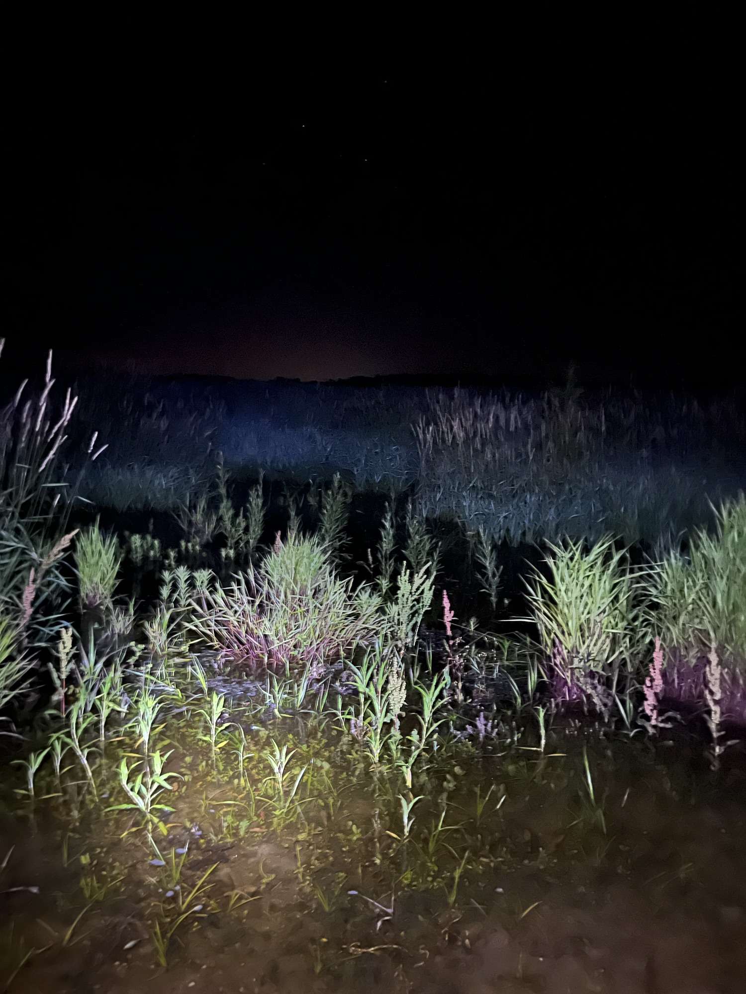
Tae and I walked a little over a mile in two hours. We were constantly stopping every few steps to look closer at what the beams from our headlamps illuminated. After all we were not racing the clock tonight. We spent a lot of time taking photographs, collecting rocks, and jumping at the unexpected splashing coming from the fish near the shallows.
The water levels were high, spilling out over their normal boundaries like I suppose they often do around here. In some spots, we just trudged right through the wet gravel of the trail that runs through the small lake here. Others spots were to deep so we had to hop from small concrete barrier to concrete barrier to keep our shoes and pants dry.
Nocturnal Wildlife:
The real show, though, happened down near the water. We spotted a frog holding still near the edge, and another clinging to the edge of a concrete block.
The shallows were alive with motion. A bunch of smaller fish, maybe minnows, were splashing aggressively, creating rhythmic, chaotic bursts of sound that broke the silence. Down the path a bit further was one weird-looking juvenile fish that didn’t quite fit the usual mold. The fish had an elongated mouth, resembling a gar almost.
Further down toward the end of the trek, near the bridge that was partially swallowed by the rising water, we heard heavier, booming splashes, accompanied by people setting net traps near the walkway.
Midnight Fish Behavior:
The most interesting and albeit startling part of the night wasn’t just the silence, it was the noise coming from the water. Did you know that in shallow aquatic zones, nighttime triggers distinct biological shifts for fish and amphibians?
Many species of fish move into the shallows after dark to feed on insects, amphibians, and organic matter washed in by high water levels, while others use the cover of darkness to escape larger predatory fish that hunt by sight during the day. This behavioral shift creates the chaotic, rhythmic splashing you hear break the surface.
Relics & the Starry Sky:
No trek out with Taelor is complete without finding some bizarre article of clothing left behind by humans. True to form, we tracked down a stray flannel shirt hanging on a pole near the path. At least it wasn’t underwear this time, so we’ll chalk that up as a win.
Beyond the oddities on the ground, the main event was overhead. Out here, with minimal to no light pollution, the night sky opens up in a way that feels increasingly rare. You forget how many stars are actually hiding behind the ambient glow of everyday life until you step into a dark-sky pocket and let your eyes adjust.
We also picked up a few small fossils, minerals, and crystals along the way. These are tiny tactile souvenirs of a landscape shaped by ancient waters and quiet earth.
The roadway warnings back at the entrance had hinted that our drive might be flooded out like our walk was. Thankfully, the asphalt held, and the way in and out of the wildlife areas were clear. This particular stretch of land allows for hunting, fishing, and late-night wandering which offers a rare kind of outdoor freedom.
Shelbyville, Illinois:
There is a distinct kind of peace in exploring a place that doesn’t punch a clock. When you trade the midday heat for the chill of midnight, familiar ground turns into an entirely different map. Between the starry expanse overhead, the frantic splashing in the dark shallows, and the quiet rhythm of the walk, Shelbyville, Illinois State Fish & Wildlife Area after dark proved that the best parts of the trail only sometimes show up when the rest of the world goes to sleep.
Hikers tired of rebuilding their packs from scratch every weekend, multi-hobbyists (dog owners, rockhounders, photographers), & anyone wanting to scale their gear from a quick loop to a full afternoon trek.
If you have to unpack your entire rucksack, stare at a pile of gear on your living room floor, and rebuild your kit from scratch every single time you want to hit the woods, you are most likely going to stay home.
Most hiking advice treats every trip as a brand-new expedition. It forces you into a repetitive cycle of guessing what you might need, throwing it all in, and inevitably forgetting something vital, carrying three pounds of gear you don’t, or both forgetting things and bringing way to much extra crap.
Experienced hikers don’t start from scratch. We use a system; relying on a permanent base kit combined with interchangeable modules, scaling our setups effortlessly based on whether we are walking a thirty-minute local loop or spending six hours deep in an Appalachian forest.
Here is how you can build a modular pack that adapts to your trip instead of draining your energy before you even touch the trailhead.
The “Twenty-Nine Minute Rule:”
Scale matters when it comes to what you bring on your trek. If you find yourself bringing an overstuffed expedition pack on a quick thirty-minute local park loop you may end up feeling ridiculous; likewise, heading out for a six-hour trek with just one hydroflask and a prayer is asking for trouble.
To fix this, structure your packing expectations by time and distance rather than a one-size-fits-all checklist:
The Local Loop (30 Minutes to 1 Hour): You are never more than a mile from a paved parking lot or cell service. Your pack should practically disappear. Keys, phone, a tiny roll of dog waste bags, and a liter of water. That’s it. Leave the heavy layers and extra gadgets in the car.
The Half-Day Trek (2 to 4 Hours): This is where your true day pack baseline kicks in. You need your core hydration, a first-aid basics, a headlamp, a light rain shell, and trail snacks.
The Deep Forest Stretch (4+ Hours): You are stepping away from civilization. This is where your specialized modules go into the bag, adding extra hydration, a portable battery bank for electronics, and extra weather protection.
By matching your pack weight directly to the clock and the weather, you stop carrying unnecessary baggage on short walks while staying appropriately covered for longer miles.
The Modular Pack System:
Instead of a chaotic catch-all bag, your pack should function like a tool belt. You have your Permanent Base Kit (the essentials that never leave the bag: first aid, multi-tool, headlamp), and then you fill up external pouches or compartments with other tools depending on the mission profile of the day.
The Dog Module: A dedicated zippered pouch holding the long line, a collapsible silicone bowl, extra waste bags, and doggie shoes. If Luna isn’t coming on the hike, this entire pouch stays on the shelf.
The Rockhounding Module: A small, sturdy canvas bag for mineral finds, a pocket brush, a small pickaxe, and a compact hand lens. When you’re just doing a standard walk, leave the rock tools behind and let your shoulders rest.
The Cold Weather Module: A separate packing cube containing your seasonal adjustments, extra wool socks, thermal beanies, or thermals.
You don’t rebuild the pack; you just swap the modules. It turns prep time from twenty minutes of anxious guesswork into a ten-second snap-in routine.
The Hiker, Rockhound, & Dog Owner Problem:
Let’s address the elephant in the woods: most gear guides assume you are doing one thing. They assume you are just walking, or just birdwatching, or just trail-running.
Your reality is messier. You are hiking with your dog, keeping an eye out for interesting fossils or Flint Ridge chert along the creek bed, and maybe trying to snap a few photos of a rare wildflower. If you add specialized gear for every single hobby into your bag simultaneously, you will instantly transform yourself into an exhausted pack mule.
How do you balance competing priorities without breaking your back?
Prioritize the Primary Engine: Your feet and your dog are the primary engine of the hike. Their gear is non-negotiable.
Rotate Secondary Hobbies: If today is a heavy rockhounding mission along a creek, leave the photography telephoto lens at home. If it’s a scenic walk through Hocking Hills, leave the heavy digging tools in the trunk and enjoy the views.
Use the Car as an Extension of the Pack: Not everything has to live on your spine. Your trunk can act as your basecamp staging ground.
The Car Basecamp & Trail Pack Duo:
One of the best organizational secrets you can adopt is drawing a hard boundary line between what lives in your vehicle and what actually goes onto your back.
Stays in the Trunk (Car Basecamp): A gallon jug of emergency water, a spare change of socks and shoes for the drive home, a full-sized first-aid kit, a heavier blanket, and dirty-gear storage bins.
Goes on the Trail (The Pack): Just the lightweight, high-utility tools required for the specific duration of today’s hike.
When you stop treating your day pack as a rolling closet for your entire trunk’s inventory, your pack stays light, your shoulders stop aching, and getting outside becomes effortless.
Moving Forward:
A well-designed pack isn’t a random collection of survival items; it’s a living system. By using time and weather based rules, modular pouches, and a smart split between your car and your back, you take the friction out of the outdoors.
Build your modules, stage your gear, and let the trail be about the walk, not the weight.