
Best For
State high-point seekers, easy summit hikers, individuals interested in climbing observation towers, rainy day adventures, Appalachian forest enthusiasts, families that hike, boulder lovers, and quick payoff trails.
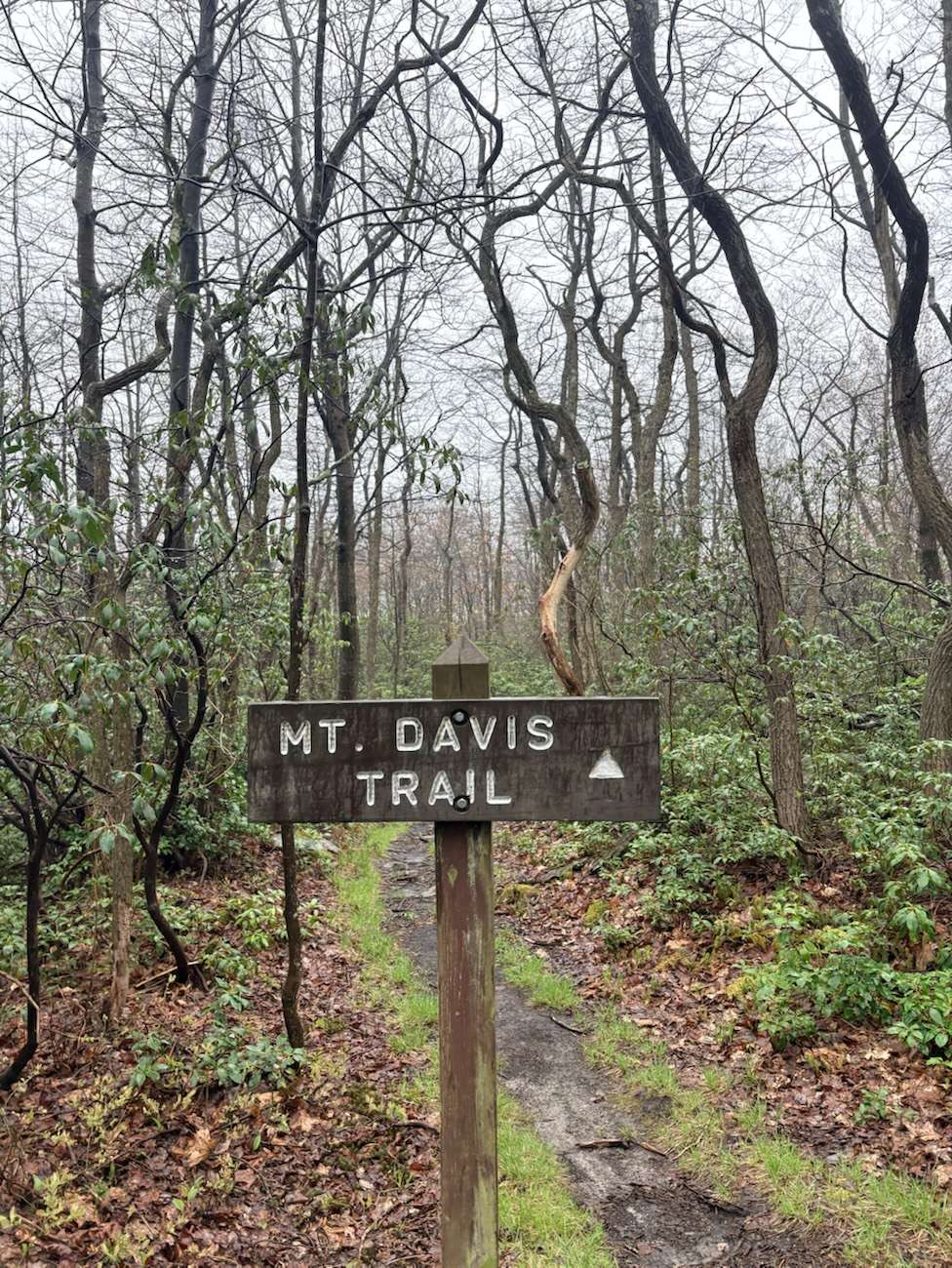
Trail Notes:
- Date: May 6th, 2026
- Location: Mount Davis High Point Trail in West Salisbury, Pennsylvania
- Distance: 1.8 miles
- Trail Type: Out-and-back
- Time: 32 minutes
- Difficulty: Easy
- Elevation: 3,213 ft
- Elevation Gain: ~118–147 ft
- Weather: Rainy, foggy, and overcast
- Fees: Free
- Pass Required: None
- Dog Friendly: Yes, leashed
- Trail Markers: Yellow blazes
- Features: Pennsylvania high point observation tower, boulder fields, Forbes State Forest, and a picnic area

Pennsylvania’s Highest Peak:
Mount Davis
Some hikes make you work for every inch of elevation they allow you to gain.
Others quietly hand you the highest point in the entire state in a much gentler exchange.
After leaving High Rock on Savage Mountain in Maryland, Taelor and I drove less than twenty minutes north and crossed into Pennsylvania for our second hike of the day.

Somehow within a short drive we had gone from standing on one mountain overlook in Maryland to chasing the highest geographic point in the neighboring state of Pennsylvania.
The weather still had not improved.
The rain followed us.
Bringing with it the fog that higher-elevation rain usually pairs with.
The cold ears stayed with us too.
Though our moods definitely did not match the weather.
This was Taelor’s third hike ever and already our second trail of the day. Our excitement levels seemed to gain elevation with us even after spending the morning climbing mountains in the rain.

Geography of Mount Davis at Highpoint Trail:
Mount Davis rises to 3,213 feet and holds the title of Pennsylvania’s highest natural point. This summit isn’t a 14er like the dramatic mountain summits found in the western United States.
Though Mount Davis does sit along a long elevated ridge within the Allegheny Mountains.
These mountains themselves are part of the larger Appalachian system. Mount Davis’s summit stretches along a roughly thirty-mile ridgeline that extends south toward Maryland.

One thing that surprised me was how different this landscape felt from the locations I’ve hiked closer to what I consider home.
Ohio and even Northern West Virginia hikes often feel full of life in much different ways. The woods typically feel less full and containing other types of flora or stones.
The overlooks back home generally sit at lower elevations and feel more manicured than this trek.

Here the mountain forests seemed denser with growth, rockier, and even more layered with things to see. The summit itself remained heavily forested, which is exactly what the fifty-foot observation tower was built to combat in the first place.
Without climbing it, the trees would steal much of the expansive view.

Ancient Mountains + Mountain Stones
The Appalachian Mountains are ancient.
Just on the off chance that you don’t know this already… these mountains are also geographically similar to the mountains in Scotland.
These ridges began forming hundreds of millions of years ago when continents collided and pushed enormous layers of rock upward. Over time erosion wore those mountains down into the softer, rounded ridges we have seen here today.

Mount Davis also contains unusual geological features created during freezing and thawing cycles over thousands of years. Frost-heaving pushed stones into circular patterns throughout portions of the mountain landscape found here.
This is what makes the entire hike feel rocky.
Boulders also lined large sections of the trail, leaving many looking as if they had simply crashed into one another or been left there by a giant who played with them in the past.
Some leaned together in ways that looked oddly shaped… forming almost home-like structures.

Tiny stone houses or even apartments.
They came in all sizes: a Hobbit home, a toad’s abode, or even a fairy house.
Naturally me being me, I pointed each of them out and said:
“I’d live there if I were smaller.”

This honestly, just felt like the most obvious extension of my usual hiking sayings when I had been hiking by larger caves. If you have gone with me frequently you know every time I have found caves or cave-like structures in Ohio my first instinct is basically to say:
“Leave me here.” Or
“I live here now.”
The Hike Up:
The Mount Davis High Point Trail itself was easy to follow and fairly flat with what felt like minimal elevation gain. This trail was not a brutal assault on our lungs, thankfully.
To be honest, a good portion of the trail felt less like a difficult climb and more like a relaxed walk through a mountain forest.

Which honestly worked out because Taelor and I spent most of the hike doing what we were actually there for:
Yip yapping, as well as being amazed by the different flora, moss, and trees that we were seeing.
We were just two friends catching up at the same time that we were experiencing a new side of nature. Both of these facts added to the excitement and vibe of the trip.

We made pretty good time moving through the moss-covered forest. Especially when you consider we had the giant boulders, flowers, cool trees, and bright green plant life that lined the trail stealing bits of our time for photography.
The rain somehow made everything look more alive; this storm wasn’t the dreaded downpour type of rain.
The moss here especially stood out. The foliage here, the ferns, leaves, and grass, appeared brighter green.

Some even seemed softer to the touch.
One could describe the scenery as out of this world.
At one point I kept teasing Taelor:
“If you need a break, just let me know.”
Meanwhile my own legs definitely remembered that we had literally just come from another mountain hike. Internally, I was praying she’d just ask for a damn break, so I didn’t have to.

Before the Trails – People of the Mount Davis:
Long before these Pennsylvania roads and trail systems existed, Indigenous peoples traveled through the Allegheny region for hunting, gathering, movement, and seasonal use. Various nations, including groups connected to Shawnee and Seneca nations, moved through these mountain corridors over generations.
The ridges here weren’t just unused vast wilderness.

People knew these landscapes long before the hiking signs, trail markers, and overlooks were placed or used to point them in the correct direction.
While standing on this mountain within this vast forest I made sure as I always do, to take time and think about the land and the people who traveled here before.
After all, these mountains and ridges existed long before us and they’ll continue existing long after us too.

Summit Views + Observation Tower:
At the end of the trail, the turnaround point, is where the Mount Davis Observation Tower sits. This tower is built in a way that resembles the older fire towers though it is not nearly as wobbly as they are.

In the same flat area of the summit sit multiple signs, benches, an access road, intersecting trails, and information markers.
You all should already know that Taelor abandoned me immediately, barely making it up the tower. Of course, we were still on the first rung of stairs.
As we know this is what everyone does.
So I climbed the rest alone per usual. I’ll do the tower climbs alone or with a friend, I don’t care. I’m seeing the view.
The weather had become extremely foggy by the time I reached the observation deck. On the way there, visibility dropped during parts of the drive, enough that seeing ahead became difficult.

The view from the tower?
Fog and tree-tops everywhere.
And I mean everywhere.
I could actually see it drifting through the tops of the trees around me.
I feel like normally people climb towers for endless clear sky views.
This time the weather gave us something different.
I loved it.

Things to Know:
Parking is available at the designated Mount Davis High Point Trailhead and picnic area.
If you are a hiker wanting more mileage, the larger Mount Davis High Point Loop offers a longer route through Forbes State Forest.

Where you will unlock deeper sections of rocky mountain terrain.
You are permitted to bring dogs though, they must remain on leash.
Always carry out what you carry in.
Try to respect the mountain.
Our Trek:
This trek became one of my favorite hikes almost immediately, though I feel like I say this frequently.
It wasn’t extremely difficult. Nor was it a stop that offered endless mountain views.
Yet, it somehow turned the rainy second hike of our day into a one-of-a-kind experience that just worked.

The moss, fog, tiny stone houses, our yip yapping and the mountain.
This trail made for one of my favorite first hiking experiences in Pennsylvania.
Given the chance I would absolutely love to hike it again.
TLDR:
Mount Davis High Point Trail was a short and easy hike leading to Pennsylvania’s highest natural point.
After leaving High Rock in Maryland, Taelor and I headed here for our second hike of the day.
Here we found fog, moss-covered forests, giant boulders, observation tower views, and one of my favorite rainy hikes so far.

Plan Your Trip:
US Highpoint Guide – Highpoint Trail
AllTrails – Highpoint Trail – Mount Davis
Savage Mountain – Maryland – Our First Hike Today


Leave a Reply