Category: hiking journal

Journals of recent hikes, including accessibility, who went, kid- and dog-friendliness, weather, and nearby trails or other nearby cool spots. Posts layer photos with trip-specific moments, reflections, and thoughts. Other journals show past adventures and past nature spot reflected on based on a prompt or thought, some photos maybe added when available.

  • Sunset at the Newark Earthworks Walk Along Hopewell Earthworks

    Sunset at the Newark Earthworks Walk Along Hopewell Earthworks


    Sunset bare trans and a sign about the earthwork
    Sunset

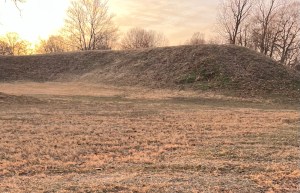
    Sunset at the Mound on the Heath/Newark Ohio Border with Luna

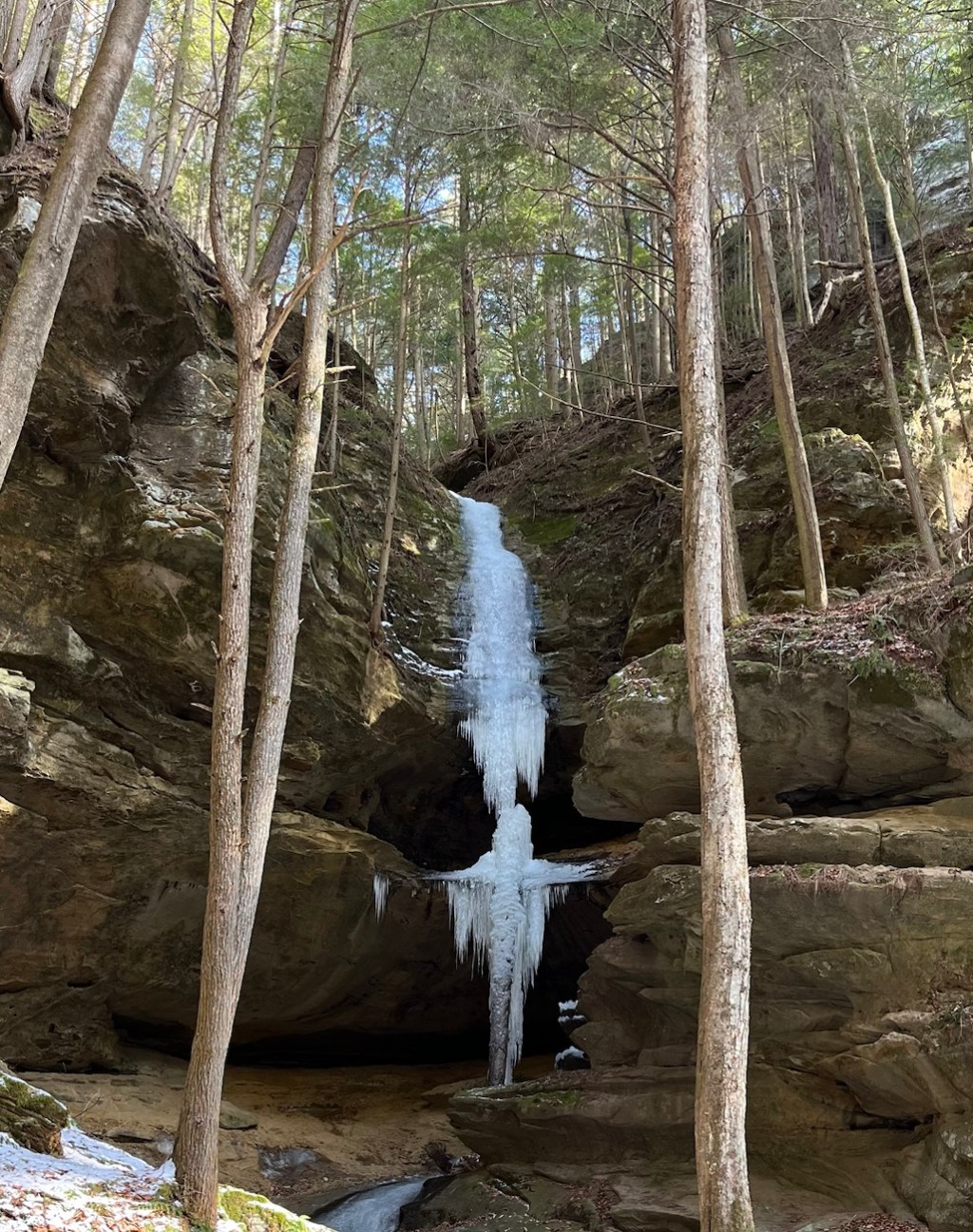
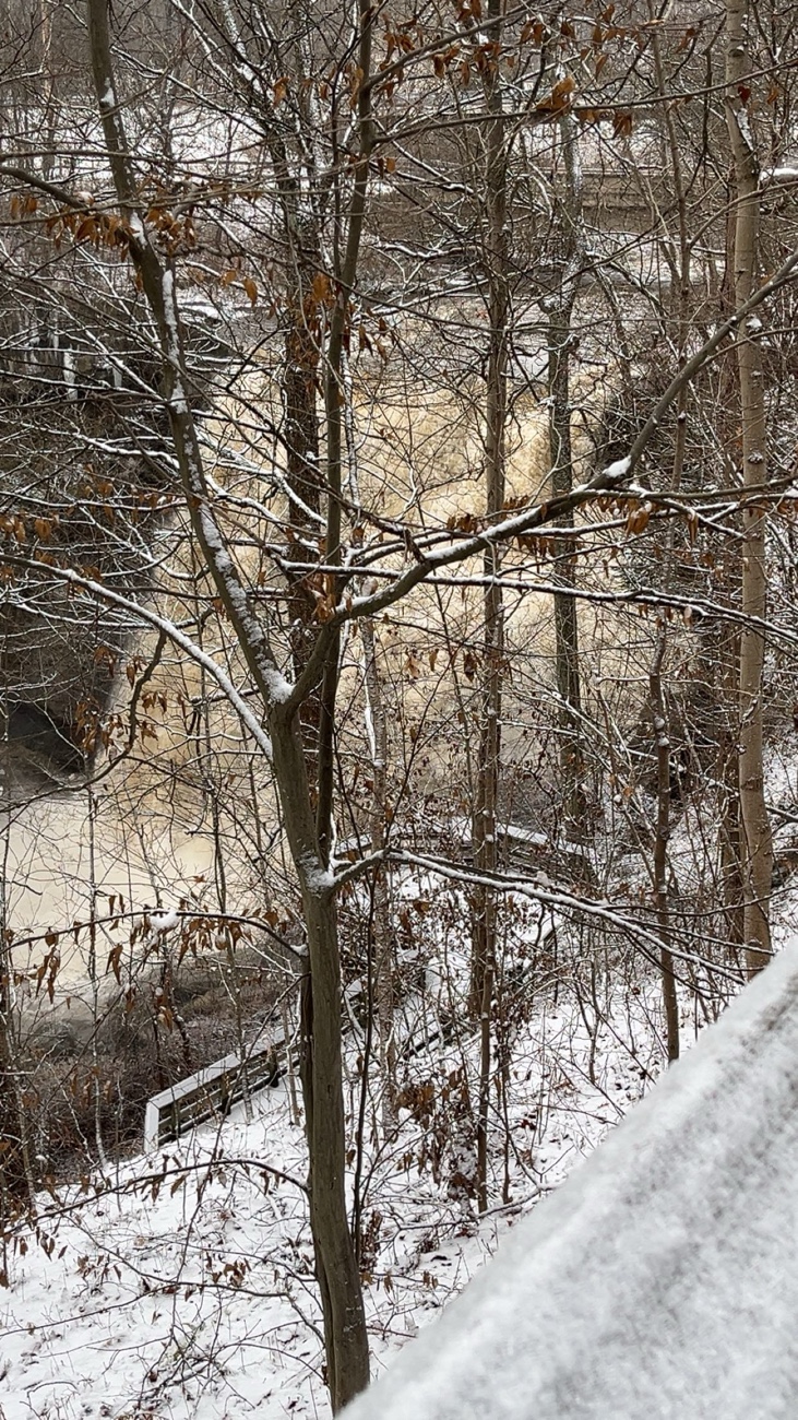
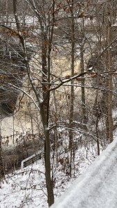
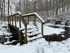
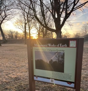
    On January 23, after a full day of winter hiking around Hocking Hills and Licking County, Luna and I stopped at an earthwork in the Heath, Ohio. Where we decided watch the sun drop behind ancient earth. We walked about a mile along the length of the mound at low light, dusted snow underfoot, and cold air rolling down from the hills.

    This wasn’t just any hill. What we walked along was part of the Newark Earthworks, one of the most remarkable prehistoric complexes of geometric earthworks in the world, built between roughly 100 BCE and 400 CE by Indigenous peoples often called the Hopewell culture. 

    Pinks and oranges make up the blue sky before sunset in heath, Ohio

    What the Newark Earthworks Are and Why They Matter

    The Newark Earthworks are a National Historic Landmark and World Heritage Site recognized in 2023 for their ancient craftsmanship and cultural significance. 

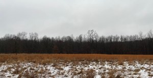
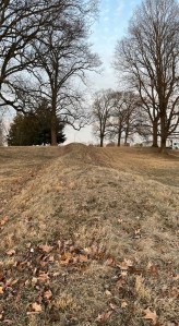
    The complex originally spread over several square miles of what is now Licking County, anchored by monumental earthen structures including the Great Circle Earthworks, the Octagon Earthworks, and the Wright Earthworks.  The walls you see rising gently from the ground are not random hills but carefully constructed embankments, once part of geometric patterns aligned with cosmic cycles. 

    At the Great Circle Earthworks, for example, the nearly 1,200‑foot diameter enclosure is one of the largest prehistoric geometric earthworks in the Americas, with walls originally up to 8 to 13 feet high surrounding a deep ditch that may once have held water. 

    These works were more than simple mounds. Archaeologists now interpret them as multi‑purpose cultural landscapes used for ceremony, social gathering, astronomy, seasonal observation and memorialization, built by Indigenous people with deep knowledge of geometry and the sky. 

    One area of the mound free of snow with bare trees and the sun setting
    Part of the mound

    Hopewell Culture and Indigenous Wisdom Beneath Our Feet

    Although we lack direct written records from those who built them, what the earthworks tell us is profound. These structures are part of a network of Hopewell Ceremonial Earthworks across Ohio, collectively recognized for their monumental scale and alignment to solar and lunar events. 

    For centuries, Indigenous peoples traveled, met, traded and participated in spiritual gatherings around these sites. The precision of placements and connections among enclosures suggests knowledge of astronomy and cosmology far beyond mere utilitarian construction. 

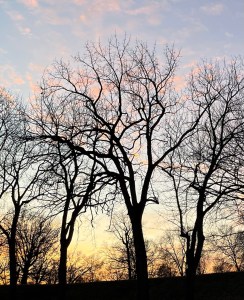
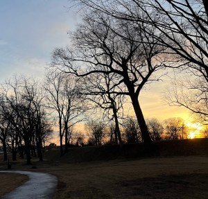
    Walking along the mound as the sun lowered, it was easy to feel a sense of time deep time, held in the earth beneath my steps, not just as distant history but as lived landscape.

    Another view of the mound no snow dead grass and bare trees
    More of the mound

    Sunset Light and Winter Walk Energy

    January’s sunset brings a special light. Golden rays flatten across ancient embankments and bring out texture in what otherwise looks like low, gentle rises in the ground. Luna and I walked about a mile of these earthen lines, the long shadows changing faster than the chill. The quiet of winter, sparse birds, cold wind, distant cars on the Ohio roads, made the moment feel wide in memory even if short on clock time.

    Barren trees sunset and the heath ohio mound
    Sunset over the mound

    Mounds, Meaning and Respect

    These earthworks are sacred places as much as they are archaeological landmarks. They were built for ceremony and memory by real people whose descendants today maintain cultural ties to this land. Visiting them demands curiosity, respect, and quiet observation rather than disturbance. 

    The Great Circle, near where Luna and I walked, could once have hosted gatherings of people from across the region, moments of shared meaning held in earth and sky that were much more than simple trails or tourist stops.


    Quick Facts for Visitors

    Location: Near the border of Heath and Newark, Ohio in Licking County.  Builder: Created by Indigenous peoples of the Hopewell culture between about 100 BCE and 400 CE.  Designations: National Historic Landmark, UNESCO World Heritage Site.  Structures: Includes the Great Circle Earthworks, Octagon Earthworks, and Wright Earthworks.  Purpose: Likely used for ceremony, astronomy, social gathering and memorial practices shaped by landscape and cosmos. 

    Standing near these earthworks at sunset with Luna was a reminder that Ohio’s past is vast, visible, and deeply present in its landforms. The lines of earth underfoot tell stories of ancient organization, knowledge and presence. These stories long outlast cold winters and quick days. The mound was quiet at dusk, but in its silence was an invitation to listen across centuries, a living memory beneath winter sky.


    Glenford preserve

    Poeaxtry links

  • Winter at Conkle’s Hollow Gorge Trail – Trip Two

    Winter at Conkle’s Hollow Gorge Trail – Trip Two


    Axton, Kelsey, And Kylie's Shadow's Photographed Axton shows peace sign, kelso double middle finger, and ky a heart.
    3 Musket Queers

    A Winter Walk Through Conkle’s Hollow, Where Ice Meets Stone

    On a cold December day in 2025, I first stepped onto the Conkle’s Hollow Gorge Trail, and I knew I’d be back. Perfectly tucked into the rich Hocking Hills region of southeastern Ohio. This State Nature Preserve draws hikers for its towering Black Hand sandstone cliffs rising nearly 200 feet (ca. 61 m) above the shaded valley floor. And of course for the narrow gorge that feels carved by time itself. The frozen ground, fallen leaves and winter hush slowed us down just enough to allow us to experience the full beauty of winter in Ohio.


    Axton in a yellow jacket and Kelsey in a Black Jacket in front of rocks
    Kelsey & Axton

    The Return After Cantwell

    After the icy return from Cantwell Cliffs, on January 23, I came back to Conkle’s Hollow. This trip my partner Kelsey and our friend Kylie came along also. We visited the grotto, and saw two frozen falls while we made new memories.

    The Gorge Trail starts out accessible a paved path through a cool canyon of ferns, moss, and deep shadows. Flat enough that people often think of it as very easy in warm weather. In winter, when ice seals every rock and forms frozen patches, it demands respect and slow steps.

    We left the concrete walkway and entered the dirt-trail stretch. This is where the gorge narrows, and tree roots twist across worn rock. The cold was sharp between cliff walls, silent except for our footsteps, conversation, and laughter.

    At the head of the hollow, the waterfall lay before us, a sculpted cascade of ice and black stone. It was not rushing with spring thaw, but frozen into quiet architecture. A tall and inviting angel of ice. It felt like a reward, for my commitment to return, in December the fall was void of even ice.


    Kylie in her winter hiking clothes with a stick she found
    Kylie & Stick

    Icy Steps, Butt Slides, and Winter Realities

    There was one part that tested us all. the steps back out. Kelsey found the ice so slick that they had to carefully slide down on their butt. Smart, one controlled tug at a time, rather than risk a fall. Winter on stone is beautiful, but it’s also unpredictable. The paved trail that’s easy in summer turned into glassy slope in January, and footing matters more than speed.

    Conkle’s Hollow’s lower trail (paved portion) is often about 0.5 miles each way but in winter it feels longer, each step a negotiation with ice and shadow. Hikers should always check current conditions, wear suitable traction, and move with intention when temperatures dip and water becomes more like stone.


    Kelsey in their black coat sliding safely down the stairs
    Kelsey sits on the steps.

    Have you ever had to make a safe exit creatively? Tell me how you did it in the comments.


    The Grotto at Conkle's Hollow Kelsey, Axton, and Kylie stand in front
    3 Musket Queers & The Grotto

    Why Conkle’s Hollow Stands Out

    Conkle’s Hollow isn’t just a trail, it’s a deep, cool gorge named for early explorer W.J. Conkle, whose name was once carved into sandstone within the hollow. The valley floor supports a rich ecosystem of ferns, hemlock, wildflowers, and moss that thrives in the shaded canyon. This is one of the deepest gorges in Ohio despite its modest trail length.

    The rock here is ancient Black Hand sandstone, formed long before Ohio was dotted with trails and preserves. Over eons water and climate slowly carved this gorge. cliffs Today the hollow holds cascading waterfalls in wetter months and dramatic ice in winter.


    Small Frozen Waterfall at Conkle's Hollow
    Small Frozen Fall

    Trail Tips for Winter Hikes Like This

    Traction devices are worth having. Things like winter boots with microspikes or traction will change an almost impassable section into a managed stretch. Poles help balance especially on packed ice and uneven terrain. Respect the preserve’s rules. Luna stayed home dogs are not permitted in Conkle’s Hollow State Nature Preserve. So plan hikes depending on location and land regulations.


    Frost Flowers and Dirt
    Frost Flowers. I have now seen twice in my life. Both times in this location.

    A Season to Return

    We may save the rest of the dirt trail for a visit in spring. When ice melts and water flows edge to edge over the stone. Standing before that frozen cascade was a moment in itself. Quiet, still, and deeply rooted in place. There’s something in winter hiking that makes a trail feel like a secret told only to those who return with patience, preparation, and a little warmth in their pack.

    Conkle’s Hollow reminded me that running into winter on a trail is not about distance, it’s about presence. It’s about the cold ice on stone, the hush between trees, the sound of boots on packed earth, and the ice-sealed waterfall waiting for another season. I walked it in winter with friends twice, and it felt like finding a story already in the landscape, just waiting for us to step in and read it.


    Share with a friend you want to explore Conkles Hollow or another Gorge with this winter season.


    Conkles Hollow Rim Conkles Hollow Gorge 1
    All Poeaxtry’s Links


    A view of the rock wall formations at conkles hollow with snow, bare trees, sunshine, and vibes showing
    Winter Wonderland

  • Winter at Cantwell Cliffs – can’t be done without Spikes

    Winter at Cantwell Cliffs – can’t be done without Spikes


    First Trip

    On January 20, around 4pm, Luna and I pulled into the Cantwell Cliffs trailhead inside Hocking Hills State Park. This is a place known for deep sandstone gorges, rugged terrain, and a waterfall that peeks over the cliff edge in wetter seasons. Cantwell Cliffs sits in a more remote and quieter area of Hocking Hills. It is no less dramatic in its geology and vibes though. 

    Cantwell CLiffs brown park signage in the snow
    Cantwell Cliffs

    This trail is carved by the erosion of water through Blackhand sandstone, forming towering cliffs up to 150. And of course my favorite type: unique narrow passages like Fat Woman’s Squeeze. 

    Winter had settled in hard this week. The stone steps that lead down toward the waterfall, steps that usually give way to moss, soil, and leaf litter, now completely glazed in ice. Around 0.4 miles in, with Luna leashed and alert but feeling my unsure cues, we turned back. I have to listen then instinct speaks, my instincts told me we had gone far enough. The air was cold, the footing slick, and every step demanded focus. I don’t take dangerous risks in this manner. We turned back at the top of the frozen steps, crocs crunching ice on the trail and silence surrounding us.


    Axton in Jeans and a Yellow jacket, Kelsey in a black jacket behind axton, and kylie with a peace sign up behind axton aswell at cantwell cliffs
    Kylie, Kelso, &Axton

    Return Trip: January 23 with Company and Better Eyes on the Trail

    A few days later, on January 23, I returned with my partner and our friend Kylie, a perfect team for winter hiking. Sharp eyes, quick laughs, and an easy readiness to pivot plans when conditions demand it. The trail, a loop with both rim and canyon routes, was still icy, our confidence grew as we descended beyond the first switchback. 

    We made it farther this time, to where the waterfall usually tumbles over the cliff’s edge. Today the water wasn’t exactly falling, it was frozen. The rest of the trail simply impassable without traction devices. The ice was thick, smooth, and unyielding, a reminder that winter beauty can be equal parts breathtaking and brutal. So we called it there, admired the frozen gorge and soaked in the steep walls rising around us. 


    Comment and share a time you knew you should turn around. What was the moment you knew the risk was not one you needed to take? How did you prepare better for your next visit?


    Frozen waterfall at cantwell cliffs.
    Cantwell cliffs frozen waterfall

    Trail Realities

    Cantwell Cliffs’ trails are moderate to strenuous. They are a mix of rim views and valley floor loops that can take one to two miles to complete. The stairs and rock steps that are fun in spring and fall become tricky in winter without gear. This hike is one where maps matter, muddy or frozen conditions demand caution, and everyone, dogs included, need attentive footing. 

    The park allows well-behaved pets on leash, so Luna’s presence was completely in line with trail etiquette. But winter on ice makes most four-legged friends slower and more cautious. 


    Gear on the Way: Poles, Headlamps, Spikes

    I already ordered hiking poles and a couple of headlamps. Incoming night hikes? DUH! Those poles will add balance and support on uneven rock steps to say the least. Next on the list is spikes. Microspikes or traction devices that bite into ice and make icy slopes climbable rather than perilous. On the next order, spikes are a priority. We may save the full trail for spring melt. Water flow will return to the falls and the trail will soften underfoot.


    Ledges view from inbetween them at Cantwell Cliffs
    I love Rocks!!

    Cantwell Cliffs in Context: History, Geology & What Makes It Worth It

    Cantwell Cliffs is not just a destination for waterfall views. It’s a State Nature Preserve with history dating from its conservation roots in the early 1900s. Formal preserve designation happened here in the 1970s. Remarkable and remaining still one of the less visited, more rugged parts of Hocking Hills. The gorge and cliff walls were formed over millions of years as Blackhand sandstone eroded. Thus creating deep box canyons, overhangs, and passages that feel alive with time. 

    That raw geology is what makes winter hikes like this one special. The trees are bare so contours pop in the light. You can almost read layers of stone like a palimpsest. Waterfalls turn to glassy ice sculptures waiting for a safer season to sing again. 


    Looking Ahead: When the Water Really Falls

    If you wait for spring snowmelt and seasonal rain, Cantwell Cliffs often contains a beautiful fall. Though modest yet lovely it cascade over the rock shelter that feels earned after the descent. 

    Winter is beautiful, but spring may be our comeback. Poles, daylight stretching, and warmer ground.

    Cantwell Cliffs reminded us of what winter hiking really asks: patience, respect for conditions, humility, and the willingness to turn back. When instincts give you blessings rather than push forward you listen to the warning, and you come back. Luna was safe, we were safe, and the cliffs still stand ready for the next chapter.


    Share with someone who you think appreciates following natural instincts when outdoors.


    Want to explore more?

    Visit Poeaxtry and the Prism’s Archive Cheat Sheet. Discover all post categories, with a blurb and link to full post archive for each. Then find every post in that category in chronological order.


    View all Poeaxtry Links
    Conkles Hollow
    Conkles Hollow Gorge


    mid way down the steps view
    I could stay here for a while.
  • Flint Ridge Trail, A Winter Walk Through Deep Time

    Flint Ridge Trail, A Winter Walk Through Deep Time


    Iron stained flint druzy quartz at flint ridge
    Huge flint chunk with druzy quartz

    On January 6th, I walked the Flint Ridge to the Creek Trail, a modest distance, just under two miles, but heavy with time. This was not a mileage day, it was a listening day. Winter had stripped the woods back to their bones. No leaves to soften the view, no green distractions, no canopy to hide the land’s shape. Just stone, bark, frozen ground, and the quiet pressure of cold air sitting against the skin.

    January in central Ohio does not ease you in. The air was sharp without being cruel, cold enough to keep the trail firm and the mud locked in place. A thin crust of frost clung to shaded patches, crunching under my crocs. While open stretches stayed dry and reliable. Wind moved lightly through the ridge, not howling, just enough to remind you that winter was in full effect. And she was paying attention. This coldness rewards preparation and punishes distraction, gloves on, layers balanced, breath steady.


    Location, Location, Location…

    A frozen pond and bare sticks and tree branches
    Frozen pond with barren tree limbs and sticks

    Flint Ridge sits in Licking County, Ohio, preserved today as a State Memorial. Long before trail markers, paved lots, and signage, this ridge was one of the most significant prehistoric flint quarry sites in North America. For more than 10,000 years, Indigenous peoples returned here again and again to extract flint. This stone is prized for its durability, predictability, and clean fractures. Projectile points, blades, scrapers, and tools made from Flint Ridge flint have been found across much of eastern North America. This is evidence of vast trade networks and migration routes that existed long before colonial borders or state lines.

    Geology

    A small frozen pond at Flint Ridge in Licking country ohio. some some holes in the ice, snow dusted woods floor and bare trees
    One of the ancient quarries filled with frozen rainfall

    The geology is the reason the ridge exists at all. Layers of Mississippian-age limestone hold dense seams of high quality flint, exposed through erosion and time. What you see today, shallow pits, uneven ground, subtle rises and dips, are not random. They are the physical record of careful extraction methods repeated across generations. These are not careless scars. They are marks of knowledge, restraint, and survival.

    Trails

    Walking this trail in winter makes those features easier to read. Without undergrowth, the old quarry depressions stand out clearly, small bowls in the earth that catch shadow and light differently. You are not just walking through woods, you are moving across an active historical document. This one was written in stone and absence.

    The Flint Ridge to the Creek Trail begins near the quarry landscape and gradually descends toward water. The grade is gentle, approachable for most hikers, and well suited to days when you want presence over push. Underfoot, the ground feels distinct, firmer, and rockier in places. Almost, as if the land is reminding you what it is made of. Dogs and kids are welcome. Though the trails aren’t exactly ADA accessible, there is a nice-paved part with educational sines and a museum.

    As the trail drops, sound becomes more noticeable. Water moving beneath thin ice, then opening up again, a distant-low conversation that cuts through the quiet. The creek is not wide or dramatic, but it anchors the hike. Stone and water have always worked together here, shaping tools, shaping trade, shaping movement.


    Dogs

    Brown dog with blue collar
    Luna

    As mentioned, it is a dog friendly trail. Though, hiking it with a dog in winter adds another layer of attentiveness. Leashes are required, and for good reason. The terrain is uneven in spots, and the historical features deserve protection. Winter conditions also mean watching paws for ice buildup and cold exposure. I always make Luna don booties. You need to remember water even when temperatures are low. Always stay alert near the creek edge. The trail length makes it a solid outing for dogs who enjoy exploration without overexertion, especially on colder days.


    Ethics

    Flint Ridge State Memorial is a protected site, collecting flint or removing natural materials is prohibited. This matters. Rockhounding ethics are not optional here. The ridge has already given enough. The act of leaving everything where it lies is part of respecting the thousands of years of use that came before modern recreation.


    Winter field dusted in snow with trees in the distance
    Field view at flint ridge park

    More trail traits

    The trail itself is well-marked and easy to follow, even in winter. Foot traffic keeps it visible, and the shorter distance makes it accessible while still feeling meaningful. This is not a destination built around spectacle. There is no overlook designed for photos, no dramatic payoff at the end. The reward is cumulative, built step by step. The pieces of flint and quartz you see along the way, and the history.


    More trails and things to see

    Flint Ridge State Memorial also includes additional trails and an interpretive center. Education here goes deeper into the archaeology, geology, and cultural significance of the site. Even without stepping inside, the land teaches quietly. It shows how landscapes hold memory, and how walking can be a form of respect when done intentionally.

    One of the educational signs on the paved trail
    Educational sign

    This January hike did not need distance to feel complete. Just under two miles was enough to feel grounded, slowed, and centered. Winter sharpened the experience, stripped it down to essentials. Stone. Water. Breath. Time.

    If you hike Flint Ridge, go gently. Stay on trail. Keep dogs leashed. Leave what you find. Let the ridge speak for itself. Bring your kinds and educate them. The story is already there, layered beneath your boots, older than any of us, and still very much alive.


    Winter mushrooms growing in a tree
    Large mushroom growths on the trail

    Want to explore more?

    Visit Poeaxtry and the Prism’s Archive Cheat Sheet. Discover all post categories, with a blurb and link to full post archive for each. Then find every post in that category in chronological order.


    Check Out All Poeaxtry Links
    Mound Hike

  • Hiking Sustainably in 2026, Exploring Ohio

    Hiking Sustainably in 2026, Exploring Ohio


    A small frozen pond at Flint Ridge in Licking country ohio. some some holes in the ice, snow dusted woods floor and bare trees
    Frozen Quarry at Flint Ridge filled with rainfall.

    Eco-friendly Hiking Plan

    This year the goal is simple but deliberate, energetic, we hike sustainably where we live first. I take you all virtually to explore Ohio’s state parks, preserves, arboretums, city parks, hidden gems, and more. I will also fold in planned travel to visit my sister in North Carolina. As well as trips back home to West Virginia. I plan to even sprinkle in Pennsylvania, Kentucky, Indiana, and Michigan. I’ll do this in a way that honors the land, reduces my carbon impact, and celebrates the natural world local.

    We’re not waiting to see the world somewhere else. We’re learning to love the world right where we are.


    Why Eco-Friendly Hiking Matters

    Eco-Friendly hiking isn’t about guilt. It’s about intention. It means hiking where you already are and where you’re already going. Instead of planning huge trips that blow your carbon-footprint out of the sustainable realm. It means choosing nearby parks and preserves over flights, embracing city parks, local trails, hidden overlooks, and lake shore paths. And still planning longer multi-state legs when meaningful and reasonable.

    This approach:

    Shrinks the carbon footprint, builds local connection, deepens seasonal awareness, supports local economies, and grows appreciation for everyday nature.


    Axton sit's on the edge of a cliff on Conkles Hollow Rim trail
    Conkles Hollow- Rim Trail

    Some of Ohio’s State Parks, Preserves, and Outdoor Wonders We’re Seeing

    Hocking Hills State Park

    A cornerstone of Ohio hiking with waterfalls, deep rock shelters, winding forest trails, and sandstone ravines. It’s dramatic, popular, and beautiful, but also a reminder that crowds can challenge trails and quiet places alike. Hiking sustainably means going off-peak or seeking the lesser-known corners of the park to spread impact. As well as signing up for permits (they are free for specific areas) to protect the environment.

    Maumee Bay State Park

    Perched on Lake Erie’s shore, this 1,336-acre park offers boardwalk hiking, wetlands, bird watching, fishing, and nature observation. Bonus – No miles of difficult terrain, great for low impact days and water-linked hikes. 

    Highbanks Metro Park

    This park is just north of Columbus with roughly ten trails. It has massive bluffs above the Olentangy River, ancient earthworks, and a nature center. Here you can learn how this all connects to geology and culture. The Perfect place for mindful hikes that meet both history and ecosystem. 

    Kelleys Island State Park

    I may be most excited for this one. Sitting on Lake Erie the island park with six miles of mixed trails, shoreline, habitats, and glacial grooves. This is a place where water meets stone and slow walks deliver unexpected insight. 

    Hidden Nature Preserves like Wahkeena Nature Preserve, with wetlands and orchid habitat, unique fen landscapes, and boardwalk trails. Offering us a lesson in preservation and quiet observation. 

    City and Gateway Gems

    Arboretums, hidden parks, local preserves, and more. Hudson Springs Park with lakes and easy trails. The Holden Arboretum canopy walk, mixing local beauty with accessible low-impact visits. 

    Smaller hidden spots like the Buckeye Trail that spans over 1,400 miles of varied terrain, linking birding routes, marshes, forests, prairies, and beaches right across Ohio. These places work at reminding us that nature doesn’t need to be far. 

    Double Waterfall at Piatt Park - January 2026
    Piatt Park – January 2026 Monroe County, Ohio

    Comment and share ways you already practice Eco-Friendly hiking, or ways you plan to practice them in the coming year! I love to hear from all of you!


    North Carolina

    We’ll hike trails near Asheville and the Blue Ridge parkway. I’ll be prioritizing waterfalls, overlook points and local favorites.

    West Virginia and Pennsylvania Routes

    top level of mount wood overlook and part of the rolling hills view
    Read a poem I wrote here Mount wood Overlook – Wheeling, Wv

    West Virginia’s natural treasures like North Bend State Park provide rail-trail hiking and wooded climbs with minimal emissions per mile.  Nearby Pennsylvania’s Raccoon Creek State Park or Ryerson Station State Park. These offer forested trails that are a short drive from the Ohio border and great for combined adventures. 

    Michigan Days

    Lake shore paths, urban parks and natural dunes, give us water, wind, and open space without long internal flights.


    How We Practice Low-Impact Hiking

    Stay on trail or areas you are allowed to explore. This is to protect flora and soil.

    Always pack in, pack out.

    Try to choose trails near home first.

    Gently Carpool or combine trips.

    Balance rugged hikes with easy preserves.

    Learn local natural history as you hike.

    This isn’t about saying no to travel. It’s about saying yes to responsible adventure that doesn’t erase the places we love.


    A thought as we part….

    This year, I aim to build a map of sustainable footsteps. As well as a collection of Ohio parks, preserves, arboretums, city parks, hidden gems, and eco-friendly travel corridors. These reflect how I plan to see the world without leaving a heavy mark behind. Nature is everywhere. Let’s make sure our footprints are thoughtful.

    A photo of the Big Spring
    Kitch-Iti-Kippi- “Big Cold Spring”

    Share with someone you’d like to practice more Eco-friendly ways to love and see nature with!


    Before you go please consider supporting Eco-friendly hikes, and art work that takes the lead when it counts! Donation are accepted via CashApp, PayPal, Ko-Fi, or Buy Me a Coffee. This helps to keep our projects and community thriving.


    Check out all Poeaxtry Links

  • Pictured Rocks, Lake Superior & The Upper Peninsula in June 2024

    Pictured Rocks, Lake Superior & The Upper Peninsula in June 2024

    Axton with black hair and black glasses in a Nirvana shirt with Kelsey in black and gold glasses and a black shirt in front of a waterfall in Munising.

    Think back on your most memorable road trip.


    You remember some trips for laughs and snacks, others leave a quiet ripple in your bones. June of 2024 was the latter. A week I spent in Michigan’s Upper Peninsula with my fiancé. Camping at Munising campgrounds, wandering Lake Superior’s massive shore, hunting stones, honoring memory by scattering my mom’s ashes into the cool blue water. We enjoyed many local coffee beverages while watching waves roll in like heartbeat rhythms.

    Pictured Rocks National Lakeshore sits on the southern edge of Lake Superior. The largest freshwater lake in the world by surface area. Its cold deep water a clear, glassy mirror to the changing Michigan sky.

    The cliffs of Pictured Rocks rise 50 to nearly 200 feet above the water. They are streaked in minerals that paint reds, oranges, greens, blacks and whites into sculpted sandstone faces. These formations stretch for about 15 miles along the 42-mile lakeshore.

    Campfire inside a fire ring on a beach

    Camping & Nights Under the Sky


    We stayed five nights at the Munising area campgrounds. Pulling our tent up near the lake edge. We listened to waves crash into dusk and we were woke by bird calls before sunrise. Campgrounds on the lakeshore are primitive but magical. Each site has a fire ring and picnic table. Of course you are also under a vast sky with little to no cell service. Every moment felt rich and unfiltered.


    Rock Hounding & Lakeside Wandering

    Axton walking in the forest away from lake superior


    Picking stones isn’t allowed directly inside Pictured Rocks due to protection rules. So we headed a bit farther east near Grand Marais and along Twelvemile Beach. We found uv reactive slag, agates, jasper, granite, and more!


    Lake Superior View

    Beaches, Waterfalls & Cliffs


    The lakeshore has beaches from sandy Miners Beach to the long empty waves at Twelvemile Beach. They are all mostly framed by deep green forests and airy sky. Waterfalls drop in emerald forests, the region offers dozens of cascades, from Mosquito Falls to Chapel Falls. Each a place you can pause, breathe, and listen.

    Munising Falls, Munising Mi

    When you finish reading this, comment and tell me about a trip you took and why it stayed with you.


    Views From Water & Trails


    From boats that cruise past sea caves, Miners Castle, and the East Channel Lighthouse, to paddling into hidden coves near Lovers Leap and Grand Portal Point, Lake Superior’s moods shift from glass calm to wind-ruffled waves. Trails thread through forests and above shorelines, revealing endless angles on water and stone.


    Bates Motel sign on the way to UP Michigan.

    Local Flavor & Small Town Finds


    Days of sun and trail work were punctuated by coffee stops and local eats in the Munising area. Pasties, fresh fish plates, pizza, and icy cups of coffee that hit great after sandy hikes. It’s small town food with big soul, the kind you taste better after a day of wind and sun.


    Why It’s Unforgettable


    We went to roam… to wander… to remember and to love… and every vista answered with something new. Lake Superior’s hush gives you room to think, Pictured Rocks’ colors make your eyes linger, and the Upper Peninsula’s quiet kindness reminds you that the best journeys aren’t just about the places you go. The ones that stay with you matter most.

    Kelsey and Axton take a selfie infront of iconic Kitch-iti-Kippi

    Kitch-Iti-Kippi

    On the way home we stopped at Kitch-iti-kipi, Michigan’s largest natural freshwater spring tucked into Palms Book State Park near Manistique. It felt like the perfect last chapter to a week of wide water and wilderness. The spring’s enormous crystal-clear pool, roughly 200 feet across and about 40 feet deep, pumps out over 10,000 gallons of emerald-green water every minute from limestone fissures below. This keeps the water near a steady 45° Fahrenheit year-round and so clear you can see deep into the bowl’s shifting sands. Of course there were many trout beneath the surface. Visitors glide on a manually operated raft over the quiet, mirror-like water, passing ancient tree trunks and limestone-encrusted rock as if suspended in time itself. Seeing that “Big Spring” under the vast Upper Peninsula sky reminded us that some places stay with you long after the road bends away.

    A photo of the Big Spring

    Share with someone who you think would enjoy what Munising and the surrounding Michigan areas have to offer.


    Want to explore more?

    Visit Poeaxtry and the Prism’s Archive Cheat Sheet. Discover all post categories, with a blurb and link to full post archive for each. Then find every post in that category in chronological order.


    Be seen, celebrated, and connected! All Free! Submit to Poeaxtry Spotlights today. By form or email Poeaxtry@gmail.com


    Explore more of Poeaxtry here. Best of Poeaxtry here . Concerns? Questions? Comments? here


  • Piatt Gorge and Raven Rocks: Waterfalls and Heart Rocks

    Piatt Gorge and Raven Rocks: Waterfalls and Heart Rocks


    Axton in a black hat, black jacket, and jeans with his dog in front of a waterfall
    Luna and I at Piatt park

    Today’s hike didn’t go how Cyble and I had envisioned it. Yet, unlike normally when the destination changes and everything’s worse tbis ended up better than I ever expected. I woke up thinking Morgantown was the same distance from Newark as Wheeling and that was a dumbass mistake. Yet, sometimes you win, sometimes you learn. Instead of heading straight to Cooper’s Rock near Morgantown, West Virginia, Cyble and I took a detour that turned into one of the most beautiful, muddy, quiet, awe-inspiring hikes I’ve done in Ohio.

    We drove from Newark to Cambridge, Ohio, and ended up at Piatt Gorge in Woodsfield. From there we went on to Raven Rocks, about 19 miles away in southern Belmont County, and spent the whole day chasing waterfalls, heart rocks, caves, creek crossings, laughs, slips, and exactly zero people.

    Axton in a black hat, black jacket , and jeans sitting on a large rock

    Piatt Gorge: Caves, Waterfalls, and Heart Rocks

    Piatt Gorge was incredible. The trail loops through rich hardwood forest, switchbacks, and rock shelves. We took the west side trail through a massive cave-like passage that opens up into a waterfall. Waterfalls were everywhere: some roaring, some trickling, some dry even though it was raining. Every waterfall was perfect for photos, and some spots looked swimmable, though I didn’t see any signs saying you could or couldn’t.

    Two falls flowing into eachother at Piatt park
    Double falls at Piatt park

    I had both Luna and Cyble with me and they got all the views, all the rocks, all the laughs. I fell twice, didn’t get hurt, and got some hilarious photos. At one point I collected two heart rocks at the same spot and gave them to Cyble for her and her boyfriend Hunter. I brought home twenty-four little heart rocks, I photographed one huge heart rock big enough for five people to sit on, another large one under a waterfall that I left because it was too poetic, two orange slabs with red and black stripes, two cool conglomerates, and some other orangey stones I liked. Six of these went straight onto my altar.

    Photo from inside cave at Piatt park
    Inside a cave at Piatt park

    The trail was wet and muddy with a few creek crossings. It’s kid- and dog-friendly, but some cliffy sections will pose situations where help for kids and others may be needed. Benches are scattered along the path, but it’s not ADA accessible. Shoes that can handle mud are a must.

    Another fall at Piatt park
    Another fall at Piatt Park

    Planning a day trip from Newark, to Cambridge, or nearby Ohio towns? Piatt Gorge is perfect for waterfalls, caves, and heart rocks. Grab a friend, your dog, a camera, and some waterproof shoes. You’ll want to take your time and explore the cave and waterfall sections.


    What’s your favorite Ohio cliff or fall?

    Tell us in the comments!


    Raven Rocks: Cliffs, New Signs, and Quiet Trails

    Cliff waterfalls at ravens rocks in Ohio
    Cliff falls at raven rocks preserve

    Next, we went to Raven Rocks nature preserve in Beallsville, Ohio, which is open to the public but privately owned. The 0.4-mile loop at the trailhead drops into ravines with sandstone cliffs and small waterfalls. There are new wooden steps replacing the old ones and trail signs now that weren’t there last time I visited. The place was quiet with no one else around, giving a sense of being completely immersed in nature.

    Raven rocks scenery photo with streams and fall leaves
    Scenery photo at Ravens rocks

    Trails were wet and muddy, with some creek crossings and cliffy areas that need attention if you’re bringing kids. Dogs are allowed and Luna’s energy made the hike even better. We picked up some garbage in the parking lot and carried it to the bins. Please remember to respect the trails.


    Cooper’s Rock: The Classic Dream

    Though we didn’t make it there today, Cooper’s Rock near Morgantown, WV, still calls to me. It has miles of trails, overlooks of the Cheat River Canyon, and rock formations that make for epic hiking and photography. After today, I’m even more excited to return.


    Trail Notes and Tips

    Trails in these locations are muddy and slick after rain, so wear shoes you don’t care about. Creek crossings are simple but need attention. Kid- and dog-friendly doesn’t mean easy, cliff areas need supervision. Pack out trash and respect private property. Every fall, every splash, every heart rock, and every waterfall is part of the experience.


    So tell me what do you collect on your trail adventures?


    Axton holdings up a nice sized heart shaped rock with a treeline view behind it
    Heart shaped rocks call to me

    Today’s hike exceeded expectations. Piatt Gorge and Raven Rocks are beautiful, challenging, and unforgettable. Share this with someone you want to explore these trails with. You’ll get laughs, muddy shoes, incredible photos, and the quiet magic that only hidden Ohio trails can offer.


    Two other epic Ohio hikes: Hike hike


    Poeaxtry links

  • Quick Pit Stop at CVNP- A December Glimpse at Brandywine Falls

    Quick Pit Stop at CVNP- A December Glimpse at Brandywine Falls


    The Stop-On-a-Whim

    I had the day off. A buddy and I were driving through the Cleveland area to pickup her kid… no big plan, just the open road. Then inspiration struck: swing by Brandywine Falls. Duh

    Brandywine falls in the summer CVNP
    Brandywine falls view from above

    I’ve only seen it one other time — during a parched summer when the falls were more whisper than roar, barely a bit more than a modest trickle through the gorge. That day felt almost ghostly. But on Friday, December 19 2025… things looked very different.

    Straight on view of Brandwine falls wintertime.
    Brandywine falls December.

    Because of recent snowfalls, the water was high and alive, rushing over the ledge with a force that made the air taste cold and feel charged. The falls were full, the gorge echoing with the crash of water, the kind of sight that silences you for just long enough.

    Why Brandywine Falls Hits Different

    Brandywine Falls drops about 60 feet, that makes it the tallest and most impressive accessible waterfall in the park.  Geologically it’s classic: a hard cap of ancient Berea Sandstone formed roughly 320 million years ago. This overlies softer layers of Bedford Shale and Cleveland Shale, formed from 350 to 400 million years ago sediments. Water erodes the shale faster, undercutting the sandstone which eventually breaks off . Thus creating and reshaping the gorge over millennia.  In dryer seasons the falls tend toward a graceful, slender, almost ghostlike.  But when precipitation or snow-melt fills the creek as it had before our visit, the falls swell. The volume surges, the drop becomes a roar, and the gorge lives and breathes again.  For early settlers the falls weren’t just pretty, they were power. Starting around 1814, a sawmill built at the top of the falls by pioneer George Wallace. Who used the rushing water to cut lumber. Over the next decade a small industrial settlement grew around it, with gristmills, wool mills and even a distillery.  Today you reach the falls by a brief walk from a parking lot. Then by using a boardwalk and stairs lead you to upper and lower viewing decks. For a spontaneous, quick-hit nature fix it’s perfect. 

    What It Felt Like This Time

    This trip felt like the falls remembered what it meant to be alive. That snow before our visit, frozen ground underfoot, everything conspired to give Brandywine a roar. The water hammered the ledge, threw spray outward, carved the air. The usual quiet winter slush was gone. Instead the gorge pulsed.

    Walking the boardwalk felt sacred everything slick and cold, the wood mutes under crocs, water humming below, the gorge walls rising steep and ancient on either side. I looked down at the pool where water crashed, looking darker and deeper than in any dry-season visit.

    For a brief second I remembered my first visit: quiet, soft, almost disappointed. This was its other face. Raw, untamed, majestic. A reminder that even small-town waterfalls can show you something wild if you catch them at the right moment.

    Why It Matters; For Hikers, Writers, Dreamers

    Brandywine Falls isn’t just a “quick stop” waterfall. It’s a dynamic landscape that changes with seasons, storms, snow. It whispers history through rock layers millions of years old, human history etched in 19th-century mill stones, and still today it offers a bridge between calm and chaos… depending on when you show up.

    If you wander there mid-winter or after heavy snow or rainfalls, expect power. Expect water roaring. Expect solitude and wildness, even if you’re a two-hour detour.

    If you go again, listen: to water, to rock, to history.

    Brandywine falls December 2025 in the distance fresh snowfall
    The majestic Brandywine of CVNP

    Links Brandywine the 1st time the plan

  • Winter Quiet at Conkle’s Hollow: Gorge Trail Snow-Covered Hike

    Winter Quiet at Conkle’s Hollow: Gorge Trail Snow-Covered Hike


    Wide of the creek you cross to get to the gorge and rim trail heads.
    ❄️

    The Walk

    On December 4, 2025, I dramatically layered up. I’m saying multiple layers, coveralls, a heated jacket, hiking shoes, 3 pairs of socks, multiple sweaters, and more! Then I headed out the lower gorge of Conkle’s Hollow State Nature Preserve. Of course I had to have friends with me so Skylar, the baby, strapped in. We found something rare… peace. No chatter, no other hikers, just the hush of winter slowing everything down. Literally not one other car at Conkles hollow beside a forest employee is UNHEARD OF!

    We followed the path up to the first waterfall, just past where the concrete path ends. From there the trail becomes rougher. A little too uneven, icy, and rocky. Totally not ideal when you’re carrying or walking with a little one. So we paused the adventure there, grateful for what we saw, and turned back. Safety first, always.

    Axton all layered up, bright yellow jacket and jeans showing, goofing off in the Grotto at Conkles Hollow in Hocking Hills, Ohio.
    The Grotto

    The gorge in winter has a ghostly hush to it. Frozen trickles, patches of ice along the creek, stones dusted with snow, frost clinging to moss and rock. And we just got a nice bit of snow. To me it felt like walking inside a memory, or a dream. The cliffs loomed high, silent sentinels watching over the narrow floor beneath.

    Even with the smaller hike (1.2 miles), coupled with the 29 degrees Fahrenheit the baby didn’t seem to mind. I felt the weight of quiet, with the kind of calm that demands you slow your breath, and your thoughts. That alone the silence, the cold, the hush, honestly made the hike worth it.

    Even if you account the 5+ feral and ethereal gut wrenching screams I let out. I got the baby to join but Sky wouldn’t even try.

    Frost flowers peaking out of soil and snowfall!
    Frost Flowers

    I only just learned about “frost flowers” earlier in the morning the day of this hike! These are surreal little winter magic flowers. What you’re seeing isn’t a true bloom, but thin ribbons of ice exiled from plant stems. This happens when cold air hits sap‑rich plants while the ground is still warm. Water gets drawn up from the roots, freezes in the stem, cracks it open, and then slowly seeps out and crystallizes in delicate, sheets of ice… fragile and fleeting, often gone by mid‑morning once sun or warmth touches them.

    A Month Ago Rim Trail,

    11/8/2025

    Axton sit's on the edge of a cliff on Conkles Hollow Rim trail

    A few weeks earlier, on November 8 my momma’s death anniversary, and a day I dedicate to celebrating her. Kylie and I walked the rim trail on the top of the rock walls at Conkles Hollow. The contrast between that high, exposed cliff line covered in early Autumn bliss and the now frozen ravine beneath struck hard.

    I remember sitting on a sandstone edge, dangling my legs over the drop, taking in the leaves changing colors for mile in the forest, valley. Up there the wind carried memories, grief, quiet gratitude. Down below the gorge held silence and survival. And I now got to see just how high my seat really was. I basically had to do a backbend to see the top of the cliff from the gorge trail!

    Conkle's Hollow Rim trail, one of many overlooks boasting autumn leaf treetop views, clear skys, and stone cliffs

    Walking the rim gave me perspective… on loss, on smallness, on beauty. Walking the gorge later with Skylar gave me gratitude… for warmth, life, safety, and the chance to bring new memory into old stone.

    Why Conkle’s Hollow Means Something

    Deeper

    Conkle’s Hollow lies carved into the ancient bed of Black Hand Sandstone. These formed roughly 350 million years ago when this land was under a shallow sea. Over time, sands and silts compressed and hardened. Later Earth’s shifting gave rise to uplift, and water carved deep gullies and gorges into this sandstone. And that erosion sculpted the cliffs and narrow ravines you see today. 

    Cliffs of nearly 200 feet tower above a gorge so tight in places it’s only 100 feet across.  Inside the gorge the micro‑climate supports ferns, hemlocks, hardwood trees, mosses and wildflowers. Deep shade, cool air, damp rock, and sometimes timelessness. 

    The preserve was purchased by the state in 1925, and dedicated as a protected area in 1977. This means these ancient cliffs and narrow depths are preserved, free for folks to walk through and reflect on age and time. 

    What to Know: Tips + Safety for a Winter Baby Hike

    Lower Gorge trail: mostly paved or flat at first, but rougher after the concrete ends. Icy snow and uneven footing make anything past the first waterfall risky when carrying a baby or holding their hand. Dress in warm layers! I had three sweaters, three pants, and coveralls. Under a heated jacket. Hiking shoes with grip are essential when snow or ice coat stones or wood. Stay on marked trails. Cliffs rise high up to 200 feet and rims above the gorge are beautiful but dangerous when wet or icy.  In winter the gorge is almost silent. So no crowds, no summer moisture but, that also means less water from the falls, and colder, steeper, slick-er terrain.

    Caves, cliffs, rock walls, snow, and not one waterfall in sight.
    The “waterfall” pp

    Nearby Trails & Bonus Stops Continue the Hocking Hills Journey

    If you liked Conkle’s and want to wander more in the region, check these spots:

    Cantwell Cliffs State Nature Preserve about 7 miles from Conkle’s Hollow on S.R. 374. Deep gorge, rugged terrain, canyon-like passageways and spring wildflowers. A great “next time” option for us since we had planned to go there before I became starved!

    Rock House State Nature Preserve a “cave” cut into Black Hand Sandstone cliffs. Tunnel‑like, dramatic, offers a contrast to open gorge and rim walks. 

    Good for slow days, clear skies, or scratching your itch for hidden magic.

    Reflection Loss, Life, Little Feet on Old Stone

    Walking those cliffs and that gorge reminded me just how small I am… how fleeting we all are. Rock 350 million years young, carved slow over eons by water and time?! Well now compared to that, my grief and memories feel small.

    Walking with the baby and my buddy down that gorge, past icy stones and silent walls, I felt something bigger. A bridge between the ancient, the lost, and the living. A chance to carve a new memory in the old stones of the world.

    That’s the power of this land. It is timeless but alive. Harsh but beautiful. And it allows you hush your grief into the quiet of a winter gorge, and come out lighter.


    Links Rim trail rock house permits

  • Early morning snow, slow steps on Robert’s Ridge & Valley

    Early morning snow, slow steps on Robert’s Ridge & Valley


    Luna in a pink and blue coat on a snow covered bench
    I know you all are actually here for these

    Luna and I slipped into Granville just after sunrise. The cold air would have been biting at my cheeks. However, I had a ski mask. 3-5 inches of snow dusting everything around us. The ridge-and-valley trail, rated moderate on All Trails was short enough to feel manageable even under slick, icy underfoot. This trail wound us into a hush only a heavy winter snow brings. We stepped carefully, Lunas dog boots crunching against snow and hidden ice. Yet, the forest around us hushed, still, listening.

    A found penis in the snow.
    This was too good to pass up! I didn’t make it but i definitely laughed!

    The old tennis courts near the trailhead are gone now. Where once we walked around the edges of morning tennis matches, now sat silence, empty ground, and memory. That absence felt right, emptied for the woods to reclaim.

    A snow covered bridge crossing a creek
    A snow covered bridge

    Ice underfoot made each step deliberate, thoughtful. That crisp quiet … that grey-blue dawn light pooling between tree trunks … felt sacred. We moved slow, careful, but alive nonetheless. The valley hollows, frozen underbrush, skeletal trees leaning like old bones over snow, all whispered winter’s poetry.

    Fresh snow fall and a bare tree
    I just love looking at snow

    What this trail gives, and what snow shows

    The loop of Robert’s Ridge and Valley Trail sits close, compact, modest in distance, but in winter it feels larger. Snow shifts perspective, makes what’s familiar uncanny. In warmer months this trail echoes with birdsong, rustling leaves, soft earth underfoot. It also boasts tons of wildflowers! Snow hush replaced that, turning the woods into a slow, listening world. The winter transform pushes you into presence. Now every breath, every crunch, every cautious step feels sharper. It becomes meditation with boots instead of a casual walk.

    My heated jacket and ski mask
    The cold can’t keep me down

    Luna and I kept quiet much of the way. The world was stripped down, clean. Cold air in our lungs, slow steady pace. Felt like winter was whispering a poem we can’t quite write yet.

    Other nearby woods and quiet places worth your next wander

    If you like to explore, here are a few other Granville-area spots that hold magic. No pretension, just land and history and timing.

    Denison University Biological Reserve

    350-acre reserve on the north end of Granville, open to the public dawn to dusk.  Offers a well-marked trail system through varied habitats… woodland, wetlands, springs. This place is perfect for longer walks or quiet afternoons.  It is a local favorite when I want more than a quick. This is a deeper walk, richer in flora, maybe a bird or deer sighting if you’re quiet, and loads of fungi!

    Fanchion Lewis Park (aka Ty Tawel Farm woods and pond)

    43-acre pocket of woods with a pond, forest trails, easy loops. This is a favorite of ours as well ,and is good for quick resets or a short afternoon wander.  Think simple, friendly trails, nothing demanding. A great choice for when you want calm without commitment. 

    A note under your boots, ancient shapes in the hills

    If you wander east in town you’ll find Alligator Effigy Mound, a prehistoric earthen sculpture carved by early Indigenous people long ago.  

    This area of central and south central Ohio is historically rich with Native American artifacts. I have frequently visited the Earthworks in Health, Ohio as I lived on the same block for a year. I’ve visited Cross mound near Lancaster, Ohio. As well as the Serpent mound in Peebles, Ohio. A mound in Cedarville, Ohio. Infirmary Mound in Granville, Glenford Preserve in Somerset and others. When visiting these ancient sacred places please be respectful and kind.

    Links