
Best For:
West Virginia hikers seeking overlooked natural spaces, tri-state area nature enthusiasts, Appalachian folklore readers, history buffs, and anyone interested in real life trail journals.
Trail Notes:
- Our Hike: 1 mile approximately| rock scramble| fat man squeeze|36 minutes on trail|
- Trail: .4 miles| 88 ft. Elevation gain| loop trail|Ghost of the fugitive cooper|
- Highlights: Caves & Rock Formations to Explore| Overlook Views| Almost Heaven WV swing| Fat man Squeeze|many other trails accessible| climbing|Cooper’s Rock Through history|
- Amenities: Restrooms| gift shop| playground|
Cooper’s Rock State Forest
Bruceton Mills, West Virginia

The Last Stop Today:
The last stop of trek Taelor and I planned was at Cooper’s Rock. We had intended to do the overlook view followed up by the trekking the often overlooked Underlook Trail.
We included optimistically, might I add, the rock city Trail, and the Eagle Loop, Trail which you’ll learn quickly why we decided to save them for later. Which is something I never seem to mind doing.
We spent roughly 1 hour maximum at this state forest. What can I say though, it has always been a favorite of mine to do a quick trip to or stop by visit on my way through.

We reached our last stop before heading home about 35 minutes after we left Cucumber Falls in Ohiopyle State Park.
Today had already taken us from one of Maryland’s highest points, to Pennsylvania’s highest point, multiple emotional stops in a State Park from my past, and finally into the mountains of West Virginia at Cooper’s Rock State Forest.
From there, this stop became the final stretch of a long day moving across multiple states.

Cooper’s Rock State Forest:
The change into West Virginia was immediate.
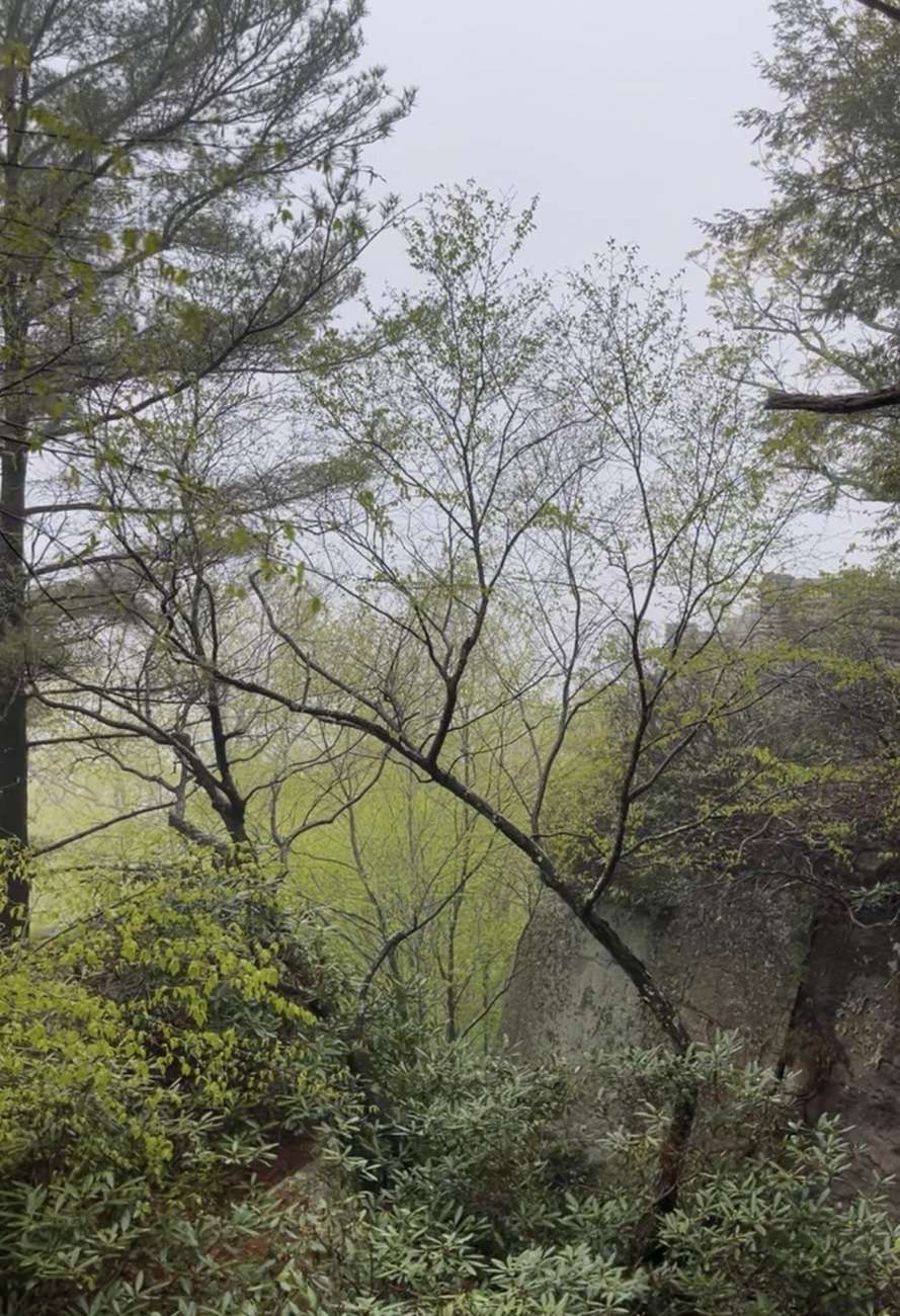
The drive itself hit us with the most intense fog of the entire trip so far, which is saying something considering how much atmospheric haze we had already been moving through across these multiple states.
The road was a whiteout at points and in others it felt almost submerged, with the forest narrowing into dense, saturated greens that never seem to change season to season.
Every time I come through here, I become convinced the forest is greener than anywhere else I have ever been. I find myself thinking no place on earth has ever managed to be quite this green.

The Slight Replanning:
We arrived expecting the usual overlook stop, but found the pedestrian bridge to the main overlook completely closed and out of commission.
That was a first in all the times I’ve been here. Normally, this spot is little more than a quick pull-off to enjoy the view, for me at least. This time we planned to move differently through the land instead of just observing it from above. That closure forced a different approach to the stop.

The Often Overlooked:
Even with the main overlook inaccessible, we pushed into the Underlook Trail. This shift ended up being the main point of our stop instead of a bonus we planned to include.
The trail drops you beneath the cliff line, directly under the structure most people only ever see from above. It turned into a short but technical loop, with rock scrambles, fat-man-squeeze like passages, and uneven stone underfoot.
We finished the route by climbing back up through a rock section that reconnects hikers to the main overlook area. This added a nice physical edge to what otherwise would’ve been a simple stop.
It was a short trail, but it didn’t feel like a short moment in the context of the day.

Internal Batteries:
By this point in the trip, we were running on empty in a very real way. Even if I am good competition for the energizer bunny that keeps going and going, sometimes even I lose steam.
This stop came after a stacked run that started in Ohio as the take off point at three o’clock in the morning and went across multiple states.
All of it back-to-back, with no real recovery window, just as I like it. So even a little over a mile here carried weight. Nothing about it felt minor at that stage.

A West Virginia Native:
As a West Virginia native who was later transplanted to Ohio, thankfully still close to many of the places I grew up loving. I naturally found myself revisiting old memories here. This stop pulled up older layers of memory for me.
At one point, Tae and I approached a sign I had once rested my feet upon while holding the leashes of my dog, Luna and a friend’s dog for a photo. Which allowed me to pose for another rendition the same photograph retaken all these years later, and sadly no puppies this time.

Almost Heaven Swings:
As a West Virginia native that means I am also a sucker for those almost heaven, West Virginia swings. I have seen three in person now including this trip.
- The one at the waterfront in Wheeling West Virginia.
- The one overlooking Oglebay Park, also in Wheeling.
- And now the one at Cooper’s Rock State Forest Morgantown, West Virginia.
We had planned to also trek two other trails here, and there are many more still, but we left them for another time. What we did cover was enough for us.

The Missing Overlook:
For the first time in all the years I have visited Cooper’s Rock, the overlook itself was closed. As we approached the familiar pathway, bright caution tape stretched across the entrance and the bridge across was no where to be seen.
Standing there in the fog, staring through the barriers, my mind immediately started trying to fill in the gaps.
Had a storm damaged it? Had years of Appalachian winters finally taken their toll? Had a fallen tree taken it out?

When a familiar landmark suddenly disappears, it’s easy for the imagination to have a bit of wild fun.
As it turns out, the closure was part of a major bridge replacement project. The aging structure had reached the end of its lifespan and was being completely rebuilt.
While I was disappointed to miss the overlook view, there was something fitting about it. Sometimes the view you always include isn’t the one that leaves the strongest impression.

Overlooked Underlook Trail:
Before setting out beneath the overlook itself, know that the Underlook Trail is far from a typical overlook access path. Though less than half a mile long, this rugged loop delivers more adventure than many trails several times its length.
Instead of leading to the famous overlook, the trail drops below it, winding through the sandstone formations that define Cooper’s Rock. From beneath the cliffs, hikers gain a completely different perspective, with towering rock walls overhead and glimpses of the Cheat River Gorge through breaks in the trees and stone.
The terrain quickly becomes more hands-on. Narrow passages weave between massive boulders, small cave-like openings invite exploration, and several sections require scrambling over uneven rock. One memorable stretch resembles a natural “fat man squeeze,” guiding visitors through tight sandstone corridors before opening back into the forest.

Despite its short length, the trail can feel surprisingly technical. Loose rock, exposed roots, uneven footing, and a final scramble back toward the visitor area demand careful footing. Sturdy footwear is recommended, especially after rain when rocks become slick.
Rhododendrons, West Virginia’s state flower, line much of the trail. During bloom season, pink and white blossoms frame the rocky passageways and cliff edges, adding even more beauty to the route.
Families, adventurous kids, and leashed dogs often enjoy the trail’s cave-like atmosphere, though scrambling sections require extra caution. Its proximity to the visitor area also makes it one of the forest’s most accessible adventures despite feeling removed from the crowds above.
For those willing to explore beneath the overlook rather than stand atop it, the Underlook Trail offers one of the most distinctive experiences in Cooper’s Rock State Forest. The land itself carries a timeline far older than any modern visit.

Long Before Cooper’s Rock:
Long before overlooks, trails, parking lots, and swinging benches decorated these ridges, people were moving through this landscape.
Archaeological evidence from the greater Monongahela and Ohio River Valley suggests that Indigenous peoples traveled these mountains for thousands of years, hunting game, gathering plants, and navigating the rugged terrain long before European settlers arrived.
The towering sandstone cliffs and overlooks that draw visitors today would have served practical purposes as well. Natural rock shelters provided refuge from the elements, while the high vantage points offered views across the Cheat River Gorge and surrounding valleys.
Over the centuries, various Indigenous peoples, including the Monongahela culture and later the Shawnee, Cherokee, and Haudenosaunee nations, utilized the region for travel, hunting, and resource gathering.

Wanderlust & Wonder:
Standing beneath those same cliffs on the Underlook Trail, it is difficult not to wonder how many generations passed through these mountains before any trail signs, bridges, or state boundaries existed.
Long before Cooper’s Rock became a destination, it was simply part of a much older landscape that countless people knew and depended upon. Later stories would begin to attach names and identity to the same ground.

The Name in the Stone:
The name “Coopers Rock” is tied to a local legend from the early 1800s. According to lore, a barrel maker, known as a cooper, fled into the cliffs after running from the law.
Hidden in the sandstone formations near what is now the overlook, he is said to have built a small workshop tucked into the rock itself.
From this hidden space, he reportedly cut timber, crafted barrels, and traded them quietly with nearby settlements, staying out of sight within the mountain walls.
Over time, the cliffs where he was believed to have hidden and worked became known simply as Coopers Rock, and the name stayed long after the story faded into regional folklore.
Hikers and rock climbers spending time in the deep rock of the Underlook after dark have long claimed to hear the phantom clink-clink-clink of a ghostly hammer striking iron hoops, as if the fugitive cooper is still working on his barrels.
Eventually, the land shifted again, this time into public work and preservation.

Civilian Conservation Corps – Cooper’s Rock:
Cooper’s Rock State Forest officially became protected public land in 1936. Not long after, the Civilian Conservation Corps (CCC) arrived and began transforming the area into the destination visitors know today. The sound of hammers striking stone and axes clearing brush echoed through the rugged hills as CCC crews worked among towering sandstone outcrops and dense stands of recovering timber.
State Park or Forest:
While Cooper’s Rock is classified as a state forest, it functions much like a state park and is managed through the West Virginia State Parks system. Thanks to both conservation efforts and the work of the CCC, what was once heavily logged land, marked by stumps, muddy clearings, and scarred hillsides, has gradually transformed into a lush forest of hardwoods and evergreens. That transformation didn’t stop with construction, it continued into how the land is managed today.

Closing Out Our Appalachian Trek:
What started as a familiar stop at the end of a long multi-state push shifted into something more physical, more grounded, and more exploratory than usual. The closure at the bridge didn’t remove the experience, it redirected it.
The Underlook Trail became the unexpected center of the visit, turning what is usually a quick overlook stop into a more hands-on encounter with the cliffs themselves.
Instead of viewing the gorge from above, the day ended inside the structure of the land, moving through sandstone corridors, tight passages, and the underside of a place most people only ever see from a distance.

By the time we left, the exhaustion from the day had already settled in fully, but so had the weight of everything we had moved through: multiple states, multiple elevations, and multiple versions of the same Appalachian terrain layered across different landscapes.
Coopers Rock wasn’t an outlier in that system; it was a continuation of it, shaped by the same geology, the same ecological patterns, and the same long human history that defines the region.
Even without the overlook view, the stop still carried its own version of clarity. Sometimes the landscape doesn’t offer what you expected, but instead reveals what you were actually meant to move through on that particular day.

TLDR:
Trek the Underlook Trail with us while the main overlook bridge being closed. The hike took roughly 36 minutes on trail.
Our route included rock scrambles, tight squeezes, and uneven stone footing. It reconnects back near the overlook area.
The key features included cliffside sandstone formations, small cave-like sections, and narrow passages under the overlook structure. Elevation gain was minimal but terrain is technical.
Cooper’s Rock carries historical layers including Indigenous use of the region for travel and resources. Later folklore attributes the name to a fugitive cooper said to have hidden and worked in the cliffs.
The Civilian Conservation Corps developed the area into public land in the 1930s. It remains part of the West Virginia State Parks system.
This stop is defined by movement through the rock system rather than the overlook view. The experience is shaped by terrain, not distance or scenery alone.

Plan Your Appalachian Trek:
WV State Parks – Welcome to Cooper’s rock State Forest & Cooper’s rock State Forest trails
WVU DIY Outdoors Guide – Cooper’s Rock
Savage Mountain Maryland & Ferncliff Ohiopyle Trail


Leave a Reply