Best for:
Geological information, history buffs, hikers interested in Hocking Hills, Ohio Exploration, creative writing readers, and nature journal enthusiasts.
Trail Snapshot
- Total Distance: 3.23 miles
- Duration: 2 hours (solo pace with photo stops)
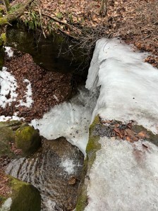
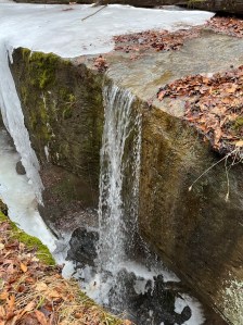
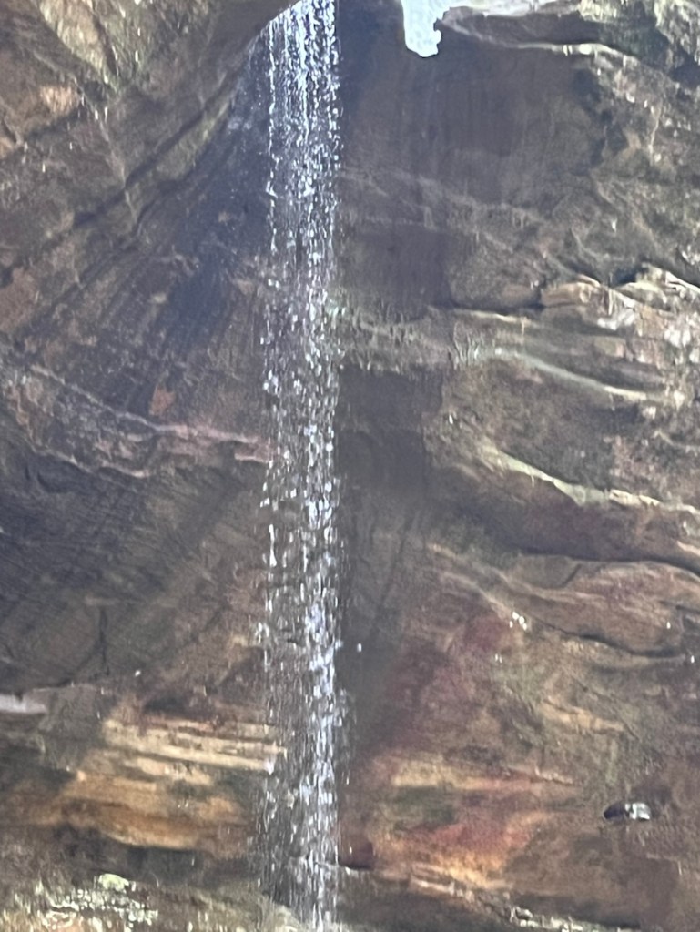
- Waterfalls Encountered: 3 of decent size
- Key Feature: Walking under the bridge before crossing the top.
Navigating in the Ice:
On February 18th I headed out to explore the winter woods. When I noticed that seasonally the woods have their own ways of demanding your full attention. When every step you take is a gamble against a thawing wet slick sheet of ice. My recent solo trek to Rockbridge State Nature Preserve was a lesson in patience and persistence.
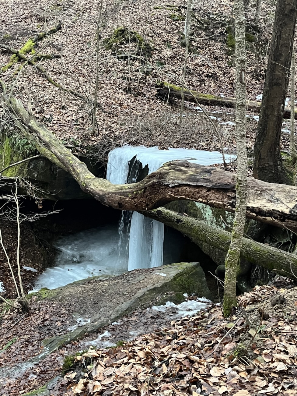
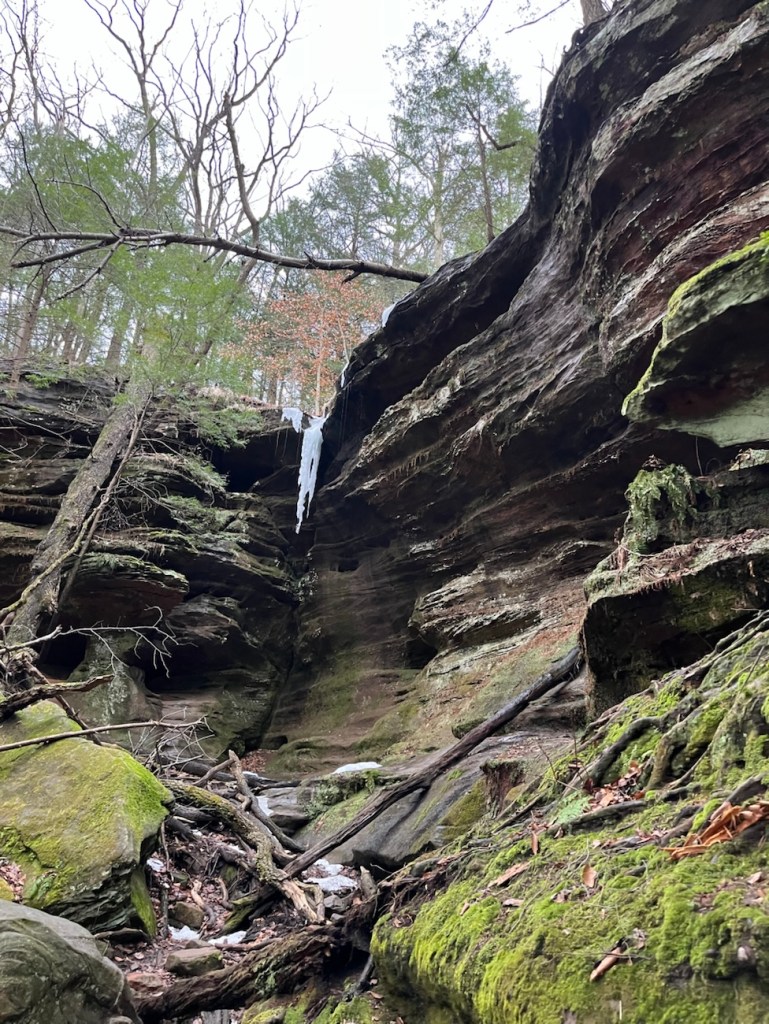
While my previous two attempts at Cantwell Cliffs were thwarted by deep freezes, Rockbridge was in a state of beautiful, messy transition. Approximately half-frozen, half-thawed, and entirely captivating. From the sheer scale of the natural bridge to the surprise of three distinct waterfalls, I was in awe of nature everywhere I looked. This roughly 3.23–mile journey was a reminder of why we brave the cold for the sake of the trail.
The bridge is not just a crossing; it is a frozen moment of deep time, suspended over the hollow.
3 Miles, 3 Falls, 2 Hours
The Trail’s Conditions:
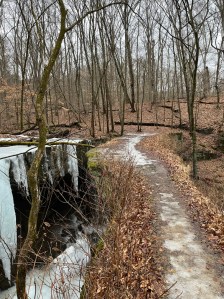
The trail conditions were “technically challenging.” Which we all know, is hiker–speak for “I nearly ate dirt five times.” The path was significantly slicker than expected once I saw the thaw. Though, the liquid melt on top of the thawing ice made conditions interesting, to say the least.
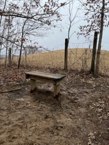
Despite the slips and slides, my pace was steady. I clocked just over 3 miles in about 2 hours, including my many stops to journal and capture the scenery.
The Trail’s Highlights:
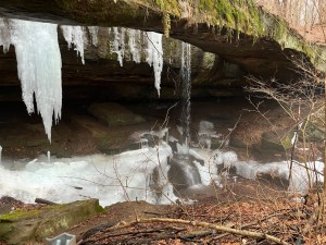
The main highlights of this specific trail are standing under and crossing the rockbridge itself. Before I began crossing over Rockbridge, to follow the trail I made sure to descend into the ravine to walk under the massive span. There is a clearly marked foot trail allowing this. Seeing the waterfall tucked right against the rock bridge from below gives you a perspective of the power of flowing water that you just can’t get from many places.
The Trail’s Geology:
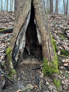
To understand the deep geological-history of Rockbridge and black hand sandstone, you have to look back millions of years to when Ohio was submerged under a warm inland sea. The “bridge” we walk on today is composed of Black Hand Sandstone, a rugged sedimentary rock that defines the Hocking Hills region.
Geologically, this bridge formed through a process of “re-entrant” erosion. The middle layer of the sandstone is softer and less cemented than the top and bottom. Over eons, groundwater and wind carved out a deep recess (a rock shelter) in that soft middle layer. Eventually, the erosion met a natural joint plane behind the cliff face, leaving only the narrow, 100-foot-long arch standing. It is officially the largest natural bridge in Ohio, stretching 50 feet across the ravine.
The Trail’s History:
The area isn’t just a geological wonder; it’s a historical one. The name “Black Hand” when referring to sandstone comes from a famous petroglyph of a human hand found in the nearby Licking River gorge. This was used by Indigenous peoples to navigate toward Flint Ridge.
There is now a Nature Preserve, called Black Hand Gorge located near Nashport, Ohio. This is where the “Black-Hand” petroglyph was found before being destroyed.
Locally, the Rockbridge area was once part of the Crawford family farm before being sold to the state in 1977. In the 1840s, the Hocking Canal ran nearby, and later, the railroad transformed this rugged landscape into an industrial corridor before it was reclaimed by the forest we see today.
Pause With Me:
Have you seen any of the mid-western or eastern natural bridges and archways located in Ohio, Kentucky, Michigan, Virginia, or Tennessee?
What about the western natural bridges and archways in Utah, Arizona, New Mexico, Nevada, California or Oregon?
Or have you been to those in Illinois or Alabama?
Do you have plans or dreams to see any one or few of them?
Tell me in the comments where you have been, where you plan to be, or where you dream to go. I look forward to and appreciate all the things you have to add.
To walk across a natural bridge is to step on the spine of an ancient sea floor, lifted and carved by the slow hands of water and wind.
Hiking Tips for Rockbridge
If you’re heading out to Hocking Hills and the surrounding areas:
- In winter – Check the Thaw: Rockbridge and other Hocking Hills locations tend to hold ice in the ravines even when the meadows are clear.
- Mind the Joint Plane: The “sky light” hole near the bridge is a 40-foot drop; stay behind the natural joint lines.
- The Waterfall Bonus: The falls here are “wet weather” features. Winter thaws and spring rains are the best time to see all three active.
- Solo Safety: Always let someone know your trailhead and expected return time, especially when the trails turn into ice rinks.
- Comfortable sturdy shoes are a must, in winter weather ice spikes do shoes wonders. As well as trekking poles in any season help our knees. Carry extra hydration, snacks, batteries, inhalers, epi-pens and other essentials in a trail bag, and always pack out what you took in.
A Bridge Between Seasons
Rockbridge is a testament to the beauty of persistence. In both the persistence of the water that carved it and the hiker who braves trek to see it. While the 3.23-mile trek was a bit of a workout for my balance, in the half thawed, slick ice seeing three waterfalls in their semi-frozen state made every slip worth it. It’s a distinct experience from the more crowded Hocking Hills State Park, offering a quieter, more intimate look at the ancient geology that makes this part of Ohio so unique. Whether you’re there for the balancing act worthy views or the quiet of a solo hike in a less packed Hocking Hills location, Rockbridge never fails to bridge the gap between our busy lives and the deep history of the Earth.
Let’s Pause One Last Time:
If you have a friend that enjoys seeing natural landforms and geology while hiking share this with them and invite them to explore Rockbridge, Ohio or somewhere near you with similar rock formations.
Before You Go:
Read Poeaxtry’s Poetry for free!?! Small free collections (13 poems or less) and small samples live on Wattpad, Quotev, and Booksie!
Explore shorts at your pace or even sample e-books, e-zines, minis, and more before committing!
Internal Links:
Cantwell Cliffs– 2 failed trips in snow & ice
Conkles Hollow gorge trip 1 & Trip 2 winter hikes with homies
Conkles Hollow Rim Trial In Autumn
Black Hand Gorge Rim & Canal Lock Trail
Rockbridge, Ky Red River Gorge
Piatt gorge– waterfalls and caves
External Links:
Etsy.


Say it. Don’t spray it.