A Mid‑Winter Reckoning
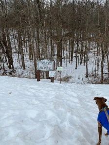
On February 11, 2026, we stopped at Salt Fork on the way home. We found history and nature under a sky that’s color was reminiscent of spring time blue, while the sunlight played peak-a-boo with Luna and I. I decided we would take the trail named the stone house loop.
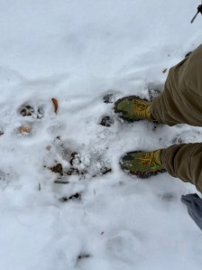
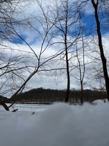
Like a blessing we were the only ones there. This is a loop that sits just shy of 2 miles on AllTrails, i guess that’s if you don’t include the curious hikers’ wondering steps. My final count was closer to 2.5 miles. The park was transformed by mid‑shin snow drifts and a deceptive layer of melting ice and snow mixed into the layers underfoot. Trail physics and keeping my feet on the ground mattered here more than fast mileage.
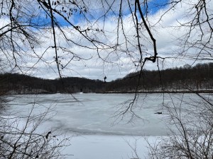
The Lake
The lake reflected the stark winter quiet in the few places that reached fully thawed. Leaving a mostly frozen lake with randomly thawed and thin ice spots where the sun’s rays had hit during the recent warm spell these last 3 days.
The slide
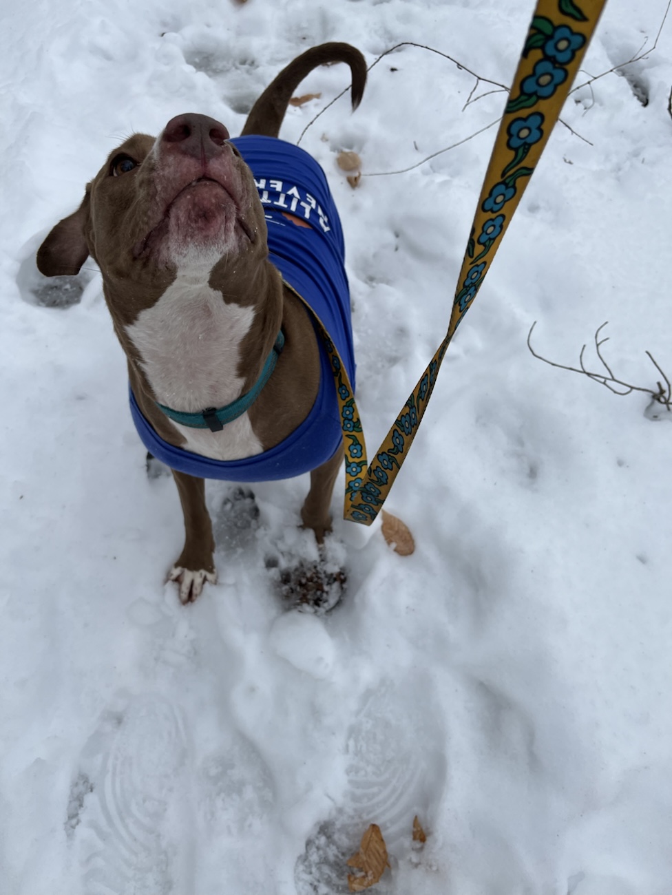
Luna moved through the drifts with a canine confidence I couldn’t match even if you paid me. While I navigated the uneven terrain by digging my heel into the snow with each step I took carefully I placed to avoid a full fall. I nearly slipped many times before the final hill pulled me down the majority of its length like a park slide. Which I followed up with a burst of uncontrollable laughter and cold adrenaline. A reminder that winter hiking is as much about surrender as it is about movement.
The Vertical Timeline
To walk this ridgeline is to traverse a vertical timeline of human history layered over land made by deep water, salt, and stone.
Long before the 3,000‑acre lake was dammed in the 1960s, this land was a map of survival. The park’s name comes from the natural mineral springs and salt licks along Salt Fork Creek that brought deer, bison, and people long before written history.
Native Americans
Indigenous groups including Paleoindians, followed by Woodland and Mississippian cultures, left their signatures in stone tools, pottery fragments, and trail networks that would echo in the paths we walk today. Shawnee and Delaware people later moved through these hardwood ridges, using salt springs and creek corridors as seasonal food zones and travel routes.
European Settlers
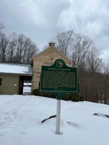
By 1830s, the landscape shifted again with European settlement. Benjamin Kennedy purchased land here and chiseled local sandstone into what is now the Kennedy Stone House. Which was constructed from huge native blocks and positioned to be overlooking the lake and hills. The house stayed in the Kennedy family until 1966. Now Stone House sits on the National Register of Historic Places, preserved as a as a witness to a century of transformation in this valley, and is still used as a museum.
Currently
Standing before it in the snow, the house feels less like a museum and more like a witness to the layers of displacement, ambition, and “progress” that define Ohio’s geography. Time and time again we are reminded of the people and cultures that the were destroyed by the European settlers as we explore Ohio. Please make sure to pay respects to the original people of the land we stand on in this country.
Salt Fork: Trails & Terrain
Salt Fork’s beauty is jagged and layered. While the Stone House Loop provides the historical heartbeat, the surrounding acreage offers a deeper, more rugged silence. The park’s trails range from short nature loops to moderate terrain that follows forest ridges, caves, creek valleys, and some higher points overlooking the lake.
Other Trails in Salt Fork and Nearby Areas
- Hosak’s Cave: This isn’t just a “cave” in the casual sense, it’s a sandstone formation sculpted by eons of wind and water, with crevices that hold ice inflows in the cold months. It’s tucked along a short trail that allow you to walk through ancient stone veins.
- Morgan’s Knob: A quiet hike into higher forest where the wind feels a bit different. In other seasons the summit offers panoramic views of the reservoir and ridges. In winter it becomes a silent cathedral of bare branches, frozen lakeshores, and distant mostly barrrn ridgelines.
- Salt Fork Ridge and Bridle Trails: A large group trails that makes up one interconnected single track. Winding through open meadows, steep climbs, and dense woods. A network of trails that mirrors the iconic Ohio terrain beyond this park.
These trails are living corridors of history and just a few of those contained in Salt Fork. The soils that once held footprints of Indigenous peoples, settlers, and now hikers like us.
Local Additional Day Trip Spots
- Seneca Lake Park: 12–15 miles south.
A smaller public park centered around Seneca Lake with wooded paths and shoreline walking. Trails here are shorter and gentler than Salt Fork’s ridges but still offer varied terrain and lake views in all seasons. It’s one of the most accessible local parks for a small companion hike or a secondary stop after Salt Fork. - Wolfe Run State Park: 20-25 miles north. A classic Ohio state park with rugged woodlands. It features a section of the Buckeye Trail plus additional loop paths that dip into forest and around Wolf Run Lake. It’s a solid same-day alternative when you want elevation, trail diversity, and a quiet feel a bit closer to Salt Fork’s type of terrain.
- Dillon State Park- 45 miles west.
A larger state park built around Dillon Reservoir with forested ridge trails, longer trail loops, and scenic overlooks. It has several established hiking options ranging from short nature routes to longer connector trails. Trails hug hardwood hills and bluff edges. This makes it great for a more demanding additional location to make full-day hiking trip either before or after a Salt Fork trail if you are looking for more.
The Industrial Shadow
The peace of Salt Fork is currently caught in a vice. Hiking here you are moving through the Utica Shale region. Which is a landscape increasingly defined by extraction as much as it is recreation.
In January 2025, the Groh well pad near Antrim, less than five miles from the park entrance, exploded and burned for more than half a day before fire crews could bring it under control. State crews closed State Route 22, evacuated nearby homes, and let the fire burn to avoid danger to responders. Thankfully no one was killed, but the explosion became a stark visual manifesto of the risks posed by fracking operations near public lands.
According to environmental groups, this well pad was part of a site with requirements under an EPA consent decree that included pressure monitoring and corrective action plans. These may not have been timely implemented. Multiple other regional spills and past violations show the ongoing vulnerability of water and soil where oil and gas activity is permitted near wildlife areas. Not to mention the disruptions to wildlife’s natural environment and their health.
Save Ohio Parks and allied advocates argue against fracking under or adjacent to state parks. This is sending millions of gallons of water mixed with sand and chemicals into deep shale to crack rock and force hydrocarbons to the surface. Fracking is incompatible with protecting the natural and historical legacy of places like Salt Fork.
Every quiet mile hiked here now feels like an act of quiet protest as much as it does a blessing we may not always get to experience.

The Vibes of the Hike
This wasn’t just a walk; it was a tactile engagement with history and the elements. Between Luna’s frantic leaps through snow and my own snow‑covered slide, the hike became a story of excitement, effort, and presence. Where snow that still clung mixes with thaw, every footfall feels like a negotiation with earth and water.
Salt Fork is a living document. From the Indigenous hunters of the mineral licks, the Kennedy family’s masonry, to now the modern threat and aftermath of the Groh well pad explosion. The land carries its scars and its beauty simultaneously. Salt fork left me woke to the precariousness of the wild spaces we have left.
Check out my Hosaks Cave trip.
Find all Poeaxtry links.
Shop all digital collections, readings, and freebies Gumroad and Payhip.


