List five things you do for fun.
For me fun is a way of breathing, a way of lighting up and grounding down. It’s where the ground meets breath and I feel small.
These five things are my ways of playing, dreaming, and just being alive in this wild world that keeps pulling me back into wonder. I do them where I am, Ohio mostly, but I carry them into every place I rest my pack.
I’ll take you to see why these matter to me, why they might speak right into your own understanding of joy.
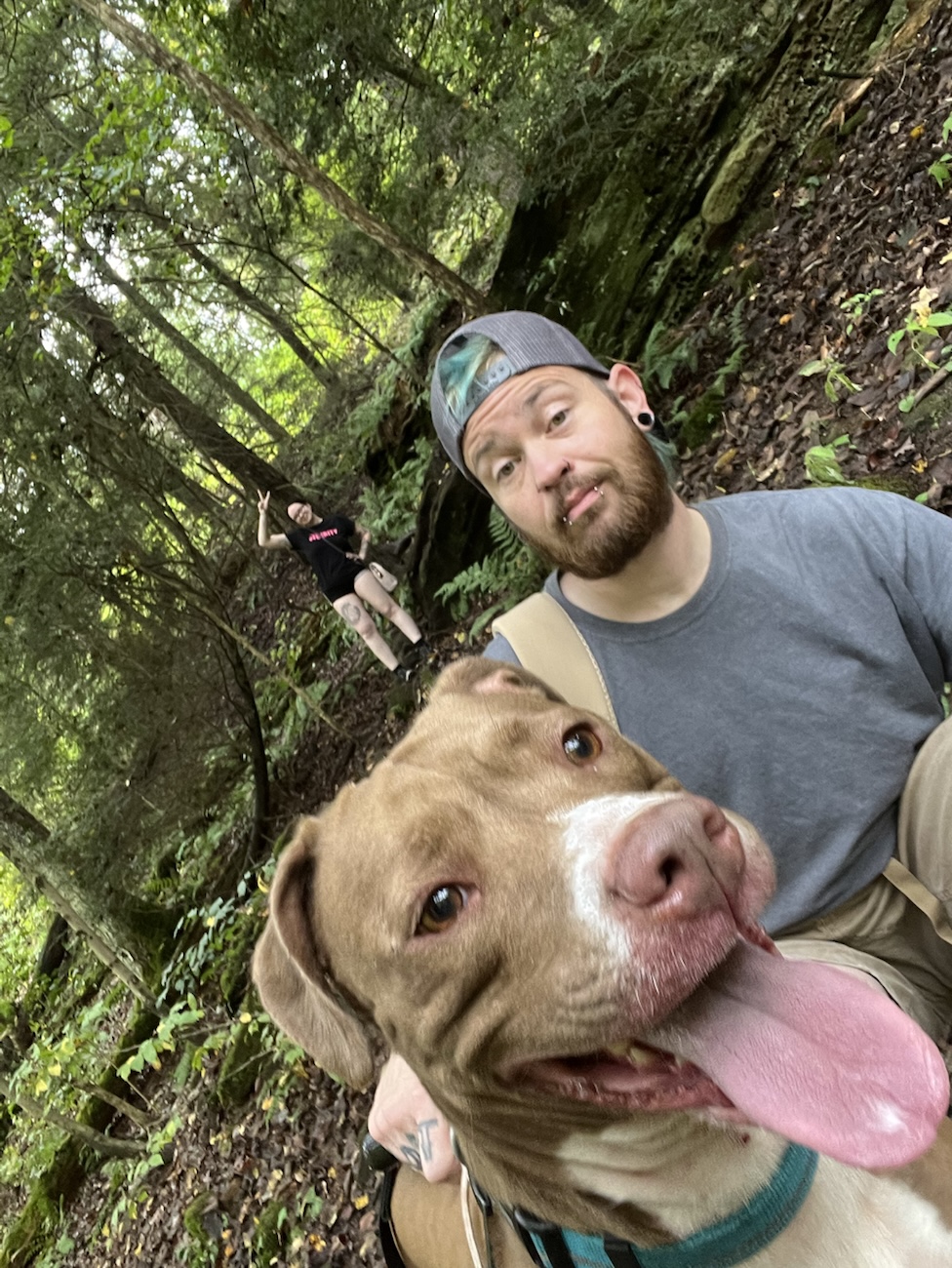
1. Hiking Ohio Parks and Beyond Nature Is My Church
Hiking isn’t a checklist it’s church. It’s the quiet place where my steps speak prayers and the wind becomes a kind of hymn. I spend most of my trails in Appalachia, the ancient ridges and hollows that hold stories beneath moss and stone. From Hocking Hills to the places tucked close to home like Piatt Gorge and little forgotten hollers you pull up on with a shaky signal. The perfect quiet, each park feels like a teacher.
I pay attention to sustainability and my carbon footprint while I go. That isn’t some Instagram line. Before I hit a path I do my research. Then I pack water, snacks, a bag for trash, dog care, a med kit, and I learn the trail conditions because respect for land means knowing what it needs from me. Hiking grounds me in my own body, gives my heart room to slow, and every leaf and cliff edge reminds me why I love this breathing world.
Most trails I wander are close to Ohio Indiana, West Virginia, Pennsylvania, Michigan, Kentucky, and North Carolina. As well as the spaces in between when I travel. Mostly this year though is for Ohio trails first unless the road calls me to loved ones far off.
2. Rockhounding Finding Stones with Stories
Rockhounding is play with purpose. I drive gravel roads look at creek beds and run my hands over banks until something whispers like a buried story. Raw stones, fossils, flint and quartz hidden with sun baked secrets in their fractures, they pull me in every time. When I hold a piece that once lived underground or in some ancient sea bed my worries become small, and my imagination gets loud in the best possible way.
Crystals and stones aren’t just things to me, they’re little time capsules of heat and pressure, of being shaped into something timeless and beautiful. I find peace in the chase and gratitude in every piece that makes me stop and say yes, this feels like something.
3. Witchcraft and Spiritual Creativity
Witchcraft for me isn’t theatrics its creation and alignment. I make spells, tools ritual pieces, wands, and more because that crafting is prayer in motion. I love grounding my intentions into objects made by hand, tuning materials to purpose and watching them hum with meaning. That’s fun and that’s healing and it’s something that keeps me steady when the world feels too loud or too empty.
I also love to teach my craft. I share to help others learn because I know what it’s like to want language and structure for this spiritual play. It’s honest and it’s real and it’s part of bringing more wonder and respect to every day. These tools aren’t props they’re companions, they’re ways to bring intention into living.
4. Making Things From What I Love
Making jewelry charms witchy goods and objects that feel alive under fingertips is where fun and work become the same lovely loop. I take what I find rocks, bone, feathers, metal bits, or bits of wonder and put them together until they feel like something someone else might also like.
This act of creation is rooted in love for material and moment, it’s about giving the raw world form and function, and it’s about connecting with whoever ends up loving these pieces too. When you make something you connect, and that connection is why making things is fun for me. It’s about transformation and meaning and care all rolled together like a stone in the palm that suddenly feels like belonging.
5. Xbox Unwind and Chill Recharge Sessions
Then there’s the alone but together world of Xbox and unwinding. I love a good game, something to sink into when the music in my head needs outside rhythm. Sometimes I add a bit of weed to soften the edges and let the world blur into color and sound, sometimes it’s just me and a controller and a story that feels like living another life for a little while.
I also love a good book, real pages or a screen that feels like touch. Both ground me because fun isn’t always high energy sometimes it’s recharge and release, play, and presence without pressure. It’s the quiet joy of story and challenge and that world you can slip into after a long day on real trails or at your bench turning rock into talisman.
Take a breath right now and think about your own fun. What pulls your shoulders down from your ears and makes your eyes soften? Whatever it is jot it down, revisit it soon when the world whirls loud again. Fun isn’t frivolous it’s fuel, it’s what keeps you moving and rooted all at once.
These five things: hiking, rockhounding, witchcraft and spiritual creation, making art from earth and unwind sessions, are my ways of living out loud. Here I am grounded in nature and creativity. They are the places I find meaning, play, fill my lungs, and quiet my mind. Maybe some of them echo in your own life, maybe they inspire you to try something new.
If this felt like something you recognize in yourself or in someone you know share it with them, let them read about joy that feels rooted and real not flashy or sold.
Before you go!
Tell me what you do for fun and how it feels in your body. What pulls your breath into wonder? Yes, even if it’s nothing like mine. I want to know what lights you up as much as what grounds you.
Check out Poeaxtry’s Links for all things Poeaxtry. Stores and socials, follow along for real life fun, creative habits, and hikes that feel like holy ground.
Or if you want to explore more…
Visit Poeaxtry and the Prism’s Archive Cheat Sheet. Discover all post categories, with a blurb and link to full post archive for each. Then find every post in that category in chronological order.